GPS4PPC is an open source application, written with Basic4ppc that includes a set of tools for navigation and GPS data.
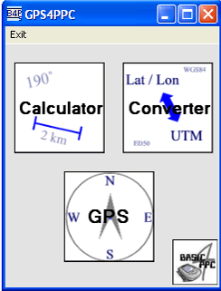
GPS4PPC supports:
- Converting coordinates between UTM and Lat / Lon.
- Converting coordinates in different datums.
- Calculating the distance and course between two coordinates.
- Show GPS data.
- Animated compass.
- Built-in numpad for fast and easy input.
Like it? Share with your friends!
If you got an error while installing Themes, Software or Games, please, read FAQ.
Supported operating systems:
Windows Mobile 5.0, Windows Mobile 6 Classic, Windows Mobile 6 Professional, Windows Mobile 6.1 Classic, Windows Mobile 6.1 Professional, Windows Mobile 6.5 Professional
Similar Software:
Gippos Gippos is an application for mobile devices allowing the user to locate his or her position on the map, share the location with friends and see other users on the same map. Users can also exchange instant messages with their friends
GpxView GpxView - For those who use their GPS for fun and who play Geocaching, this little unpretensious utility will allow them to manage their caches directly with the PLDA.
Thi sprogram is stricly documentative. There is no communication with the GPS. Information is retreived via Internet from the reference site Geocaching.com
RulerGPSed RulerGPSed - RulerGPSed uses the GPS on your PocketPC to calculate geodesic distance in 3 formats between two points specified by the latitude/longitude of your GPS using "The Vincenty inverse formula for ellipsoids" (accuracy to within 0.5mm, or 0.000015").
This program requires that you have both the 'BeanDLL
VITO Navigator II VITO Navigator II-GPS navigation tool for geocaching, hiking and touring to be used without area maps. is our next navigation product, that inherits all advantages of popular VITO Navigator and includes many new features. Elaborated functionality combined with easy-to -use interface gives you unique GPS tool, working fine with the most of GPS receivers
Glympse Glympse is the easiest, most flexible way to safely share your location. Just a couple clicks, and you can decide who and for how long your friends can see your location on a map.
How it works:
Send a Glympse - Share your location from a mobile smartphone.
Receive a Glympse - View a shared location on either a computer or mobile smartphone
AlarmGPSs AlarmGPSs - AlarmGPSs uses the GPS on your PocketPC as a proximity alarm. When you start the GPS the program tracks your home location. You can set a distance range and when the PocketPC is moved past the distance then the alarm sounds.
This program requires that you have both the 'BeanDLL.dll' file ** and ** the runtime files for Visual Basic on your PocketPC computer
Navimote Navimote is an on-demand mobile phone-finder based on push technology. With Navimote you can enable others to retrieve your position in real-time
PictureGPS PictureGPS allows you to tag pictures from your PocketPC camera in real time with a GPS stamp and view the distance of each picture via your current GPS. You can use the ruler to view the distance of each picture and also view the GPS stats for each picture with a Google.com map. The map service is provided by Google
RoadMap RoadMap - RoadMap is a car navigation system. RoadMap displays a map of the streets, tracks the position provided by a NMEA-compliant GPS receiver, identifies the street matching this GPS position and announces the name of the crossing street at the next intersection
GPSPicturer GPSPicture allows you to create GPS stamped JPEG files and displays them in an easy to use explorer interface. When you get a GPS lock the program will display the JPEG files in order of distance to your current GPS. To view the image file simply tap on it. The map service is provided by Google
Comments on GPS4PPC:
Comments not found
If you noted an error or download link is broken, please, report it via this page or use comments.
Attention! GPS4PPC may be not compatible with your device Asus MyPal A632/A636