Bluemapia Mobile - View Maps, Search places and geotagged Wikipedia articles, GPS. Mobile Application for bluemapia, the new Web & Mobile Social Mapping for Boaters
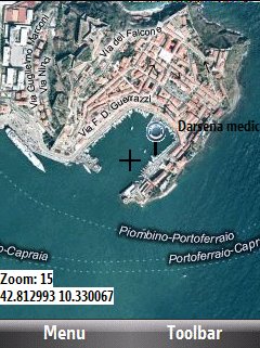
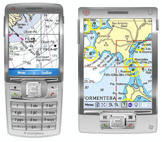
- View Maps (OpenStreetMap and other web map servers)
- Support BSB/NOAA Charts and raster, calibrated charts
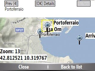
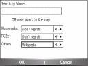
- Search places by name and bluemapia content from the web site
- View geotagged Wikipedia articles on the map
- Use a GPS to display your position on the map and set a terget destination
- Create tracks (gpx file)
- Shoot and upload photos and text to bluemapia for community sharing
Like it? Share with your friends!
If you got an error while installing Themes, Software or Games, please, read FAQ.
Supported operating systems:
Windows Mobile 2003, Windows Mobile 5.0, Windows Mobile 6 Classic, Windows Mobile 6 Professional, Windows Mobile 6.1 Classic, Windows Mobile 6.1 Professional, Windows Mobile 6.5 Professional
Similar Software:
hdSpeedo hdSpeedo is a speedometer that is driven from a GPS signal.
· User configurable background colours
· Day/Night colour schemes (Choose by clicking on the top status bar)
· Rotatable (Portrait or Landscape)
· Gesture enabled (Move between screens)
· Point and Track logging now available as
HERE(Free Send GPS Location via SMS or Email base google map link) HERE(Free Send GPS Location via SMS or Email base google map link) is a free Send GPS Location Application.
You can use it to find your location, then lets you send a link with that location to a friend,
family member, business associate and so on
GPS2day GPS2day is a today screen plug-in showing your current GPS coordinates, speed, satellite info, etc...
Languages: English, Czech, Dutch, French, German, Hungarian, Italian, Japanese, Polish, Russian, Spanish.
Currently GPS2day program works as GPS informer. It supports both metric and U.S
amAze (Samsung) AmAze is a first of its kind free navigation and local search service. It is free to download and use and it contains wide coverage of maps including aerial photo in Europe, North America, Australia and parts of Asia and Africa
SmartCaddie Pro SmartCaddie Pro with GPS
Thousands of courses, if your course is not there we will simply add it for you
12 players or more, special versions are available for leagues.
Includes enrolment for one user in the Nova Golf Internet Network (NGIN) providing further features and functions
gvSIG Mobile gvSIG Mobile is a tool oriented to manage geographic information. It is characterized by a user-friendly interface, with a quick access to the most usual raster and vector formats
GPS Tuner Essentials Full Version with British Isles Basic Map Content GPS Tuner Essentials Full Version with British Isles Basic Map Content is designed specifically for off-road use: its large buttons, selectable tool window size, multiple Compass views and the built-in Tele Atlas map makes it extremely user-friendly and reliable
GPS Toggle GPS Toggle 1.9 is a today screen plugin for Windows Mobile. It has been designed specifically for the HTC Titan, but should work on most other Windows Mobile phones that have a need for this type of application.
BAF GPS Toggle is written in native code (not .NET), and uses very little memory
Leaf Locate Leaf Locate - Navigation in the palm of your hand

.jpg "Asus P735")


")

")


