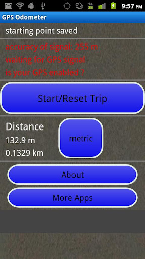
GPS Odometer - A simple and easy to use odometer. There is no maze of menus and no mysterious settings. GPS Odometer only does one thing, and does it well: measure distance traveled.
Note: Intended to measure relatively short distances, the application does not run in the background.
Like it? Share with your friends!
Supported operating systems:
Google Android 1.6, Google Android 10.x, Google Android 2.0, Google Android 2.1, Google Android 2.2, Google Android 2.3, Google Android 3.0, Google Android 3.1, Google Android 3.2, Google Android 4.0, Google Android 4.1, Google Android 4.2, Google Android 4.3, Google Android 4.4, Google Android 5.x, Google Android 6.x, Google Android 7.x, Google Android 8.x, Google Android 9.x
Similar Software:
Navitel Navigator for Android Navitel Navigator for Android - Navitel Navigator is a GPS travel assistant for Android. The app turns your phone into a personal navigation system.
Navitel Navigator comes with detailed maps and other useful features, including traffic jams, speedcams, 3D roads and intersections, instant routing and a comprehensive database with points of interest
GPS Status GPS Status is an application which displays the information received from the phone's GPS receiver. In addition to the basic location information it can extract and display the state and location of each visible GPS satellite which is displayed on a simple sky view. The outer circle represents the horizon while the center corresponds to the zenith right above your head
Phone Tracker (GPS Phone Tracking) Phone Tracker (GPS Phone Tracking) - The Phone Tracker is a free service that uses GPS technology to help you follow friends/family and see their exact location on a map. You will be able to securely track both iPhones and Androids, view their movements, and see up to 72 hours of their travel location history. ✓ Follow your child's movements during the day
TomTom Western Europe for Android TomTom Western Europe for Android - TomTom Western Europe is a turn-by-turn GPS navigator for Android devices. The app includes accurate offline maps, so you can find your way anywhere, even without an internet connection
amAze GPS light edition amAze GPS light edition provides access to worldwide street maps, full topographic map coverage of the USA and satellite imagery for 200 major cities around the world. It allows you to search in a worldwide rich POI database and you can upgrade to the full version that includes turn-by-turn voice guided navigation from within the application
LocateMyBuddyPRO LocateMyBuddy(aka LMB) is a GPS tracker and having features like "GPS Group/Friends Tracker" + "GPS Navigator" + "Friend Finder" + "GPS Location Sharing with Map URL" + "Follow Me" + "Email/Text service" + "Hybrid/Standard Map" + "GPS Location Address display Along With GPS Co-ordinates"
Wireless Info Wireless Info - Want to know more of your GPS, Phone, Wifi and Bluetooth facility. This application will display data like wifi freq, signal strength, no of satellites, bluetooth devices in vicinity etc
TwoNav for Android TwoNav for Android - A dual navigation system (On-Road/Off-Road) to perform most of your outdoor activities (hiking, biking, skiing, geocaching, ...). TwoNav can also guide you when driving. A single solution for all your orientation needs
Family Locator Blync Family Locator Blync - Family Locator is the most reliable and accurate family locator & children safety app.
Family Locator app lets your family be in touch and stay connected with your friends anytime
Other Software by developer «TappiApps»:
My GPS Coordinates and Location My GPS Coordinates and Location - A simple application with crude, but adequate, support for 40 languages. Allows you to share your position via email, text message, twitter, etc, and displays your current GPS location in both decimal format and in sexagesimal (degrees minutes seconds) format. Internet access is not required to send your location with a text message
GPS Tape Measure GPS Tape Measure - GPS Tape Measure is a virtual tape measure for your Android device. Perfect for when you want to easily find the distance between two points on earth and you forgot to bring your laser rangefinder. Simple and easy to use
Name That Plane Name That Plane - Test your knowledge of aircraft. The app features over 300 aircraft images. Compete with your friends and the world via a global score board provided by Scoreloop.
How score is calculated:
score = (percentage_correct * 10) / sqrt(sqrt(time_in_seconds))
Note that only thinking time is considered