GPS4PPC is an open source application, written with Basic4ppc that includes a set of tools for navigation and GPS data.
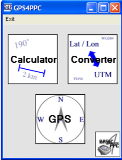
GPS4PPC supports:
- Converting coordinates between UTM and Lat / Lon.
- Converting coordinates in different datums.
- Calculating the distance and course between two coordinates.
- Show GPS data.
- Animated compass.
- Built-in numpad for fast and easy input.
Like it? Share with your friends!
If you got an error while installing Themes, Software or Games, please, read FAQ.
Supported operating systems:
Windows Mobile 5.0, Windows Mobile 6 Classic, Windows Mobile 6 Professional, Windows Mobile 6.1 Classic, Windows Mobile 6.1 Professional, Windows Mobile 6.5 Professional
Similar Software:
GPS NUT GPS NUT - GPS NUT is a GPS logger allowing you to log GPS tracks while you hike, bike, or drive. Also, load waypoints planned on Google Earth in the KML format to help guide you on to your destinations.
GPS NUT allows you to save GPS waypoints with detailed information to help you find anything
CourseLog This is CourseLogV2, an EWE application that runs under Windows Mobile 2005, WM 6 using your GPS receiver to tell you where you are, how long and how far you go and where you have been. This version 2 provides a great improvement : it displays your position on a map
FON Access Points for Bosnia and Herzegovina FON Access Points for Bosnia and Herzegovina - FON offers you a new Points of Interest service (POIs). This allows you to download FONspots directly to your navigation device.
What does that mean? You can download a Points of Interest file directly to your navigation device
TrackMe TrackMe - Tool that stores GPS positions and uses that information to generate KML files that can be used by Google Earth or Google Maps for displaying realtime or prerecorded tracks.
The data can be stored locally on your PDA or remotely on a server. You can use my server (free of charge) for storing your data
FON Access Points for South Africa FON Access Points for South Africa - FON offers you a new Points of Interest service (POIs). This allows you to download FONspots directly to your navigation device.
What does that mean? You can download a Points of Interest file directly to your navigation device
FON Access Points for USA FON Access Points for USA - FON offers you a new Points of Interest service (POIs). This allows you to download FONspots directly to your navigation device.
What does that mean? You can download a Points of Interest file directly to your navigation device
ContactGPSer ContactGPSer allows you to create and view phone/SMS/email contact number '.cgps' links and Dial/SMS or Email the contacts via GPS distance. Select 'Start GPS' to get a GPS lock and create a new '.pgps' contact link. The program displays the distance between each contact via your current GPS
Navigation BE-ON-ROAD Central Europe Q2/2011 Navigation BE-ON-ROAD Central Europe Q2/2011 - The new major version of be-on-road presents new features and is based on new platform which brings high level of reliability, portability and speed on almost any kind of device. The new be-on-road brings high value voice guided door-to-door navigation
SportyPal SportyPal is an easy to use intuitive application for your mobile device. You activate it when you start your running, cycling, walking, rollerblading or similar exercise. In two simple clicks it will start to log and map your position, movement, distance, tempo and calories burned
PictureMapperer PictureMapperer - PictureMapperer can be used to tag pictures/videos from your camera with a Google.com map and GPS data. When the program detects a new picture/video in the folder then it downloads a Google.com map and appends it to the end of the image/video with GPS information
Comments on GPS4PPC:
Comments not found
If you noted an error or download link is broken, please, report it via this page or use comments.
Attention! GPS4PPC may be not compatible with your device Asus V88i