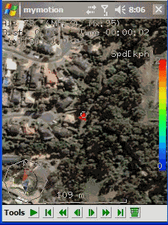
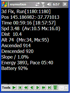
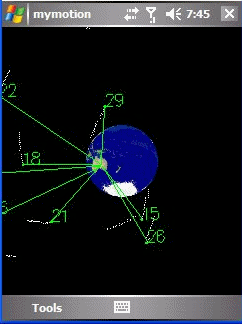
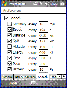
MyMotion - GPS route recording and playback with customizable spoken feedback of speed, distance and time. Uses a moving map to show progress as well as textual output. Maps can be generated from Google Earth installed on a PC using a map creation tool. Allows user to record a route then load it up as a reference for live comparison the next time it is traversed. Optional location tracking of GPS devices with GPRS or 3G, via the web and Google Earth or Google Maps.
· This software is free for personal use.
What's New in This Release:
· Performance Improvements, particularly UI responsiveness.
· User definable default file name format for track save.
· Add sensitivity enabling for menu items.
· Bug fixes: Fixed arrow direction. Fixed corruption with long (> 32 chars) file names in track files.
Like it? Share with your friends!
If you got an error while installing Themes, Software or Games, please, read FAQ.
Supported operating systems:
Windows Mobile 2003, Windows Mobile 5.0, Windows Mobile 6 Classic, Windows Mobile 6 Professional, Windows Mobile 6.1 Classic, Windows Mobile 6.1 Professional, Windows Mobile 6.5 Professional
Similar Software:
TwitterGPSings TwitterGPSings allows you to update and view Twitter contacts via GPS. You can use the GPS to find your current location and send a tweet and also track your friends via Twitter. The map service is provided by Google.com. The tweet service is provided by Twitter
FON Access Points for Estonia FON Access Points for Estonia - FON offers you a new Points of Interest service (POIs). This allows you to download FONspots directly to your navigation device.
What does that mean? You can download a Points of Interest file directly to your navigation device
gOmniTracker Wonder where was your teenager spending time last night? or when did they leave school, home, or tennis-practice? Or maybe it's granny you're concerned about whether she got back home from the park yet
Trailcompanion Trailcompanion is a software for gps-enabled windows mobile phones that allow you to track your way offroad.
Trailcompanion is designed with trekking in mind and will let you record your path, save waypoints, follow routes and exchange them with Google Earth and many others desktop software
TravelGPSes TravelGPSes uses the GPS on your PocketPC to find your current latitude/ longitude/ speed and altitude and looks up the Tixik.com GPS listings and displays them. Tap the button to start the GPS and when you get the lock tap the button again to view the Tixik.com listings for the area. This service is provided by Tixik
PoliceGoogler PoliceGoogler uses the GPS on your PocketPC to find the 50 closest police services sorted via GPS distance. Tap the button to start the GPS and when you get a lock tap on it to view the list of local police services. You can also dial the numbers. The GPS maps and pig search service is provided by Google
FON Access Points for Costa Rica FON Access Points for Costa Rica - FON offers you a new Points of Interest service (POIs). This allows you to download FONspots directly to your navigation device.
What does that mean? You can download a Points of Interest file directly to your navigation device
FON Access Points for United Arab Emirates FON Access Points for United Arab Emirates - FON offers you a new Points of Interest service (POIs). This allows you to download FONspots directly to your navigation device.
What does that mean? You can download a Points of Interest file directly to your navigation device
Other Software by developer «Ian Pendlebury»:
not found
Comments on MyMotion:
Comments not found
If you noted an error or download link is broken, please, report it via this page or use comments.