GPSToday-GeoTerrestrial GPSToday now brings an unbeatable combination of location features to your mobile device.
Driving/Walking directions in many countries, with traffic-optimization option.
Log file plotting on map and animated "playback". Also, the geologger will now never clip corners, and will perfectly follow loopy highway ramps. You can now also upload your log-files to the desktop website.(full-featured log-editing on the desktop coming soon)
Location Tracking and sharing (GeoLocation). Track your location history online for your own private use, or share with friends/family. The power-saving ability of GPSToday means you can leave it on indefinitely without worrying about the battery.
Easily and privately (or publicly) share points-of-interest, pictures, messages with like-minded folks (GeoGroups). eg. Track or update swine-flu locations, right from your phone. The possibilities are endless.
'Slideshow' through all your address-book contacts on the map, or through driving directions, or local search results, or all friends' mobile locations
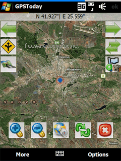
Satellite,Hybrid map views, and many more enhancements for ease of use.
Nearly worldwide support for many features that were previously US only.
Essentially the works, all in a still small package. More features are listed below the screenshots.
This software will not work on OS older than Windows Mobile 5.0 versions, or on any non-touchscreen smartphone. Data plan is recommended for online map features, but not necessary for offline features like geologging or geotagging. An Integrated GPS is advisable (but not mandatory) to fully enjoy the software.
Like it? Share with your friends!
If you got an error while installing Themes, Software or Games, please, read FAQ.
Supported operating systems:
Windows Mobile 5.0, Windows Mobile 6 Classic, Windows Mobile 6 Professional, Windows Mobile 6.1 Classic
Similar Software:
Glasgow Pocket A-Z Map Glasgow Pocket A-Z Map - This publication has been designed for a Pocket PC running Windows® Mobile-based Pocket PC (version 2002 or later). and Pocket A-Z Viewer (included). The map covers an area of central Glasgow, extending to Possil Park, Carntyne, Rutherglen, and Govan
VITO SmartMap Pocket PC VITO SmartMap is GPS moving map for your smartphone.
It uses relatively small vector maps, which are perfect for driving or hiking with it. You can also use VITO SmartMap without maps for recording tracks to find your way back
TrekBuddy Trekbuddy is a J2ME application to be used with a GPS receiver. It is designed to work with every Java-enabled device. It features capabilities such as: * GPS tracking and simple navigation * bitmap maps (without zoom, you can store bitmap maps with different resolution instead)
MyTravelr Mytravelr is a set of tools designed to help on-the-go mobile users maximize their productivity and reduce the stress of trave.
1.0F3 version:
- Fixed bug: some cities DST issue.
- Fixed bug: Weather update from forecast screen.
- Added: Option for disabling Internet Network confirmation.
1.0F2 version:
- Added: Edit cities feature (Add/Update/Delete)
TwitsnapsMaps TwitsnapsMaps uses the GPS on your PocketPC to find your current latitude/longitude/speed and altitude and allows you to upload your position via map to Twitter.com. You can customize the maps zoom, and type via the 'Options' in the toolbar. The maps service is provided by Google.com. The map/Twitter storage is from TwitSnaps
Leaf Pinpoint Mobile With Leaf Pinpoint™ on your Windows Mobile® phone, it has never been easier to find or be found. No more asking ... Where are you? or Where is it?. Simply find whatever it is on the map - anytime, anywhere, in real time
Travel Hawaii Travel Hawaii an illustrated travel guide, phrasebook, and maps. Indulge Yourself with a personal tour guide on Your PDA. FREE General Information, basic phrasebook, and a map in the trial version.
Features
Fully illustrated.
City attractions.
Historical overviews.
Interesting facts.
Street Maps, Phrasebook, and more
BackCountry Navigator BackCountry Navigator is fun-filled navigation software for the outdoor adventurer. Use it in a variety of outdoor adventures, from kayak touring to geocaching. This is a summary of what you can do with the product.
BackCountry uses free topo and aerial maps for the United States, downloaded directly from Terraserver-USA
RideSchedulesCUMTD RideSchedulesCUMTD - The RideSchedules application is a full-featured public transit assistant that includes updatable schedules, countdowns, maps, favorite stops, directions, guides, tracking tools, alarms, announcements, parking meter, vehicle finder, realtime vehicle locations, offline support, and convenient access to transit provider services
Comments on GPSToday:
Comments not found
If you noted an error or download link is broken, please, report it via this page or use comments.