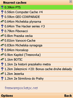
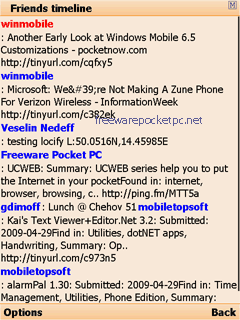
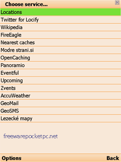
With Locify you can explore interesting places near you from Wikipedia, seek for geocaches, display map where you are (or you want to go), twitter your location, save interesting places from phone or web sync them and even navigate to them... and much more.
Locify is free application for common mobile phone. It can use phone's internal GPS or connected bluetooth GPS and is fairly usable even without any GPS device.
What's New in This Release:
· Map and navigation fix on certain phones
Like it? Share with your friends!
If you got an error while installing Themes, Software or Games, please, read FAQ.
Supported operating systems:
Java ME, Java Nokia 240x320, Java SE 240x320, Pocket PC 2002, RIM BlackBerry OS 1.0, RIM BlackBerry OS 2.0, RIM BlackBerry OS 3.x, RIM BlackBerry OS 4.0, RIM BlackBerry OS 4.1, RIM BlackBerry OS 4.2, RIM BlackBerry OS 4.3, RIM BlackBerry OS 4.5, RIM BlackBerry OS 4.6, RIM BlackBerry OS 4.7, RIM BlackBerry OS 5.0, RIM BlackBerry OS 6.0, Windows Mobile 2003, Windows Mobile 2003 Smartphone, Windows Mobile 5.0, Windows Mobile 5.0 Smartphone, Windows Mobile 6 Classic, Windows Mobile 6 Professional, Windows Mobile 6 Standard, Windows Mobile 6.1 Classic, Windows Mobile 6.1 Professional, Windows Mobile 6.1 Standard, Windows Mobile 6.5 Professional, Windows Mobile 6.5 Standard
Similar Software:
Simple Coordinate Converter Simple Coordinate Converter is a easy-to-use tool for conversion between different Earth coordinate systems
SpeedLimit SpeedLimit-this application was developed in cooperation with wikispeedia.org and is designed to allow you to quickly and easily add speed limit data to their database while you are passing a speed limit sign (Please do not use while driving, make sure you are a passenger in the car)
AutRun Which way is faster? Whether you are doing your daily commute, visiting friends out of town or running errands on the weekend, the last thing you want to do is waste your time in traffic. With Autrun, you can settle the debate once and for all
Compass This wonderful fully-featured Compass uses the built-in GPS to show your heading, speed, latitude and longitude and where True North is on a variety of stunning backgrounds. Compass is GPS-based and you MUST BE MOVING to use it
Quick Dash Light Quick Dash Light is an informational dashboard designed to be used when travelling. This first version is intended to be used in a car, but future versions might include biking or walking usage scenarios
SMap SMap -allows you to record and manage your running, hiking, cycling, MTB or sailing routes and easily upload them onto the Sanoodi website live via GPRS or later when you connect your mobile to your desktop computer.
· Two screens: a Pace Screen and a route Summary Screen
aiSpot (for touch screen) aiSpot (for touch screen) is a professional application that greatly expands your mobile phone’'s GPS capabilities. Once turned on, aiSpot constantly monitors the available GPS Satellites and updates 13 essential parameters of your trip
GPSCalc Simply calculate the distance between points on earth. Compare the distance over the surface with the distance via the rhumb line (includes rhumb bearing too)
Pitch Gauge Pitch Gauge - **How steep is this roof?
**How many squares do I need here?
Always carry your Pitch Gauge with you.
Pitch Gauge not only gets you the pitch of a roof, but also, easily calculate the amount of squares needed to replace a roof.
"Square Calculators" has been around for decades. They are usually made of vinyl or cardboard
Other Software by developer «Locify»:
not found
Comments on Locify:
B SAMBASIVARAO:
kothagudem
Date: 8 Mar 11
If you noted an error or download link is broken, please, report it via this page or use comments.
Attention! Locify may be not compatible with your device AT&T BlackBerry Bold 9700 (RIM Onyx)

")


")

