Terracrosser is a free GPS navigation software for Windows Mobile Pocket PC.
· Terracrosser works in Map and Photo modes
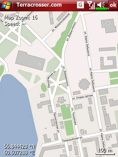
· Terracrosser uses zoomable maps
· Terracrosser is completely compatible with Google Maps service. With included Mapper module you can download maps from the Internet. All maps are automatically calibrated (geo-referenced)
What's New in This Release:
Terracrosser:
· POI system
· enhanced scrolling
· multiple options in settings menu
· maps correction to improve default maps calibration
Mapper:
· limited region to download non-square part of map
Like it? Share with your friends!
If you got an error while installing Themes, Software or Games, please, read FAQ.
Supported operating systems:
Windows Mobile 5.0, Windows Mobile 5.0 Smartphone, Windows Mobile 6 Classic, Windows Mobile 6 Professional, Windows Mobile 6 Standard, Windows Mobile 6.1 Classic, Windows Mobile 6.1 Professional, Windows Mobile 6.1 Standard, Windows Mobile 6.5 Professional, Windows Mobile 6.5 Standard
Similar Software:
FON Access Points for South Korea FON Access Points for South Korea - FON offers you a new Points of Interest service (POIs). This allows you to download FONspots directly to your navigation device.
What does that mean? You can download a Points of Interest file directly to your navigation device
SafetyRide SafetyRide Limiting the scope of searches in case of emergency, this mobile application helps people who need to walk in dangerous places. Keeping a GPS connection and sending SMS to a configured number with the latest position at determined intervals
OpenMobileMaps An application similar to Google Maps, but relying on OpenStreetMap
Wenak Wenak - Mobisoft Wenak lets you share your location with your friends, family members, co-workers and loved ones by making it easy to tell them where you are and see each other on the map. Wenak lets you share your location in the background, even when the app is closed
RaceChrono RaceChrono is a GPS based lap timing software for Windows Mobile. It can be used to measure lap times on almost any vehicle and track. It can be used to measure laptimes for example for motorbikes, bicycles, cars, water jets and quadbikes.
What's New in This Release:
· Much better looking user interface.
· Better and simplified touchscreen usage
MapGPSed MapGPSed - MapGPSed can be used to compose and view a list of GPS map location points and draws lines of the GPS routes. You can export the map in in street, terrain or satellite view. The map service provided by Google.com
This program requires that you have both the 'BeanDLL.dll' file ** and ** the runtime files for Visual Basic on your PocketPC computer
Traffic Vizzion (12 month subscription) IMPORTANT: Do not operate this product while driving; park the vehicle first. It is your sole responsibility to place, secure and use your mobile device in a manner that ensures safe driving
WorldMate Live for PPC Free subscription Turn your smartphone into a smart travel companion.
It seems travel is only getting more stressful and difficult. WorldMate exists for only one reason ? to make your on-the-go lifestyle easier
Google Navigator Google Navigator is the most powerful and easy to use GPS navigation software on your Pocket PC. Also is the best and most easy to use and convenient software on your Pocket PC. All map data is transferred from Google via network, and save permanently on your device until you want to delete it


")


