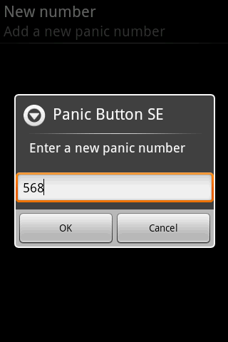
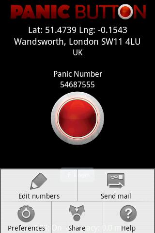
Red Panic Button - When you are in trouble press the Red Panic Button! You just have to set a panic number and the mobile phone will send a sms which contains a link to Google Maps with your fine GPS based or coarse GSM based coordinates.
What's New in This Release:
· New Feedback button!
· QVGA and WVGA screen layout improvements!
What's New in 2.1.0:
· Post Twitter Panic
Like it? Share with your friends!
Supported operating systems:
Google Android 1.6, Google Android 10.x, Google Android 2.0, Google Android 2.1, Google Android 2.2, Google Android 2.3, Google Android 3.0, Google Android 3.1, Google Android 3.2, Google Android 4.0, Google Android 4.1, Google Android 4.2, Google Android 4.3, Google Android 4.4, Google Android 5.x, Google Android 6.x, Google Android 7.x, Google Android 8.x, Google Android 9.x
Similar Software:
My place My place This application allows you to determine your current location and to share it with your friends by sms or e-mail, if you want or need this.
Also it is possible to share your location with other apps, which are already installed on your phone (Google maps, Twitter apps, notes, etc.)
NAVIGON select NAVIGON MobileNavigator - GPS Navigation NAVIGON MobileNavigator GPS Navigation Very important: ONLY customers who already have one of the previous full versions bought can use this software as an update
AugSatNav Walk AugSatNav is an augmented reality navigation system which overlays walking directions upon a live video feed of the path or road ahead.
With AugSatNav there is no need to follow instructions or interpret maps - you can simply find your way by walking along the route highlighted by a bright white line
OS Map OS Map is a tool to turn your Android phone into a handy Ordnance Survey map, with your GPS position pinpointed on it!
· Nearly all OS Map scales available (including 250,000 and 50,000).
· Touch-scrolling - simply use your finger to drag the map around.
· Fast resume from standby and fast position updates
GoPenS GoPenS is an OpenSource GPS application for Android phones, based on OpenStreetMap (OSM). OpenStreetMap is a collaborative map of the world. Therefore, one of the main functions of the application is to be able to record a trace and send it as a GPX to the OSM servers, and so edit the OSM Map
yozi yozi is a navigation software for the Android platform. It uses digital topographic maps in well-known Ozi Explorer formats for navigation and doesn't require network access like built-in Maps application on Android
Weather Forecast USA Weather Forecast USA- Displays 7-day forecast for any location in US (Alaska, Puerto Rico, Hawaii and Guam included). Location is determined via GPS on your device, so don''t forget to turn it on. Forecast is obtained from NOAA web services where it is refreshed hourly
TomTom Australia for Android TomTom Australia for Android - TomTom Australia is a turn-by-turn GPS navigator for Android devices. The app includes accurate offline maps, so you can find your way anywhere, even without an internet connection
Turbo GPS 2 (Android) Turbo GPS 2 (Android) - The known all-in-one GPS for Android devices, now in version 2
Wizi SMS Location Wizi SMS Location - Have you ever tried to explain somebody where you are or where you’re going to? Wizi SMS Location adds a new feature to your smartphone: sending your location by SMS, email, Twitter or Facebook. You can also check-in on Foursquare and facebook Places using this signle app
Other Software by developer «Ultimate Communication Software»:
Red Panic Button (iPhone/iPad) Red Panic Button (iPhone/iPad) - When you are in trouble press the Red Panic Button! You just have to set a panic number or mail address and the mobile phone will send a message which contains your address and location, determined using the fine GPS based or coarse GSM based coordinates
Red Panic Button (iPhone) Red Panic Button (iPhone) - When you are in trouble press the Red Panic Button! You just have to set a panic number or mail address and the mobile phone will send a message which contains your address and location, determined using the fine GPS based or coarse GSM based coordinates

")
")


")

")
")