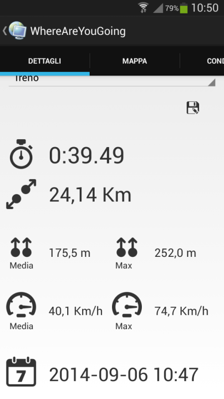
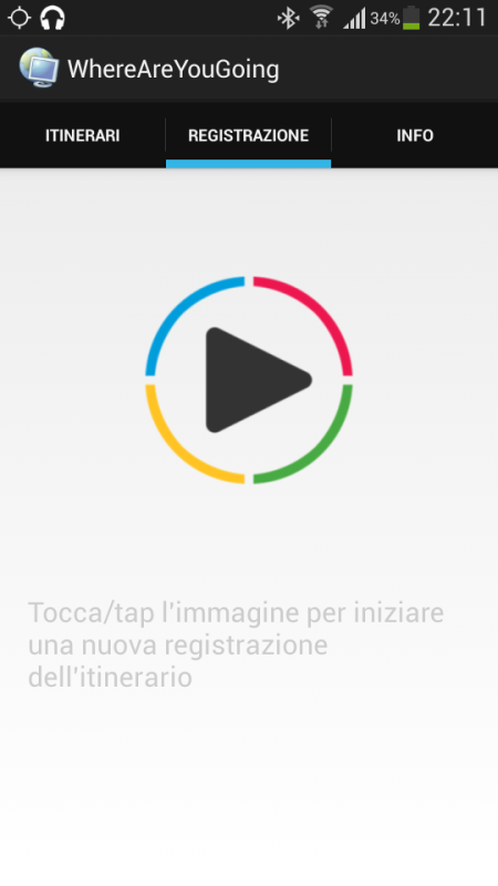
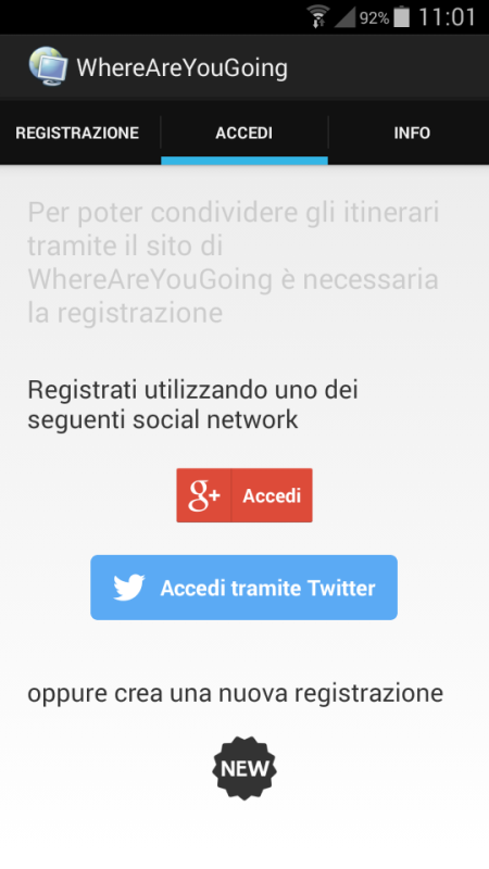
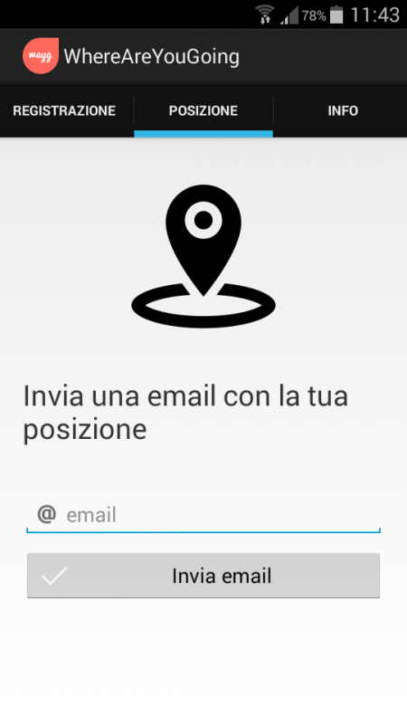
wayg - Create your trip, record your route, share your position. WhereAreYouGoing is able to record position, speed, altitude and time of your routes on your device. WhereAreYouGoing allow to share your route on the most important social network (Google+, Twitter, Facebook...), create file Kml for Google Maps or file GPX (OpenStreetMap). You have just to sign up on this web site: http://goo.gl/3eKJlw . This Gps Tracker allows create the waypoints during the record of the route and view the progress of the speed and height in the graphs. If you have any internet connection you can show in real time your position on Google maps or OpenStreetMap and share with somebody you want. WhereAreYouGoing use GPS satellites on your device to record the routes.
Like it? Share with your friends!
Supported operating systems:
Google Android 3.0, Google Android 3.1, Google Android 3.2, Google Android 4.0, Google Android 4.1, Google Android 4.2, Google Android 4.3, Google Android 4.4
Similar Software:
amAze (Motorola) AmAze is a first of its kind free navigation and local search service. It is free to download and use and it contains wide coverage of maps including aerial photo in Europe, North America, Australia and parts of Asia and Africa
BeBack Light BeBack Light - A GPS tracking and voice navigation utility economizing the battery charge.Suitable for hunters, fishers or other adventure finders: allows to walk straight to the target point with free hands according to the voice pointers, having your PDA in a pocket with the switched off screen and saving the battery charge on the way
Run.GPS Trainer UV Run.GPS Trainer is the perfect tool for sports like running, skiing and walking. It uses the Global Positioning System (GPS) to record all of your training parameters like speed, distance and altitude.
Run.GPS Trainer UV is the successor of of the award-winning Run.GPS Trainer software and has tons of new features
OpenGPSTracker OpenGPSTracker adds the capability to store and review where you and your Android device have been. Basically you press record at the start of your trip and your phone stores the route you take. This route is drawn real-time on the Maps functionality of Android or in the background with an idle device. The route is stored on your phone for review and further use
GPSHunt GPSHunt - GPS application like a handheld GPS designed by hunters for hunters. You can use it in a hunting game where you use a GPS to hide and seek containers with other participants in the activity.
What's New in This Release:
· support APP2SD
What's New in 4.0:
· minor optimization
What's New in 3
NearMe NearMe application gives you a fast and easy way to find places near you. In addition, you can set the area (in Km) where to search. With every found place you have some useful options:
* Call
* Add To Contacts
* Open In Maps
* Get Directions
And other option is History: it keeps for you all places you have searched for
GPS Test All your GPS information in one app. Large colourful easy to read screens.GPS Test shows basic GPS signal (SNR) and satellite information as well as your current location and time read from the GPS engine
TomTom France for Android TomTom France for Android - TomTom France is a turn-by-turn GPS navigator for Android devices. The app includes accurate offline maps, so you can find your way anywhere, even without an internet connection
Car Locator Bluetooth Plugin Save your car's location whenever your phone disconnects from car's bluetooth! As seen on the Verizon commercial
CopsAlarm No more tickets Show where the hiding police are on Google Map As well as speed cam,red light locations Lite shows police,red lights only
Comments on wayg:
Comments not found
If you noted an error or download link is broken, please, report it via this page or use comments.
wayg is compatible with your device BBK Vivo Xplay 3S X520F


")


