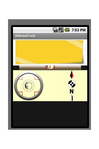
AlignDroid - Simple Android application that uses the phone's sensors to provide two levels (horizontal and vertical) and the magnetic compass. Everything you need to check alignment.
Like it? Share with your friends!
Supported operating systems:
Google Android 1.6, Google Android 10.x, Google Android 2.0, Google Android 2.1, Google Android 2.2, Google Android 2.3, Google Android 3.0, Google Android 3.1, Google Android 3.2, Google Android 4.0, Google Android 4.1, Google Android 4.2, Google Android 4.3, Google Android 4.4, Google Android 5.x, Google Android 6.x, Google Android 7.x, Google Android 8.x, Google Android 9.x
Similar Software:
Therm Therm Calculate the values of thermal resistance of the Wall. First after installation select English checkbox. The box wall thickness of 0.45 meters, specify if the wall is 45 centimeter thick. If it is different, of course, specify its size. 25 cm as 0.25 etc. Box LAMBDA coefficient of thermal conductivity, coefficient specify the material of which the wall is built
Click Computer Services Created for Click Computer Services/ AZ Legal I.T customers.
Use to create tickets, contact us, etc
Pinouts Pinouts is a collection of common audio / video / lighting / computer and other connector pinouts
AutoCAD AutoCAD - is a mobile version of a software for making and editing designs. Big variety of tools will help you complete difficult tasks without using your computer. You can share the final results fast via the Internet or any other data transfer technology
Plastic Analyzer Plastic analyzer v1.0 Plastic analyzer helps you know the quality of plastic you are using on a daily basis. Go green
Distance and area measurement Distance and area measurement - Turn this application on and walk or drive around a region to measure its area. The path length is measured as well.
To start a measurement; wait until the GPS receiver is ready and then press start. If the positioning is a little shaky in the beginning, press restart as soon as it has stabilized
Architecture Preview Architecture Preview is a tool for previewing 3D models in the real world. This application allows importing of a model (in OBJ format) and placing it relative to the Android phone. Once placed, the phone can move around the 3D model and see different aspects of the model
PPC ZipRSS PPC ZipRSS - Innovative application that allows the reception of RSS feeds at low cost. The operation is as simple as effective.
1. The application connects to the developer's server and asks for the required feed;
2. The server obtains the feed at the site that produces it;
3. The server performs the compression of required feed;
4
ppc FindMyCar ppc FindMyCar - Innovative software for Windows Mobile devices that uses the GPS signal to show signs that allow to reach a geographic location.
Suitable for various uses (eg. find car parked in a parking area or in an unknown city, finding a person (who has sent their coordinates) in a lovely beach, in a fair, in another boat, find an area of sea fishing, etc..)
PPC PersonalTrainer Calculate calorie needs and kcal, fat, fiber, carbohydrates and proteins recruited. Calculate the optimal body size
J2ME Checklist Todo List for mobile devices. My Checklist is a simple task manager that helps keep track of to-dos either in your personal or professional life. Gives you help in your new year resolutions
Sms2WhereAreYou Sms2WhereAreYou - Send and receive text messages on the mobile phone with the geographical position
j2me FindMyCar j2me FindMyCar - Innovative software for mobile devices that uses the GPS signal to show signs that allow to reach a geographic location.
Suitable for various uses (eg. find car parked in a parking area or in an unknown city, finding a person (who has sent their coordinates) in a lovely beach, in a fair, in another boat, find an area of sea fishing, etc..)
j2me PhotoGeoTag j2me PhotoGeoTag - Take pictures with your mobile phone and incorporate the data of the geographical location. The application allows you to include in the photographs, data from the GPS receiver, along with a brief note. If you know the coordinates, not having the GPS receiver, you can also handwrite geographic data