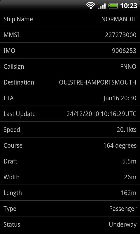
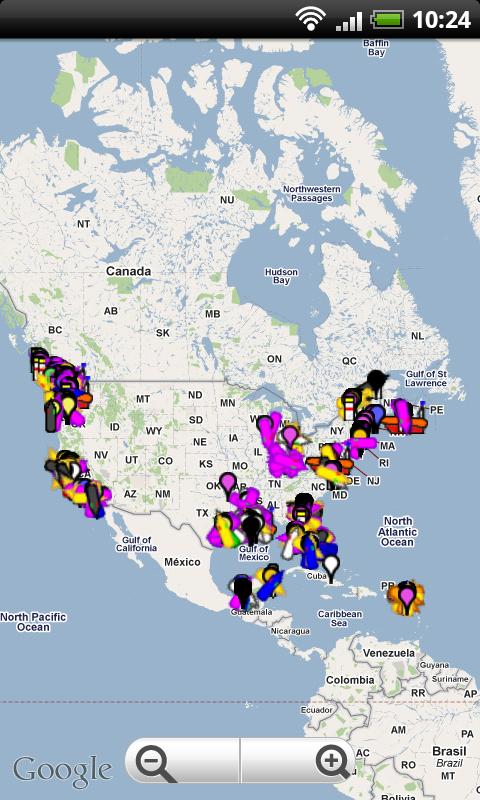
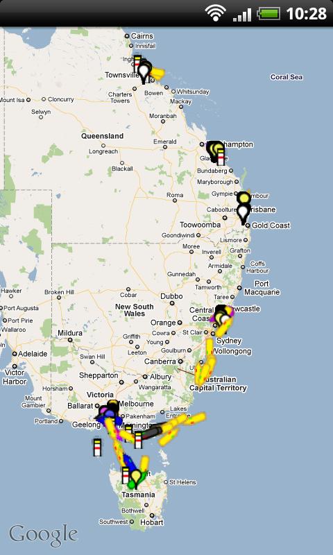
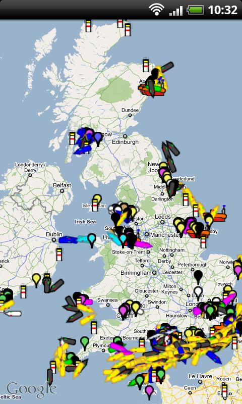
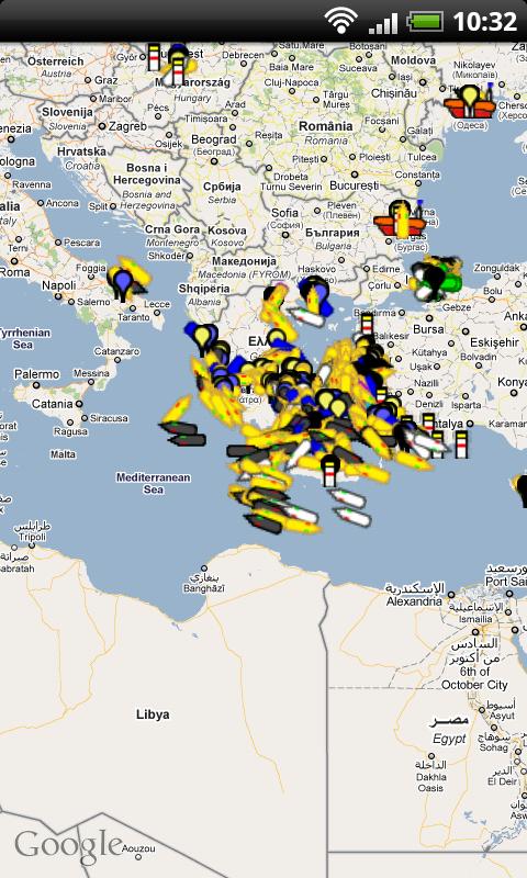
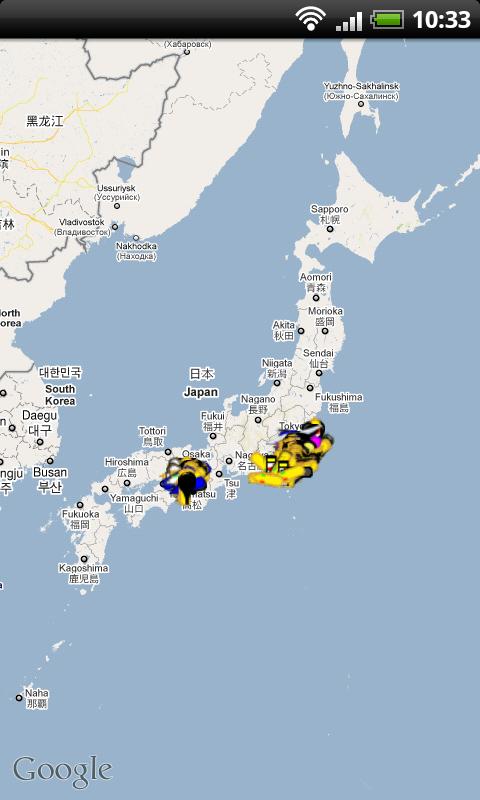
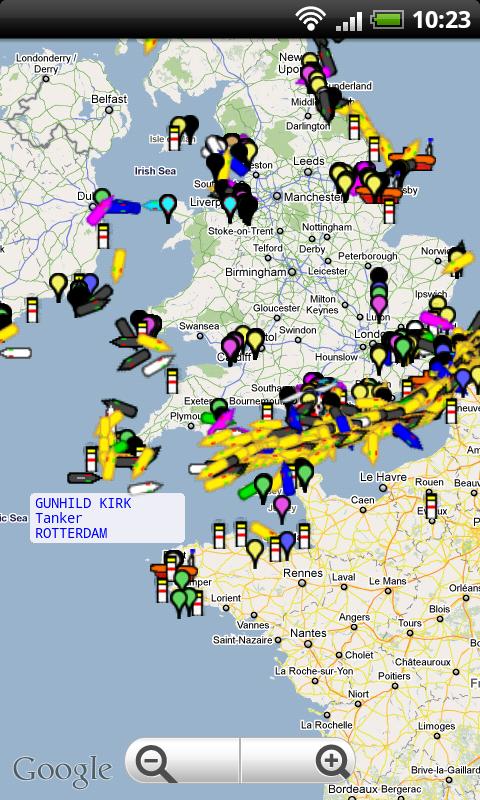
Ship Finder for Android - Ship Finder is a useful application that allows you to track ships in near real-time on a 2D map.
Tap on a ship to view its name, port of registration, destination, ETA, location, MMSI, IMO, callsign , heading, length, width, draft, etc.
The app works by picking up AIS feeds used by the ships for safety and navigation purposes.
What's New in This Release:
· Fixed the crashing when low/no signal
Like it? Share with your friends!
Supported operating systems:
Google Android 1.6, Google Android 10.x, Google Android 2.0, Google Android 2.1, Google Android 2.2, Google Android 2.3, Google Android 3.0, Google Android 3.1, Google Android 3.2, Google Android 4.0, Google Android 4.1, Google Android 4.2, Google Android 4.3, Google Android 4.4, Google Android 5.x, Google Android 6.x, Google Android 7.x, Google Android 8.x, Google Android 9.x
Similar Software:
Android Photo GeoTag Android Photo GeoTag - Take pictures with your mobile phone and incorporate the data of the geographical location. The application allows you to include in the photographs, data from the GPS receiver, along with a brief note. If you know the coordinates, not having the GPS receiver, you can also handwrite geographic data
GeoRecorder The ONLY GPS logger app you'll ever need on the Android platform!
TomTom Eastern Europe for Android TomTom Eastern Europe for Android - TomTom Eastern Europe is a turn-by-turn GPS navigator for Android devices. The app includes accurate offline maps, so you can find your way anywhere, even without an internet connection
Outdoor Share for Android Outdoor Share for Android - The Outdoor Navigation software is your best friend through your adventures in the wild.
Go into the outdoors with confidence and enjoy your activities without worrying about the tools to help you navigate. Your Outdoor Navigation app is made by the people who have been developing this software since 2003 across multiple platforms
amAze (Motorola) AmAze is a first of its kind free navigation and local search service. It is free to download and use and it contains wide coverage of maps including aerial photo in Europe, North America, Australia and parts of Asia and Africa
Phone Tracker (GPS Phone Tracking) Phone Tracker (GPS Phone Tracking) - The Phone Tracker is a free service that uses GPS technology to help you follow friends/family and see their exact location on a map. You will be able to securely track both iPhones and Androids, view their movements, and see up to 72 hours of their travel location history. ✓ Follow your child's movements during the day
Polaris Navigation System Polaris Navigation System - The Polaris Navigation System is a powerful navigation software for Android. It includes all the standard GPS functionality, including an odometer, altimeter, speedometer and directional compasses.
The app also allows you to record trails and view them on a map
TomTom Iberia for Android TomTom Iberia for Android - TomTom Iberia is a turn-by-turn GPS navigator for Android devices. The app includes accurate offline maps, so you can find your way anywhere, even without an internet connection
NAVIGON select NAVIGON MobileNavigator - GPS Navigation NAVIGON MobileNavigator GPS Navigation Very important: ONLY customers who already have one of the previous full versions bought can use this software as an update
I am here I am here - This Android application allows you to share your current location between your friends by sms, e-mail and other communicative programs, which are already installed in your phone.
Also you can send your location to other programs, which can work with text like notes, etc
Other Software by developer «pinkfroot»:
Plane Finder for Android Plane Finder for Android - Plane Finder is a flight tracker that shows real-time air traffic on a 2D map.
Tap on a plane to view airline, flight number, route, speed and altitude, aircraft information, departure and arrival data, etc.
The app allows you to search for more than 12,000 aircraft, which are tracked in real-time using ADS-B data
Plane Finder 3D for Android Plane Finder 3D for Android - Plane Finder 3D is a flight tracker that shows live air traffic in beautiful 3D.
With simple touch controls you can pan and zoom to fly around the planes, and can even get on board a plane for a captain's eye view from the cockpit.
The app allows you to search for more than 12,000 aircraft, which are tracked in real-time using ADS-B data
Plane Finder HD for iPad Plane Finder HD for iPad - Plane Finder is a flight tracker that shows real-time air traffic on a 2D map.
Tap on a plane to view airline, flight number, route, speed and altitude, aircraft information, departure and arrival data, etc.
The app allows you to search for more than 12,000 aircraft, which are tracked in real-time using ADS-B data
Plane Finder for iPhone Plane Finder for iPhone - Plane Finder is a flight tracker that shows real-time air traffic on a 2D map.
Tap on a plane to view airline, flight number, route, speed and altitude, aircraft information, departure and arrival data, etc.
The app allows you to search for more than 12,000 aircraft, which are tracked in real-time using ADS-B data
Plane Finder 3D for iPhone/iPad Plane Finder 3D for iPhone/iPad - Plane Finder 3D is a flight tracker that shows live air traffic in beautiful 3D.
With simple touch controls you can pan and zoom to fly around the planes, and can even get on board a plane for a captain's eye view from the cockpit
Ship Finder HD for iPad Ship Finder HD for iPad - Ship Finder is a useful application that allows you to track ships in near real-time on a 2D map.
Tap on a ship to view its name, port of registration, destination, ETA, location, MMSI, IMO, callsign , heading, length, width, draft, etc.
The app works by picking up AIS feeds used by the ships for safety and navigation purposes
Plane Finder Free for iPhone Plane Finder Free for iPhone - Plane Finder Free is a flight tracker that shows real-time air traffic on a 2D map.
Tap on any plane to view flight number and plane registration / tail number.
The app can show the location of more than 12,000 aircraft, which are tracked in real-time using ADS-B data


")


