Google Maps - Now you can get business locations, maps and directions while you're on the go. And it's all free.
· Navigation: Free, voice-guided GPS navigation system using GPS with Google Maps
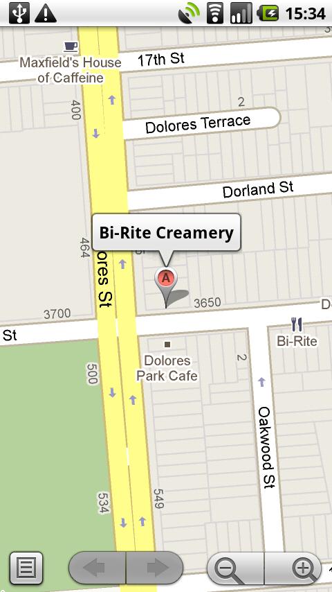
· Places: Find nearby places and see hours, reviews, etc.
· Latitude: See friends on the map
· Directions: Driving, transit, biking, or walking
· Traffic
· Street View
What's New in This Release:
· Turn-by-turn navigation with lane guidance displays distance, arrival time, and quick access to alternate routes
· Save and manage offline maps in a custom list for when you're traveling or have a slow connection
· Transit results now display total walking time of your trip and the next scheduled bus or train
· Sign in to see your "Places to review" list from recently saved or searched-for places
· If you have the Uber app installed, open it right from Google Maps when comparing route options
What's New in 7.7.0:
· See a list of upcoming events and performances at participating venues
· Tap and hold anywhere on the map to drop a pin, save and share that location
· Bug fixes
What's New in 7.3:
· New design for Android phones and tablets
· Enhanced navigation including live traffic updates, incident reports and dynamic rerouting
· Explore: A new way to browse and discover popular local places to eat, drink, shop, play and sleep
What's New in 6.9.0:
· Save maps for use offline
What's New in 6.8.1:
· Fixes Latitude bug
What's New in 6.8.0:
· See reviews from experts and people you know
· Find just the right places with Zagat scores and summaries
· Get directions directly from map bubbles.
What's New in 6.7.0:
· New, simplified menu for Google Maps Navigation (Beta)
What's New in 6.7.0:
· Discover nearby Google Offers in the US
· Indoor walking directions (Beta) for Japan and the US
· See 360° panoramas inside restaurants and stores
What's New in 6.0.2:
· Bug fixes for newer devices
What's New in 6.0:
· Indoor maps (beta) are now available for select airports, shopping malls, and more. Learn more at g.co/indoormaps
· Menu added to the top toolbar for easy switching between common features.
· Updated home screen for Places, now with popular searches based on your location.
· Option to disable automatic screen dimming for Navigation.
What's New in 5.8.0:
· Personalize Place pages by uploading pictures from your visit
· Manage your starred and recently visited Places in the 'My Places' tab
· See descriptive terms for Places in search results and Places pages
· Add a new place to Places when checking in
What's New in 5.3.0:
· See your Location History dashboard if you've enabled Location History for Latitude
· Check in at "Home" after setting a home location in Latitude
· Add your own aspects (e.g. service, music) about places when rating them
What's New in 5.2.0:
· Post your reviews of places to Twitter.
· Check in at places with Google Latitude to earn status and share with friends.
· Ping Latitude friends to ask them to check in. Friends will get a check-in request notification from you.
· Search for a place to check in from Latitude if it's not in the suggested list of places
Like it? Share with your friends!
Supported operating systems:
Google Android 1.6, Google Android 10.x, Google Android 2.0, Google Android 2.1, Google Android 2.2, Google Android 2.3, Google Android 3.0, Google Android 3.1, Google Android 3.2, Google Android 4.0, Google Android 4.1, Google Android 4.2, Google Android 4.3, Google Android 4.4, Google Android 5.x, Google Android 6.x, Google Android 7.x, Google Android 8.x, Google Android 9.x
Similar Software:
NAVIGON MobileNavigator NAVIGON MobileNavigator - Turn your Android phone into a mobile navigation device with lots of useful functions that will delight you! The pocket navigation device will show you the right way with functions such as Reality View Pro and Lane Assistant Pro
Geosearch Geosearch is a free/open source application which allows you to monitor the movement of users on a Google map. You can send SMS, make calls and find the optimal road to reach another user
Disaster Alert Disaster Alert (by PDC) - Current global disaster info on an interactive map Disaster Alert (by PDC), Active Hazards on an interactive map and in a list as they are occurring around the globe. Additional hazard information can be viewed and shared
BeOnMyMap (Android) BeOnMyMap The Android mobile device application for the BeOnMyMap.Com service. BeOnMyMap is a location based socialisation application, consisting of the BeOnMyMap.com website, a mobile website for use on your mobile phone (BeOnMyMap.mobi) and integrated applications for mobile devices
Osm2GpsMid GpsMid is a free, fully offline, vector based map application for your mobile phone. It displays your current position on a zoomable map and can be used to search for and navigate to roads or points of interest of your liking. As all data is stored in a compact binary format on your mobile phone you will incur no charges for extra data downloads
GoPenS GoPenS is an OpenSource GPS application for Android phones, based on OpenStreetMap (OSM). OpenStreetMap is a collaborative map of the world. Therefore, one of the main functions of the application is to be able to record a trace and send it as a GPX to the OSM servers, and so edit the OSM Map
Sensorly Map Viewer Sensorly Map Viewer - How good is your cell/mobile network coverage where you need it?
Is your favorite WiFi network going to be available at your vacation spot?
See the answer with this application and join us to build worldwide coverage maps.
(Data collection is configurable and can be turned off
Street View on Google Maps Street View on Google Maps - New! Street View smart navigation -- move around by dragging "Pegman" where you want to go. Try Street View on Google Maps to view street-level imagery from your phone. To use Street View, open Google Maps, search for a place or long-press the map, and tap the Street View option
Walk And Run Keeper Walk And Run Keeper - Lets you measure how far you ran/walked, track your walking distance, speed, time, and calories burned and store a record of your daily workouts to stay fit.
This is the best way to maintain walking schedules. Use this app and measure your walking route and calculate your burned calories per session
Bagf Maps This is the first Map Application developed by Bagf, Inc. and in cooperation with Google, Inc. It is a honor for us to work with Google.. Also is it a honor to can share an Application that comes from us and Google! Enjoy!
Other Software by developer «Google»:
Google Translate (iPhone) Google Translate (iPhone) - Translate words and phrases between more than 50 languages using Google Translate for iOS. For most languages, you can speak your phrases and hear the corresponding translations
SoundBack SoundBack - augments TalkBack with additional non-speech auditory cues that make the interaction both efficient and fun
Google+ (iPhone) Google+ (iPhone) - Google+ for mobile makes sharing the right things with the right people a lot simpler. Huddle lets you send super-fast messages to the people you care about most. And no matter where you are, the stream lets you stay in the loop about what your friends are sharing and where they're checking in.
Google+ is only available for users 18 and older
Google Pinyin IME (Android) Google Pinyin IME (Android) - Google Pinyin Input Method for Android.
Please enable in "Settings" -> "Language & keyboard settings"
What's New in This Release:
· Handwriting input.
· Better support for tablet devices.
· Use system's Google account for dictionary synchronization
Google Sky Map (Android) Google Sky Map (Android) turns your Android device into a window on the night sky.
What's New in This Release:
· Minor bugfix.
What's New in 1.6
Google Maps for mobile with Latitude Google Maps for mobile with Latitude is the official mobile mapping application from Google.
Features:
New! Google Latitude
Latitude lets you see your friends' locations and status messages. Share your location and status with select friends. Get started by selecting "Join Latitude" in the menu
Google Goggles (Android) Google Goggles (Android) - Goggles uses image recognition technology to recognize objects and return relevant search results. Identifies products, famous landmarks, storefronts, artwork, and popular images found online. Goggles can translate words in English, French, Italian, German, Spanish, Portuguese & Russian
Street View on Google Maps Street View on Google Maps - New! Street View smart navigation -- move around by dragging "Pegman" where you want to go. Try Street View on Google Maps to view street-level imagery from your phone. To use Street View, open Google Maps, search for a place or long-press the map, and tap the Street View option
Blogger (iPhone) Blogger (iPhone) - Start blogging on the go with the official Blogger app!
With Blogger app for iPhone and iPod touch, you can easily publish posts with pictures, labels and location information. Also, you can view the list of posts and if you have multiple accounts or blogs, you can easily switch between them


")

")


")


")

")
")
")

")
")