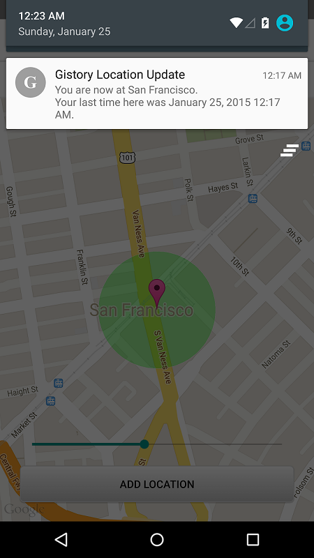
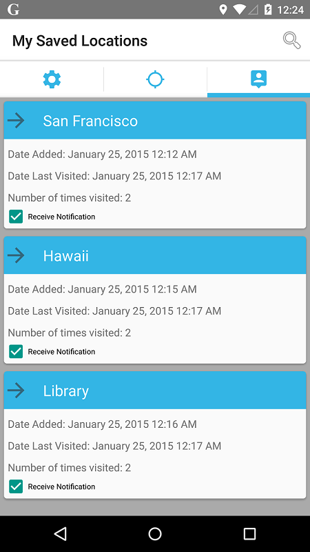
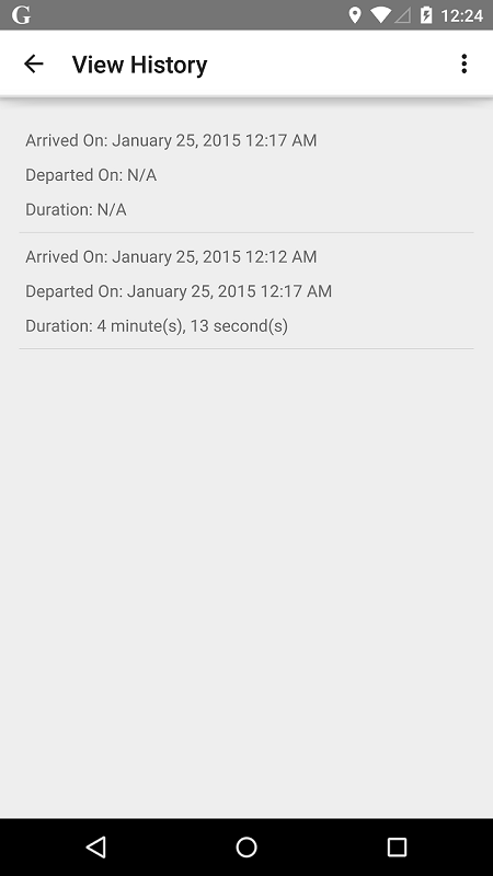
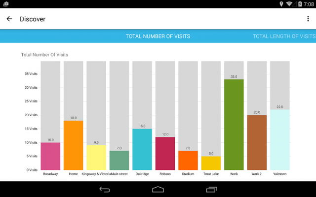
Gistory Analytics - Gistory is a powerful app that allows you to record the places you have been. In addition, you can also use the built-in analytics tool to allow you to discover how often and where you spend your time the most. Just save your current location in the app, and Gistory will take care of the rest. The next time you come back to this place, Gistory will let you know when the last time you were here and how long you stayed. In addition, Gistory will also allow you to take pictures and tag it to the place so you can remember exactly where you took them. Gistory can help answer questions like… - When was the last time I went to Hawaii? - How long do I spend at the gym every week? - Where was this picture taken? - Did I spend more time at work or at home last month? - How often did I go shopping two months ago?
Like it? Share with your friends!
Supported operating systems:
Google Android 10.x, Google Android 3.0, Google Android 3.1, Google Android 3.2, Google Android 4.0, Google Android 4.1, Google Android 4.2, Google Android 4.3, Google Android 4.4, Google Android 5.x, Google Android 6.x, Google Android 7.x, Google Android 8.x, Google Android 9.x
Similar Software:
LocationBot Lite LocationBot is an Android app that can change various settings on your phone according to your location. For example, it can switch the phone's WiFi and Bluetooth on when you are in your home or at your favourite coffee shop, or turn the volume down and set vibrate on when you are at work/church/cinema
GPS Tracker GPS Tracker is used to monitor activity of android GPS device and send data to the server
ViewRanger GPS ViewRanger is a unique mapping, navigation, tracking, and information tool for mobile phones that provides fully featured outdoor gps and trail navigation through a natural and intuitive display. ViewRanger transforms a Nokia or other Symbian S60 smartphone into a fully featured trail navigation system
GPSbySMS (Android) GPSbySMS is an application that reads navigation data from GPS and sends it to any user via SMS or email.
Purpose:
1) Read navigation data from GPS and send it to any user via SMS or email.
2) View current position on Maps (need Internet connection).
3) Save navigation data in database using data transfer via GPRS Internet.
4) Alarm Function
amAze (LG) AmAze is a first of its kind free navigation and local search service. It is free to download and use and it contains wide coverage of maps including aerial photo in Europe, North America, Australia and parts of Asia and Africa
Back Country Navigator Back Country Navigator - is a handy navigator which will help you find way in any location. The application has embedded storage so you can download the needed data and use maps without Internet connection. All you need to do is to activate a satellite navigation to see your location
NAVIGON USA for Android NAVIGON USA for Android - NAVIGON turns your mobile device into a fully featured GPS navigation system. The software provides advanced functionality for both drivers and pedestrians, including 2D and 3D maps, route planner, speed assistant, voice directions, local search, and more.
NAVIGON uses offline maps, so you don't need to worry about data traffic or roaming charges
Naver Maps Naver Maps - Smarter than ever! Experience Naver Map for Android. You can find the shortest way to get to your destination, using public transportation even it is far away. You can also search the information on the area around you easily and check whether you are heading to your destination correctly with GPS and compass
MapMyFitness+ for Android MapMyFitness+ for Android - MapMyFitness is a fitness assistant that allows you to track your workouts using your phone's built-in GPS.
With the app you can view your route on a map and record your workout details, including duration, distance, pace, speed, elevation and calories burned

")


")
")


")