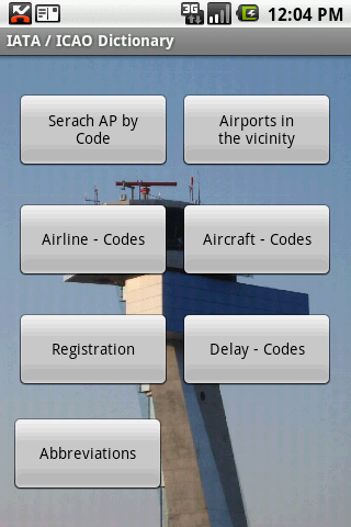
IATA / ICAO Dictionary -This application is an offline database for IATA / ICAO airport, airline, aircraft, delay codes and aircraft registration codes.
The airport database provides:
- Name
- Elevation
- Latitude and Longitude coordinates,
- timezone,
- runway and communication information (not every airport)
- Metar / TAF reports (not every airport)
- google map (not every airport)
- sunrise / set calculation
- find other airport in the vicinity of the selected airport or from your present position (GPS required)
- calculate the distance to the selected airport (GPS required)
The airline database provides:
- Name
- Country
- Callsign
- picture of the airline with airliners.net
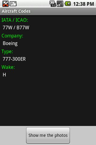
The aircraft database provides:
- Company
- Type
- wake category
- picture of the aircraft with airliners.net
Other functions are:
AC registrations; selection by
- country - registration
- registration - country
Delay codes
general aviation abbreviations
Like it? Share with your friends!
Supported operating systems:
Google Android 1.5, Google Android 1.6, Google Android 10.x, Google Android 2.0, Google Android 2.1, Google Android 2.2, Google Android 2.3, Google Android 3.0, Google Android 3.1, Google Android 3.2, Google Android 4.0, Google Android 4.1, Google Android 4.2, Google Android 4.3, Google Android 4.4, Google Android 5.x, Google Android 6.x, Google Android 7.x, Google Android 8.x, Google Android 9.x
Similar Software:
OGS-KGS Ücretleri Butun arac siniflarinin odeyecegi OGS ve KGS ucretlerini ogrenin, yolculuk hesaplariniz karismasin!
Caltroid (Android) Caltroid is a Caltrain schedule application for Caltroid is a Caltrain schedule application for Android-powered phones. Current release includes Jan 1, 2009 timetable.
Caltrain is aimed at commuters on the San Francisco Peninsula and in the Santa Clara Valley, California, in the United States
NAVIGON MobileNavigator NAVIGON MobileNavigator - Turn your Android phone into a mobile navigation device with lots of useful functions that will delight you! The pocket navigation device will show you the right way with functions such as Reality View Pro and Lane Assistant Pro
Southwest Airlines Southwest Airlines- Southwest Airlines Wireless Access puts you closer to the travel information you need while you are on the road and away from your computer. You can access several key southwest.com features via your web-enabled mobile device
Chicago Hotels Search Chicago Hotels Search Book Cheap Chicago Hotels. Save Up to 80% Chicago City Hotels The world's largest hotel search engine that combines all hotel deals from the best travel sites into one free, quick and easy search. Genius!
Informasi Tol Indonesia Aplikasi informasi tol ini dapat memberikan informasi terkini jalan tol (Gambar CCTV), peta di ruas jalan tol, tarif jalan tol, kontak layanan lalulintas jalan tol, dan informasi fasilitas area peristirahatan di jalan tol
Trip advisor Trip advisor - plan your trips and journeys easily. With the help of this application you will find the needed hotel, restaurants, sights and amusement places with detailed and informative description as well as photos and comments of people who has already visited the places you are interested in. You can do all this very fast
Africa Going to Africa? Tips and tricks to ensure a wonderful trip to this wonderful continent!
OneBusAway Real-time transit information for the Puget Sound region and beyond. Never miss the bus again! OneBusAway gives you real-time arrival information for Seattle area buses, including King County Metro, Sound Transit, and Pierce Transit
QMetro Subway World QMetro it's a simple subway map for searching stations and calculating route. About 230 maps of subways are available. Maps have an open format and can easily be edited or created. By default the package includes biggest subways of the World, and you can easy download other available maps into this app
Other Software by developer «Steve Dexter»:
Aviation Weather with Decoder Aviation Weather with Decoder - An easy way to receive metar and TAF reports from NOAA
Snowtam Decoder Snowtam Decoder - You have a snowtam in the metar report, you want to decode. Snowtam Decoder does it for you.
· Decoding of a snowtam in metar format
· Explanation of the items (A ,B , C, ..
Guess the X Guess the X - With this game you can guess a flag, a capital, a land and boundaries.
There are four input methods available to enter the answer: an autocomplete editbox, via a listview, multiple choice and a tap mode.
There are also options to change the color, size and font


")


