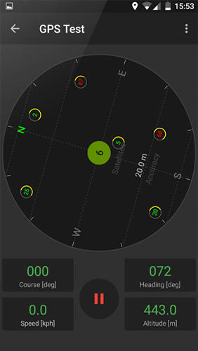
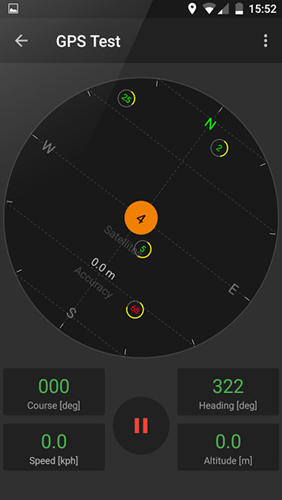
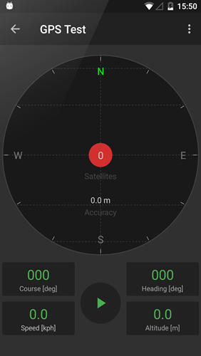
GPS Tools - is an application for calibration of a satellite module of your smartphone. The utility uses a magnetic compass, makes changes to the route, speed and accuracy of the displayed data. As soon as the calibration is completed you can track your location with maximum accuracy.
Game features:
Magnetic compass
Commercial free
Fast calibration
Big number of satellites
Like it? Share with your friends!
Supported operating systems:
Google Android 10.x, Google Android 4.4, Google Android 5.x, Google Android 6.x, Google Android 7.x, Google Android 8.x, Google Android 9.x
Similar Software:
FastToolBar FastToolBar - It is simple and easy controller:
-Sound control
-WiFi control
-Bluetooth control
-GPS control
One click and you can turn on/off this functions.
Simple and very convenient widget will not take you on the phone a lot of memory
CoPilot Live UK + Ireland (Android) CoPilot Live UK + Ireland (Android) - CoPilot Live is full-featured voice-guided GPS navigation with street maps of 1 European region stored on your Android phone. Includes 3D guidance, lane assist, speed limit warnings, safety camera alerts, planning mode.
Download maps via WiFi after purchase. Unlimited use after 10 days once Google order verified
GPS2OpenGTS Free GPS2OpenGTS will send your GPS data to an OpenGTS tracking system.
Latest version now supports UDP.
Also added is a Test function/screen to help with server configuration.
Send a NMEA GPRMC strings with the following data.
(accountID, deviceID, Latitude, Longitude, Speed, Heading and Altitude
ParkLeitSystem ParkLeitSystem is a car-park-routing system. It shows you, according to your GPS position, the nearest city with a car-park-routing system and gives you a list with all available car-parkings and shows how many free places there are. With a click on the parking it switches to google maps and shows you the position of the parking
GPS Map Camera use GoogleMap GPS Map Camera use GoogleMap - The main feature of the 'GPS Map Camera':
When you take a piture with GPS enabled, it will paste the google map, address and weather to picture. (GPS latitue/longitude also include in the information)
Please enable your network and GPS function before using this application
TomTom U.S.A. for Android TomTom U.S.A. for Android - The TomTom app allows you to enjoy smart turn-by-turn navigation on your Android device. The application includes accurate offline maps, so you can find your way anywhere, even without an internet connection
OakLogAndroid OakLogAndroid Logger application for your Android device. Records GPS and sensor information on your phone.
The log files (*.olg) can later be loaded into TrackView.NET and viewed in all their 3D-glory.
· Logs GPS position, altitude, speed, etc
NavTruck for Android NavTruck for Android - NavTruck is a GPS navigation solution created specifically for truck drivers. The app automatically calculates routes taking into account vehicle size, weight, width and load type to avoid restricted roads.
NavTruck uses offline maps, so you don't have to pay for unnecessary internet traffic
amAze (Android) AmAze is a first of its kind free navigation and local search service. It is free to download and use and it contains wide coverage of maps including aerial photo in Europe, North America, Australia and parts of Asia and Africa
WAY - Where are you? WAY - Where are you? - Share you location and find your friends easily.
Wanna find your friends?
Wanna share your location with friends?
Congratulations: YOU FOUND THE APPLICATION WHICH ALLOWS YOU THAT AND EVEN MORE.
"WAY - Where are you?" allows you to find your friends' locations in real time and/or send them free messages
Comments on GPS Tools:
Comments not found
If you noted an error or download link is broken, please, report it via this page or use comments.
GPS Tools is compatible with your device BBK Vivo Y929 Dual SIM TD-LTE


")


")
