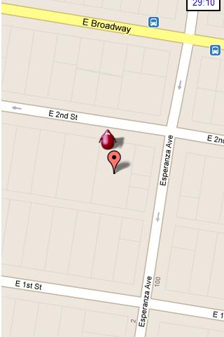
Hunting the Snark - Inspired by Lewis Carrol's poem, The Hunting of the Snark, Hunting the Snark is an action game played on both your GPS-enabled Android device and in the real world. In it, you hunt a Snark (the creature on the map in blue.) If you invade its physical location before the game time has expired, you win. Otherwise, you lose. Also, at random intervals the Snark becomes a Boojum. Your device will vibrate and the creature will turn red, and it will then attack you until a random interval expires, at which time it will become a Snark again. If, as a Boojum, it invades your physical space, you lose.
NOTE: the accuracy of the game is around 3 yards (2.5 meters.) Keep this in mind when you have the map zoomed in close.
Please play responsibly, in areas of low traffic. Adult supervision is recommended.
In the menu, you can pause or stop the game, start a new one, change the screen's orientation, and modify the settings, which include the Snark's speed, the game time, whether the Snark must remain within the region of the map, and the type and zoom-level of the map. Also, you can move the map around with your finger.
This game requires Internet access and an active GPS service, and your device must be facing an open sky. It is also STRONGLY recommended that you turn off other locator services. Though this may be dependent on your particular location and your service provider. The app has been tested on Android 2.2. It may or may not work on other systems.
What's New in This Release:
· Changed character design and animation
· Improved user notifications
· Minor UI improvements
· Replace AdSense with AdMob
Like it? Share with your friends!
Supported operating systems:
Google Android 10.x, Google Android 2.2, Google Android 2.3, Google Android 3.0, Google Android 3.1, Google Android 3.2, Google Android 4.0, Google Android 4.1, Google Android 4.2, Google Android 4.3, Google Android 4.4, Google Android 5.x, Google Android 6.x, Google Android 7.x, Google Android 8.x, Google Android 9.x
Similar Software:
runtastic GPS Coach Your personal GPS sports assistant for running, cycling, walking, hiking, ... runtastic GPS is your personal running and fitness application for all outdoor (running, nordic walking, hiking, skating,..) and indoor sports (treadmill, cardio, yoga, bodybuilding)
VGPS (Vietnamese GPS) for Android VGPS was designed to use city street map on your ordinary mobile phone without the need of having GPS receiver or internet connection. VGPS does not require internal or external GPS receiver. However, if you have internal GPS receiver or external bluetooth GPS receiver, VGPS can work with your GPS receiver as well
LocationFinder LocationFinder is a LBS application. Through this application you can search any location in map. Click anywhere in map and you find the area, nearest city and country. Apart from this, user can edit any location for search and can see the location in map
Life360 Life360 turns your phone into the ultimate safety device. * Top 10 App Worldwide - Google Android Developer Challenge* Life360 turns your phone into the ultimate safety device and let’s you know
NAVIGON USA & Canada for Android NAVIGON USA & Canada for Android - NAVIGON turns your mobile device into a fully featured GPS navigation system. The software provides advanced functionality for both drivers and pedestrians, including 2D and 3D maps, route planner, speed assistant, voice directions, local search, and more
Tricorder Tricorder - A simple tricorder simulator for Android powered phones, using real sensors to detect magnetic fields, gravity, etc. See the passing gravity wave from a distant collapsar on your phone screen (actual device sensitivity may be insufficient to detect gravity waves). Detect buried powerful magnets! Be a mega-geek! Etc
MySpeed MySpeed will record your speed and location to a log file and show it on a map.
It can use a database of speed camera locations to alert you when you're near a speed camera.
There is no speed camera database included. You'll need to download the data from a site such as scdb.info, flitspaal.nl, pocketgpsworld.com, maparadar.com, etc
GPSbySMS (Android) GPSbySMS is an application that reads navigation data from GPS and sends it to any user via SMS or email.
Purpose:
1) Read navigation data from GPS and send it to any user via SMS or email.
2) View current position on Maps (need Internet connection).
3) Save navigation data in database using data transfer via GPRS Internet.
4) Alarm Function
EV Speedo EV Speedo is a GPS based speedometer with gadgets to provide g-force and other GPS information.
A built in map is also provided and any of the gauges provided can be overlayed upon the map, for example use the map to show your location with a speedometer to show your current speed
MozStumbler MozStumbler - Mozilla Location Service is an experimental project that aims to provide location-based services using data collected from users. The objective is to create a database of cell towers and WiFi access points that mobile devices can use to retrieve their location instead of having to rely on GPS
Other Software by developer «Colin Cohen»:
not found
Comments on Hunting the Snark:
Comments not found
If you noted an error or download link is broken, please, report it via this page or use comments.
Hunting the Snark is compatible with your device BBK Vivo Z3i Dual SIM TD-LTE CN 128GB V1813T / Z3is Standard Edition (BBK V1813)

")


 for Android")


")

