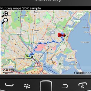
Nutiteq Maps - Nutiteq Mobile Mapping SDK demonstration application. It enables to view different map sources, including online (OpenStreetMap) and offline sources produced by TileMill (in MBTiles format) or Mobile Atlas Creator. Also online route finding is possible.
Like it? Share with your friends!
Supported operating systems:
RIM BlackBerry OS 4.6, RIM BlackBerry OS 4.7, RIM BlackBerry OS 5.0, RIM BlackBerry OS 6.0
Similar Software:
World Wonders (BlackBerry) World Wonders (BlackBerry) - Finally, in one list, the world's "top" everything:
· The world's fastest...
· The world's tallest...
· The world's most expensive...
· The world's longest..
Wayfinder Earth (BlackBerry) Wayfinder Earth (BlackBerry) - The world in your hand! Welcome to the ultimate experience of discovering the earth on your mobile device, for free.
How does it all work?
It's simple. Wayfinder Earth presents you with a 3D globe representing the planet earth, visible on the display of your mobile phone
MetrO (BlackBerry) Métro is your free guide to public transport systems worldwide (about 400 cities covered now)
PlayTube London Tube map
London Tube line status
Next train at the platform
Enjoy !
Mobile GMaps Mobile GMaps is a FREE application that displays Google Maps, Yahoo! Maps, Windows Live Local (MSN Virtual Earth) and Ask.com Maps and satellite imagery on Symbian and Java J2ME-enabled mobile phones, PDAs and other devices
J2ME OGC WMS Client J2ME OGC WMS Client is a program for accessing OGC Web map services from Java enabled mobile phone or PDAs.
It accesses the OGC WMS according to WMS 1.1.0 and 1.1.1 specifications and supports zooming and panning in the Map, WMS sublayers, and a bookmark management system for quick access.
Free for non-commercial use
Plaspy PLASPY is an application developed to enable location and a satellite tracking device or person regardless of the geographical area in which you are. It is a Global Information System Web-based Google Maps and the coordinates of a GPS device with an accuracy of 6 to 15 meters
Taegu subway This is a simple version of viewing subway maps of Taeguin Korea.
It will be kept updating more functionalities such as route finder, time table and other subway maps
Wizi Wizi- lets you send an SMS with link to an interactive map with your current location. Its free to use but requires you to have a data connection.
Wizi is a free mobile application that allows you to share your location instantly by SMS and E-Mail. Use Wizi to tell a friend where you are now or where you are going to meet
WorldMate Live Gold Annual Subscription WorldMate Live Gold Annual Subscription-Keep a personal travel assistant in your pocket! WorldMate Live will manage your full itinerary, including travel arrangements and business meetings, making all details immediately accessible on your mobile device, and ensure a smooth trip by pushing alerts regarding imminent events like flight delays
Other Software by developer «Nutiteq»:
Nutimap Mapping application based on Mobile Gmaps with some additional features localized for Estonia. Displays maps from an additional source (Regio), includes local POIs and can determine your approximate location based on the mobile network

")


")
")
")


