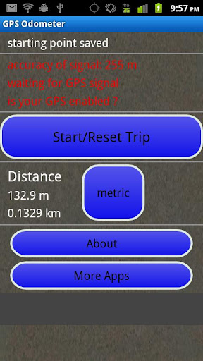
GPS Odometer - A simple and easy to use odometer. There is no maze of menus and no mysterious settings. GPS Odometer only does one thing, and does it well: measure distance traveled.
Note: Intended to measure relatively short distances, the application does not run in the background.
Like it? Share with your friends!
Supported operating systems:
Google Android 1.6, Google Android 10.x, Google Android 2.0, Google Android 2.1, Google Android 2.2, Google Android 2.3, Google Android 3.0, Google Android 3.1, Google Android 3.2, Google Android 4.0, Google Android 4.1, Google Android 4.2, Google Android 4.3, Google Android 4.4, Google Android 5.x, Google Android 6.x, Google Android 7.x, Google Android 8.x, Google Android 9.x
Similar Software:
Altimeter Altimeter - Check your altitude wherever you are with Altimeter. The app uses GPS to find your altitude. You can also check your location using google maps
Outdoor Compass for Android Outdoor Compass for Android - The Outdoor Navigation software is your best friend through your adventures in the wild.
Go into the outdoors with confidence and enjoy your activities without worrying about the tools to help you navigate. Your Outdoor Navigation app is made by the people who have been developing this software since 2003 across multiple platforms
Earth Geo Magnetic Field Calculator 3D Earth Geo Magnetic Field Calculator 3D - Earth Geo Magnetic Calculator 3D used to estimate magnetic field at a given point on Earth, and in particular, to compute the magnetic declination from true north
Super Swiss Army Knife Free Super Swiss Army Knife Free - This is a super software which has a multi-functional combination applying to life, travel and military combat. It is a veritable Swiss Army Knife with a cool widget desktop, including eight functions of ruler, protractor, flashlight, compass, gradienter, vertical, wall picture, telemeasurement
eGPS Elevation EGPS Elevation has greatly improved altitude and elevation readings. In a typical Android GPS, altitude readings are notoriously inaccurate. eGPS Elevation will even show how deep is the nearest water area
Transform Compass for android Transform Compass for android - Transform compass.Made for Transform''s fans.When you lose your way I hope Transform compass can help you. Open the Transform compass and it do work. If someone cant install ,you can tell me the detail about your cell-phone''s version.We will fix it or made another one for you
Smart Measure - rangefinder You can measure the distance and height of an object. Smart Measure Lite is the part 2. of Smart Tools series. (distance, height) This range-finder measures the Distance and the Height of an object by trigonometry
GPSTest GPSTest - Program to show off the GPS capabilities of your Android device. Displays Satellite positions and signal strengths as well as speed, bearing and altitude values. It includes a world map with the day/night terminator overlayed as well as your current location and the suns position
GeoLog GeoLog saves the sensors data (gps, accelerometer, magnetometer data, etc.) of your device to a log file and calculates the coverage of the site. The coverage is a ratio of the track covering area to the area of the site (expressed in percents)
Epic Compass Epic Compass - When you are a traveler or lost in somewhere place, you must need a compass. Caompass can be used in outdoor and many activities you can do such as hiking, climbing, flying etc
Other Software by developer «TappiApps»:
GPS Tape Measure GPS Tape Measure - GPS Tape Measure is a virtual tape measure for your Android device. Perfect for when you want to easily find the distance between two points on earth and you forgot to bring your laser rangefinder. Simple and easy to use
My GPS Coordinates and Location My GPS Coordinates and Location - A simple application with crude, but adequate, support for 40 languages. Allows you to share your position via email, text message, twitter, etc, and displays your current GPS location in both decimal format and in sexagesimal (degrees minutes seconds) format. Internet access is not required to send your location with a text message
Name That Plane Name That Plane - Test your knowledge of aircraft. The app features over 300 aircraft images. Compete with your friends and the world via a global score board provided by Scoreloop.
How score is calculated:
score = (percentage_correct * 10) / sqrt(sqrt(time_in_seconds))
Note that only thinking time is considered