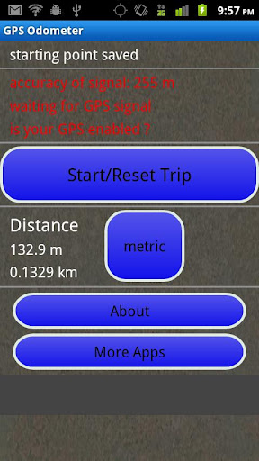
GPS Odometer - A simple and easy to use odometer. There is no maze of menus and no mysterious settings. GPS Odometer only does one thing, and does it well: measure distance traveled.
Note: Intended to measure relatively short distances, the application does not run in the background.
Like it? Share with your friends!
Supported operating systems:
Google Android 1.6, Google Android 10.x, Google Android 2.0, Google Android 2.1, Google Android 2.2, Google Android 2.3, Google Android 3.0, Google Android 3.1, Google Android 3.2, Google Android 4.0, Google Android 4.1, Google Android 4.2, Google Android 4.3, Google Android 4.4, Google Android 5.x, Google Android 6.x, Google Android 7.x, Google Android 8.x, Google Android 9.x
Similar Software:
GPS Location Lite GPS Location Lite - Use your Android phone as a professional GPS logging device.
Record different tracks and export gpx-files to sdcard.
View Distance, Time, Speed, Altitude, Latitude and Longitude.
In the GPS Location Lite settings you could choose gps or network provider. GPS interval (5-60 seconds) and some other preferences are adjustable
My Location Logger My Location Logger - My Location Logger allows you to share your exact location using your Android phone.
If you want to invite friends somewhere but don't know the directions, simply launch the app and send them a message with your GPS coordinates.
Google Maps will allow them to find your location easily
Waze: Community GPS navigation Waze: Community GPS navigation - Waze is a free, 100% user-generated, social navigation app that allows drivers to build and use live maps & real-time traffic updates to improve their daily commute
GPS Map Camera use GoogleMap GPS Map Camera use GoogleMap - The main feature of the 'GPS Map Camera':
When you take a piture with GPS enabled, it will paste the google map, address and weather to picture. (GPS latitue/longitude also include in the information)
Please enable your network and GPS function before using this application
Nöbetçi Eczaneler Ankara Nöbetçi Eczaneler Ankara - Ankara Eczacı Odası'ndan günlük olarak alınan bilgiler doğrultusunda, uygulamamızda ilçenizi seçerek, bölgedeki nöbetçi eczanelerin bilgilerine ulaşabilirsiniz
AlpineQuest AlpineQuest - AlpineQuest turns your Android device into an off-road GPS using offline topo maps. It is a complete solution for all outdoor activities and sports, including hiking, running, trailing, hunting, sailing, geocaching and much more
Phone Tracker (GPS Phone Tracking) Phone Tracker (GPS Phone Tracking) - The Phone Tracker is a free service that uses GPS technology to help you follow friends/family and see their exact location on a map. You will be able to securely track both iPhones and Androids, view their movements, and see up to 72 hours of their travel location history. ✓ Follow your child's movements during the day
Car Locator Bluetooth Plugin Save your car's location whenever your phone disconnects from car's bluetooth! As seen on the Verizon commercial
Turbo GPS 2 (Android) Turbo GPS 2 (Android) - The known all-in-one GPS for Android devices, now in version 2
My Tracks My Tracks - Use My Tracks while you run, bike, hike, or do anything else outdoors, and it will use the GPS sensor in your Android phone to record the path you took. It will also gather useful statistics such as time, speed, distance, and elevation. You can review all of this data live, or you can save it for use later
Other Software by developer «TappiApps»:
My GPS Coordinates and Location My GPS Coordinates and Location - A simple application with crude, but adequate, support for 40 languages. Allows you to share your position via email, text message, twitter, etc, and displays your current GPS location in both decimal format and in sexagesimal (degrees minutes seconds) format. Internet access is not required to send your location with a text message
GPS Tape Measure GPS Tape Measure - GPS Tape Measure is a virtual tape measure for your Android device. Perfect for when you want to easily find the distance between two points on earth and you forgot to bring your laser rangefinder. Simple and easy to use
Name That Plane Name That Plane - Test your knowledge of aircraft. The app features over 300 aircraft images. Compete with your friends and the world via a global score board provided by Scoreloop.
How score is calculated:
score = (percentage_correct * 10) / sqrt(sqrt(time_in_seconds))
Note that only thinking time is considered


")


