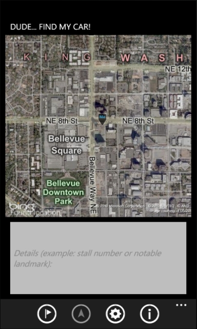
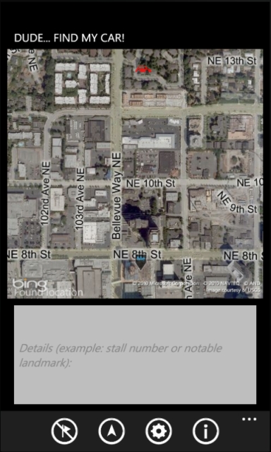
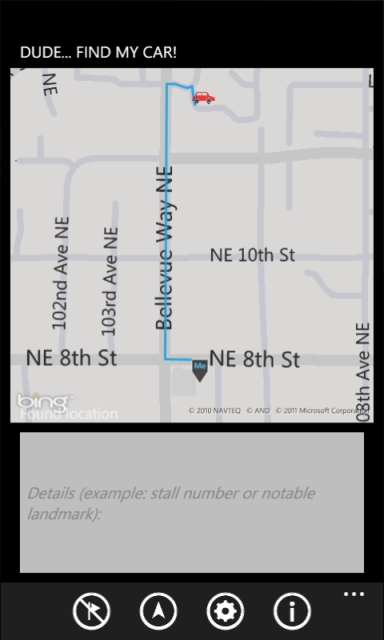
Find My Car Have you every parked your car and then went about your day, only to realize at the end of the day that you don't recall where you parked it? Then "Find My Car" is for you.
What's New in This Release:
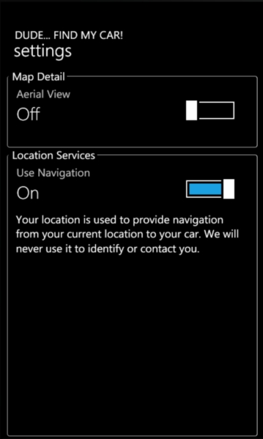
· Updated to support copy and paste functionality and update Bing maps.
· Corrected the loading screen to read “Acquiring location…” instead of “Locating location…”
Like it? Share with your friends!
If you got an error while installing Themes, Software or Games, please, read FAQ.
Supported operating systems:
Windows 10 Mobile, Windows Phone 7, Windows Phone 8
Similar Software:
Map Services This application let the user to view maps, trace routes between two places, find a place, query for the weather in the current map position
Map Compare Map Compare - Map Compare allows you to compare 12 different maps from Bing, Google, Yahoo and Open Street Maps side by side on a single screen
Bingle Maps Bingle Maps is a full featured map application. Other than the commonly desired features like Search, Routing and Itineraries, it allows you to drop unlimited personal pins and synchronize them with your DropBox account, not to mention that it also integrates with Google Maps.
Highlights:
- You can choose to use either Bing Maps or Google Maps
GMap Pro GMap Pro - Ultimate Google Maps for Windows Phone 7
In new version we have added China region detection and offset auto correction. We have also improved navigation by adding auto rerouting and current step highlighting.
We appreciate your feedback. Help us make tool you’d like
Chicago Maps Chicago Maps - Offline (no data connection necessary!) public transportation maps for the Chicago area. Click on the thumbnails and zoom in for a detailed look.
Includes:
1. an overview of the Chicago Transit Authority system with the ability to zoom into different sections using a map and/or a list
2. Night Owl bus map
Can be used in portrait or landscape view
SketchMaps Free! SketchMaps Free! - SketchMaps is the very first drawable live map which can also be saved to pictures. It's an unique idea and it's first of its kind. It's that simple. Please, view screenshots!
SketchMaps Free is full-featured, but will show ads. You can buy the full version of SketchMaps at any time to remove the ads
Free World Explorer Free World Explorer - So, you think you are good at geography? Let's see how good you are :)
Pan the map to fly the plane to the destination place and click on land button when you find the green airport symbol. You need to be connected to internet for this. Difficulty mode to challenge you with a lot more countries
Washington SR 520 Toll & Traffic Washington SR 520 Toll & Traffic - Electronic tolling on SR 520 will begin this spring. Be ready by checking how much it will cost you to cross SR 520. Application takes in account US Holidays and provides additional information, such as current crossing time for both directions, and traffic map of the bridges
GeoBC Showcase GeoBC Showcase - This app takes advantage of geospatial layers provided by GeoBC. It will include Federal Electoral Districts and Local Health areas plus Primary Survey Parcels in British Columbia, Canada.
Select one of the layers from the list, then press a point on the map and hold to get information about that geographical point
Canada Topography Canada Topography - provides topographic information for the entire country of Canada. The maps provide details such as altitude, railways and numerous other layers. Using the GPS you can center on your current location and even zoom to specific areas of the country.
All maps are provided by Geocratis Canada (http://www.geogratis.gc.ca/geogratis/en/service/toporama
Other Software by developer «Therefour Phone 7»:
not found
Comments on Find My Car:
Comments not found
If you noted an error or download link is broken, please, report it via this page or use comments.
Find My Car is compatible with your device Blu W410i Win Jr