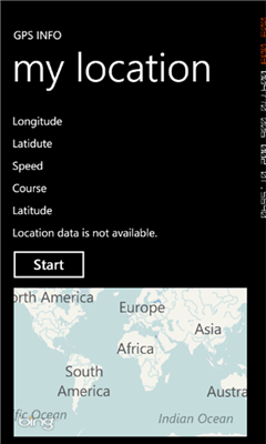
Gps info - Simple program to show your current Position on a map with location data latitude, longitude, course, speed, altitude.
Like it? Share with your friends!
If you got an error while installing Themes, Software or Games, please, read FAQ.
Supported operating systems:
Windows 10 Mobile, Windows Phone 7, Windows Phone 8
Similar Software:
MyDistances MyDistances - Die App ermoglicht es, die Koordinaten mehrerer Orte zu speichern und die Entfernungen zum aktuellen Standpunkt zu berechnen. Auch Entfernungen von einem der Orte zu allen anderen gespeicherten Orten lassen sich schnell ermitteln. Alle Orte konnen schnell und einfach auf der Karte angezeigt werden
MyGeolive MyGeolive is the ultimate application for outdoor sport fans. Follow live events on the go or start a personnal live tracking session. Share it with your friends on Facebook (they will be able to follow you live on a map with data such as max speed, total distance, routes, running time..
GPS Distance GPS Distance - GPS Distance vous permet de calculer rapidement et facilement la distance i vol d'aoiseau qu'il y a entre deux coordonnees GPS.
Les coordonnees sont donnees de facon decimales representant la valeur de l'angle en degre et le resultat est donnee en kilometre
NOAA Buoy NOAA Buoy - The National Oceanic and Atmospheric Administration keeps a database of information retrieved from smart buoys. This app retrieves the data from the buoys surrounding your current location. You can also change your location to look for other buoys
JaefreyGPS Pro JaefreyGPS Pro is the paid in and in functions enhanced version of JaefreyGPS lite.
With this application you can get your GPS position and the direction angle. Furthermore, the app allows the recording of unlimited tracks and uploading it as .kml or .gpx file in your Dropbox account. You can take various tools such as Google Maps to evaluate the path data
Distant Distant tells you where places are in relation to where you are now. It lists your places in order of distance, and colour codes them so that it is easy to tell at a glance whether you are getting closer or further away. It also tells you how long it will take to get there if you keep moving at the current speed
GPS Tracker Lite GPS Tracker Lite is an application that tracks your route while you move (walk, run, drive) and shows two main things: statistics of the route, and a map
Here I am With "Here I am" you can see your friend and your friend can see you on a map or webbrowser, on a pc or on a windows phone 7 device or other. So its easy to meet him on a unknown area (city center or a music festival).
the best of it: Its free
SmartRunner SmartRunner is the sports tracking application for your Windows Phone Device, which allows you to record your next run, biking trip, hike, walk, ride, or any other outdoor activity and publish them on www.smartrunner.com. The application informs you in real time about your average and maximum speed, distance and calories burnt. Sign up for a free webaccount at www
OS Grid Refs OS Grid Refs - A simple app that displays the phone's current location as an Ordnance Survey grid reference.
n.b. This will only be of use if the your current location lies inside the OS national grid. Using the app outside the UK will give no reading
Other Software by developer «skydiver81»:
not found
Comments on Gps info:
Comments not found
If you noted an error or download link is broken, please, report it via this page or use comments.
Gps info is compatible with your device Blu W510l Win HD