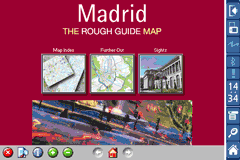
Rough Guides Map Madrid... These guides are a series of fantastic interactive maps.
Produced in conjunction with the premier travel publisher Rough Guides.
Discover and explore Madrid using full colour interactive linked maps, in this simple to use PDA version of The Rough Guides Madrid.
Find all the top tourist spots and key attractions with ease, information on the city and its sights can be quickly displayed with links to photographs and map locations. All in a superb easy to use interface.
If you''re travelling to Madrid, be sure you don''t leave home without this guide on your PDA.
The Rough Guide city maps includes:
Fully scrollable and interactive maps of the city.
Tap any location to display information and available links.
Intuitive navigation bar meaning you are never more than one click away from the information you require.
Map links allow you to directly link to other maps, photographs, or detailed views.
Categorised Find feature allowing you to quickly find any street, place of interest or station.
Categorised Information feature providing a wealth of information on the city, places of interest, etc.
1-Click Home feature, keeping the Home map always at hand.
Zoom function on all maps.
Hi Res & landscape displays supported.
Like it? Share with your friends!
If you got an error while installing Themes, Software or Games, please, read FAQ.
Supported operating systems:
Pocket PC 2002, Windows Mobile 2003, Windows Mobile 5.0, Windows Mobile 6 Classic, Windows Mobile 6 Professional, Windows Mobile 6.1 Classic, Windows Mobile 6.1 Professional, Windows Mobile 6.5 Professional
Similar Software:
TwitsnapsMaps TwitsnapsMaps uses the GPS on your PocketPC to find your current latitude/longitude/speed and altitude and allows you to upload your position via map to Twitter.com. You can customize the maps zoom, and type via the 'Options' in the toolbar. The maps service is provided by Google.com. The map/Twitter storage is from TwitSnaps
TrekBuddy Trekbuddy is a J2ME application to be used with a GPS receiver. It is designed to work with every Java-enabled device. It features capabilities such as: * GPS tracking and simple navigation * bitmap maps (without zoom, you can store bitmap maps with different resolution instead)
Sms My Position Sms My Position - How many times have you spend ages trying to explain somebody where to meet up, and finally not finding them? With this application you can just say: I''''ll send you an SMS with my location and we meet there SMS my Position is a very simple application that allows you to SMS your position in 3 clicks
amAze (LG) AmAze is a first of its kind free navigation and local search service. It is free to download and use and it contains wide coverage of maps including aerial photo in Europe, North America, Australia and parts of Asia and Africa
PathAway GPS SE PathAway GPS SE - GPS Navigation using your own maps! Convert any digital map, for use on your Pocket PC. Then, attach a compatible GPS (via bluetooth, cable, snap-on, or card) to your handheld, and you have a powerful GPS Moving Map navigation system
RideSchedulesCUMTD RideSchedulesCUMTD - The RideSchedules application is a full-featured public transit assistant that includes updatable schedules, countdowns, maps, favorite stops, directions, guides, tracking tools, alarms, announcements, parking meter, vehicle finder, realtime vehicle locations, offline support, and convenient access to transit provider services
MapKing 2007 BeiJing PPC Map in English MapKing 2007 BeiJing PPC Map in English - MapKing 2007 New Functions: More different profile Compass mode Open Tour book (need to connect to pc to edit) Support VGA monitor Nine intelligent map query (index/Crossing/ Q-find/POI/ position/City/Town/ Lat/Long/Keyword) Customer Support will not be provided for trial version
MetroMap Metro map (Moscow, St. Petersburg, Minsk, Kiev, Ekaterinburg, Nizhny Novgorod, Novosibirsk, Samara
Other Software by developer «Visual IT»:
Tube 2 Engine Pocket PC Tube 2 Engine - Transform your PDA into a fully scrollable detailed map of one of the worlds subway or metro systems.
See your journeys come alive with a superb animated display.
Save hours by automatically having the quickest routes to hand, with all the details you need including line changes, platform directions and accurate journey times
Vienna Metro 10 for iPad Vienna Metro 10 - The new Zuti Vienna Metro map makes it easy to travel in and around the city using the Metro (U-Bahn), Suburban Rail (S-Bahn) or Tram (Straßenbahn) systems
Tube 2 Paris Touristic (UIQ3) Tube 2 Paris Touristic (UIQ3) - This map package for Tube 2 is the ideal map for the tourist or business traveller who needs to get around Paris using the metro system and would like to know just exactly where they are. The map geographically locates all the central stations, making it much more informative than the official topological map
Rough Guides Map Rome Rough Guides Map Rome... These guides are a series of fantastic interactive maps.
Produced in conjunction with the premier travel publisher Rough Guides.
Discover and explore Rome using full colour interactive linked maps, in this simple to use PDA version of The Rough Guides Rome
Tube 2 Barcelona Pro (Palm OS) Tube 2 Barcelona Pro (Palm OS) - This map package for Tube 2 consists of a fully scrollable detailed map of the Barcelona metro & rail system and linked street maps of central Barcelona.
Plan journeys on the metro system, list details of the quickest routes and see a superb animated display of your journey tracking around the system map
Tube 2 Berlin (UIQ) Tube 2 Berlin (UIQ) - This map package for Tube 2 consists of a fully scrollable detailed map of the Berlin Metro (U-Bahn/S-Bahn).
Plan journeys on this system, list details of the quickest routes and see a superb animated display of your journey tracking around the system map.
Berlin is the capital and largest city in Germany
Tube 2 Paris Touristic (UIQ) Tube 2 Paris Touristic (UIQ) - This map package for Tube 2 is the ideal map for the tourist or business traveller who needs to get around Paris using the metro system and would like to know just exactly where they are. The map geographically locates all the central stations, making it much more informative than the official topological map
Tube Vienna (iPhone) Tube Vienna (iPhone) is a superb interactive guide to the Vienna Metro (U-Bahn) and Vienna Tram (StrassenBahn) systems.
With no need for an internet connection Tube Vienna will always be available to display a clear and detailed view of the city transport systems, plus list and animate the optimum route for all your journeys
Tube 2 Brussels (UIQ) Tube 2 Brussels (UIQ) - This map package for Tube 2 consists of a fully scrollable detailed map of the Brussels tram, metro & bus system.
Plan journeys on these systems, list details of the quickest routes and see a superb animated display of your journey tracking around the system map
Tube Sydney Pro (Palm OS) Tube Sydney Pro (Palm OS) - This award winning and highly acclaimed Palm application that guides you around the complex rail system of Sydney now comes in a pro version with these extra features :
A superb full colour street level map of the central Sydney area with a find feature that enables you to quickly find any street, place of interest or station on the map


 Hi Res & landscape displays supported.


")
![USA-SD [South Dakota] Map for EagleEye PDA Tracking System](https://static.mobyware.org/data/images/def_program_reduced.png "USA-SD [South Dakota] Map for EagleEye PDA Tracking System")


")

")
")
")
")
")
")