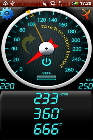
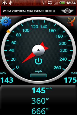
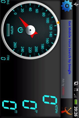
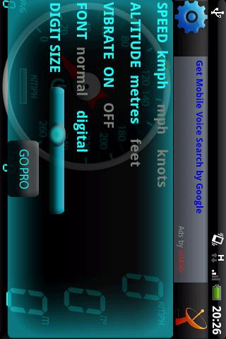
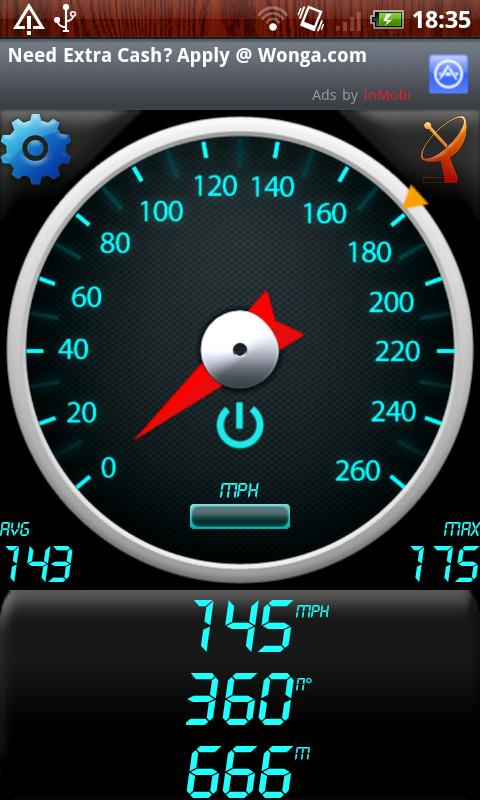
GPS Speedometer - Find out your speed by GPS Speedometer, another one application utilizing Android GPS capabilities.
Like it? Share with your friends!
Supported operating systems:
Google Android 1.0, Google Android 1.5, Google Android 1.6, Google Android 10.x, Google Android 2.0, Google Android 2.1, Google Android 2.2, Google Android 2.3, Google Android 3.0, Google Android 3.1, Google Android 3.2, Google Android 4.0, Google Android 4.1, Google Android 4.2, Google Android 4.3, Google Android 4.4, Google Android 5.x, Google Android 6.x, Google Android 7.x, Google Android 8.x, Google Android 9.x
Similar Software:
Foursquare Foursquare - helps you explore the world around you. Keep up with friends, get insider tips, and unlock discounts and rewards.
While on the go, you can easily tell friends where you are, share pictures, get their comments ("I'm right around the corner, I'll stop by to say hello"), and get insider tips ("order the Lobster Ravioli; it's the best dish by far
amAze (Sony Ericsson) AmAze is a first of its kind free navigation and local search service. It is free to download and use and it contains wide coverage of maps including aerial photo in Europe, North America, Australia and parts of Asia and Africa
eGPS Lite eGPS Lite has full GPS capabilities, showing latitude and longitude, altitude, speed, and heading. This makes it useful for all kinds of activities where you would usually want a GPS device - hiking, cycling, geocaching and letterboxing, running, location-based social networking activities, and more
RMaps RMaps is a navigation tool. You can use RMaps as an online map viewer for some popular maps. And as an offline map viewer for your own maps created on the PC.
· Auto rotate map in driving direction.
· Auto rotate map in the northern direction.
· Compass on the map.
· Auto-follow function.
· Online search.
· Full screen mode
Boundary Reminder Boundary Reminder - This application is a reminder tool which works with your location. A boundary is registered in drawing a circle on the map, you get a notification when you pass over the boundary.(The application works in background as Service.) Your location data is NOT send to a server
GoPenS GoPenS is an OpenSource GPS application for Android phones, based on OpenStreetMap (OSM). OpenStreetMap is a collaborative map of the world. Therefore, one of the main functions of the application is to be able to record a trace and send it as a GPX to the OSM servers, and so edit the OSM Map
Maverick Off-road GPS navigator with offline maps support, compass and track recording. Use offline maps and GPS even without an internet connection. This app is great for hiking, boating, geocaching and other outdoor activities
Geocast A location and multimedia enabled file sharing application
GpsTicker Gpsticker is a program for outdoor orientation and navigation with GPS, it is best for hiking and biking. Maps are downloaded automatically from OpenStreetMaps, provided the Phone has an active internet connection
Other Software by developer «Bakhtiyor Khodjayev»:


")
")

")


")
")

")
")
")
")
")
")
")