Locus Fast and useful Online/Offline map viewer for Android.
· This is also My Maps editor so Google Account permission is needed
· Contacts permission is for getting contact address on various places in app (adding point into database by contact address, etc...)
· If anything not work, send email
· If app crash, send log from logcat or Locus/logs directory
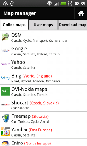
· Online maps (OSM, Google, Yahoo, Bing, OVI/Nokia, ... actually 37 types)
· Offline maps (SQLiteDB format, updated TrekBuddy TARed format)
· direct download Online -> Offline (defined area - rectangle, path, state).
· Google My Maps Viewer, Google My Maps editor (BETA)!
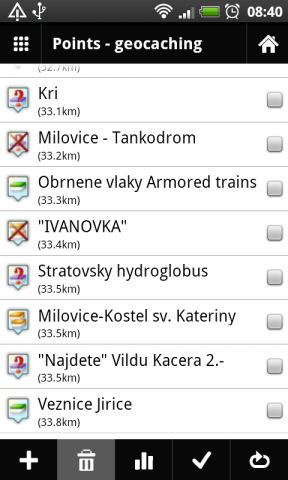
· POI handling => POI import into separated categories, viewing on map, basic guiding.
· support for Groundspeak PocketQuery
· Google Street View
· support for Bluetooth GPS
· work with c:geo, GPS Status
· quick and clean GUI
· and more
What's New in This Release:
· fixed some language troubles (import/export)
· full support for zipped files import
· better support for GPX files
· faster data importing
What's New in 0.9.21:
· fixed problem with adding categories
· rewrote a little start of app
What's New in 0.9.15:
· distance on screen during path creating
· improved handling with track styles. Now define style for import and record separately
· bug fixes
Like it? Share with your friends!
Supported operating systems:
Google Android 1.6, Google Android 10.x, Google Android 2.0, Google Android 2.1, Google Android 2.2, Google Android 2.3, Google Android 3.0, Google Android 3.1, Google Android 3.2, Google Android 4.0, Google Android 4.1, Google Android 4.2, Google Android 4.3, Google Android 4.4, Google Android 5.x, Google Android 6.x, Google Android 7.x, Google Android 8.x, Google Android 9.x
Similar Software:
MapDroyd MapDroyd - Of course, today there are many Android application featuring street maps. Most of them are based on Google Maps, which means you've to enable your mobile device's network connection through a GPRS or Wifi connection
AugSatNav Walk AugSatNav is an augmented reality navigation system which overlays walking directions upon a live video feed of the path or road ahead.
With AugSatNav there is no need to follow instructions or interpret maps - you can simply find your way by walking along the route highlighted by a bright white line
Foursquare Foursquare - helps you explore the world around you. Keep up with friends, get insider tips, and unlock discounts and rewards.
While on the go, you can easily tell friends where you are, share pictures, get their comments ("I'm right around the corner, I'll stop by to say hello"), and get insider tips ("order the Lobster Ravioli; it's the best dish by far
InstaMapper (Android) InstaMapper is a free service that allows you to track a person or vehicle online in real time using a GPS-enabled mobile phone.
To use InstaMapper, you create a free account. Registration takes only a minute or two. All it is asked for is a username, password, and a valid email address.
Next, you install a small application on your GPS-enabled phone
Maps In My Pocket (MIMP) Maps In My Pocket - The main goal of this application is to allow its users to view maps, locate themselves, follow KML or GPX formatted tracks and getting directions from place to place.
What's New in This Release:
· New Icon
What's New in 1.4.3:
· Long press and long pinch concurrency on info bubble solved
CoPilot Live Australia & NZ (Android) CoPilot Live Australia & NZ (Android) - Get a CoPilot! The onboard GPS navigation app that makes every journey better
Learn Google Maps Learn Google Maps - The reference has been prepared for the beginners to help them while using Google Maps JavaScript API. After completion of this tutorial you will be able to use JavaScript API in your web page. Google Maps is developed by Google, it is a free web mapping service which provides various types of geographical information
Map Explorer Map Explorer is a prototype that tries to improve map browsing experience. It is basically Google maps with an overlay that shows POIs even if they are beyond the display. Use the preferences to test different visualizations
MAPS.ME for Android MAPS.ME for Android - MapsWithMe allows you to access maps of all the countries in the world while on the go. The maps are based on OpenStreetMap data and work completely offline, without requiring an internet connection
Other Software by developer «menion»:
Locus Free Locus Free - Fast and useful Online/Offline map viewer for Android.
· This is also My Maps editor so Google Account permission is needed
· Contacts permission is for getting contact address on various places in app (adding point into database by contact address, etc..


")
")
")


