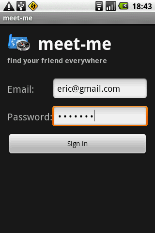
meet-me With only a few fingertips you can find your friends in the biggest crowd. Their location is presented by a stylish arrow and distance. Awesome: the positions are dynamically updated. So you can navigate to moving destinations!
Like it? Share with your friends!
Supported operating systems:
Google Android 1.5, Google Android 1.6, Google Android 10.x, Google Android 2.0, Google Android 2.1, Google Android 2.2, Google Android 2.3, Google Android 3.0, Google Android 3.1, Google Android 3.2, Google Android 4.0, Google Android 4.1, Google Android 4.2, Google Android 4.3, Google Android 4.4, Google Android 5.x, Google Android 6.x, Google Android 7.x, Google Android 8.x, Google Android 9.x
Similar Software:
ViewRanger GPS ViewRanger is a unique mapping, navigation, tracking, and information tool for mobile phones that provides fully featured outdoor gps and trail navigation through a natural and intuitive display. ViewRanger transforms a Nokia or other Symbian S60 smartphone into a fully featured trail navigation system
Navigation gestures Navigation gestures - is an application which will add navigation gestures to any Android device. With this program you will get more useful space of screen. Moreover, with the help of this utility you can set gesture functions and change appearance
Maverick Off-road GPS navigator with offline maps support, compass and track recording. Use offline maps and GPS even without an internet connection. This app is great for hiking, boating, geocaching and other outdoor activities
AugSatNav Walk AugSatNav is an augmented reality navigation system which overlays walking directions upon a live video feed of the path or road ahead.
With AugSatNav there is no need to follow instructions or interpret maps - you can simply find your way by walking along the route highlighted by a bright white line
GPS Signal Widget GPS Signal Widget - Do you get tired waiting for the GPS location to be available? With this tool you can check out the GPS satellites and the signal strength in just a nice 1X1 widget.
The spokes in the widget represents the satellites and the length of the spokes is a measure of the signal strength.
Enable or disable the widget by tapping on the widget
amAze (Motorola) AmAze is a first of its kind free navigation and local search service. It is free to download and use and it contains wide coverage of maps including aerial photo in Europe, North America, Australia and parts of Asia and Africa
Nearby Get & Go Get Set Go is an easy to use app which helps you to find ATM, Banks, Gas Stations, Restaurants, Bar, Cafe, Hospitals, Hotels, Taxi, Movie Theatres, Beauty Salon, Wi-Fi spots or virtually anything near you
FindShip FindShip - Find any ship all over the world! With FindShip, you can track your vessel' movements realtime on the mapFeatures:• * Nearly 80,000 ships online.• * Covering most ports on the world.• * Detail ship's information. In addition to AIS information, D.W.T/Gross ton/Build year is also provided.• * Powerfull ship/port search engine
Osm2GpsMid GpsMid is a free, fully offline, vector based map application for your mobile phone. It displays your current position on a zoomable map and can be used to search for and navigate to roads or points of interest of your liking. As all data is stored in a compact binary format on your mobile phone you will incur no charges for extra data downloads
Share Path Share Path - Although e-maps and GPS can provide accurate navigation, we are confined on the basis of the existing database. Many times we may go to a place which cannot be found on the e-map. For example, go to a club with friends; on a vacation to the countryside near the lake where we have never been to
Other Software by developer «meet-me»:
not found
Comments on meet-me FREE:
Comments not found
If you noted an error or download link is broken, please, report it via this page or use comments.
meet-me FREE is compatible with your device Coolpad Dashen F1 Plus 8297-T01 Dual SIM 4G TD-LTE


")


