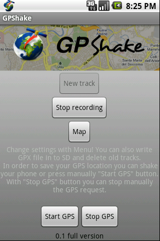
With GPShake you can track your GPS location, create GPX files, whenever you want with a shake of your phone! This means battery life saving! A great usage example could be when you want to geotagging your photo made with an external camera.
Full version:
-More than 5 GPS points
-Led notification
-Start/Stop GPS
-No ads
Like it? Share with your friends!
Supported operating systems:
Google Android 1.0, Google Android 1.5, Google Android 1.6, Google Android 10.x, Google Android 2.0, Google Android 2.1, Google Android 2.2, Google Android 2.3, Google Android 3.0, Google Android 3.1, Google Android 3.2, Google Android 4.0, Google Android 4.1, Google Android 4.2, Google Android 4.3, Google Android 4.4, Google Android 5.x, Google Android 6.x, Google Android 7.x, Google Android 8.x, Google Android 9.x
Similar Software:
amAze (Sony Ericsson) AmAze is a first of its kind free navigation and local search service. It is free to download and use and it contains wide coverage of maps including aerial photo in Europe, North America, Australia and parts of Asia and Africa
GPS Info for Android GPS Info for Android is an easy to use and functional GPS application for beginners and advanced users. All needed GPS data is bundled in one screen with perfectly designed layout, with usability in mind
runtastic GPS Coach Your personal GPS sports assistant for running, cycling, walking, hiking, ... runtastic GPS is your personal running and fitness application for all outdoor (running, nordic walking, hiking, skating,..) and indoor sports (treadmill, cardio, yoga, bodybuilding)
GPS2OpenGTS Free GPS2OpenGTS will send your GPS data to an OpenGTS tracking system.
Latest version now supports UDP.
Also added is a Test function/screen to help with server configuration.
Send a NMEA GPRMC strings with the following data.
(accountID, deviceID, Latitude, Longitude, Speed, Heading and Altitude
GPS status & toolbox GPS status & toolbox - is a very useful program for working with GPS. This utility is aimed at viewing GPS condition and settings. It can display all data of a sensor and GPS: positions and satellite signal power, accuracy, speed, acceleration, height, step and even battery status
MarineTraffic.com MarineTraffic.com - Real-time ships positions based on Automatic Identification System (AIS). Watch the positions reported by more than 35000 vessels per day on an interactive Google map.
The application provides worldwide coverage of more than 850 ports and a significant number of open-sea areas.
Port arrivals and departures are recorded in real-time
TomTom South East Asia for Android TomTom South East Asia for Android - TomTom South East Asia is a turn-by-turn GPS navigator for Android devices. The app includes accurate offline maps, so you can find your way anywhere, even without an internet connection
GPS Signal Widget GPS Signal Widget - Do you get tired waiting for the GPS location to be available? With this tool you can check out the GPS satellites and the signal strength in just a nice 1X1 widget.
The spokes in the widget represents the satellites and the length of the spokes is a measure of the signal strength.
Enable or disable the widget by tapping on the widget
AlpineQuest AlpineQuest - AlpineQuest turns your Android device into an off-road GPS using offline topo maps. It is a complete solution for all outdoor activities and sports, including hiking, running, trailing, hunting, sailing, geocaching and much more
MozStumbler MozStumbler - Mozilla Location Service is an experimental project that aims to provide location-based services using data collected from users. The objective is to create a database of cell towers and WiFi access points that mobile devices can use to retrieve their location instead of having to rely on GPS
Other Software by developer «Lorenzo Braghetto»:
BatteryDiffWidget BatteryDiffWidget is Android widget shows you in home page the estimated battery lifetime in hours:minutes according to battery consumption and time


")


