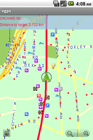
VGPS (Vietnamese GPS) for Android was designed to use city street map on your ordinary mobile phone without the need of having GPS receiver or internet connection. VGPS does not require internal or external GPS receiver. However, if you have internal GPS receiver or external bluetooth GPS receiver, VGPS can work with your GPS receiver as well. VGPS does not require internet connection so you no need to worry about connection charge.
· Offline map (totally offline application. VGPS only uses internet to validate your purchase when you activate demo version become full version. Other than that the application will never use internet)
· Map data from Garmin and OpenStreetMap
· Zoom in/Zoom out/Pan
· Search point by name,type,distance or mix type+name, type+distance
· Can touch any object on the map
· GPS real-time tracking
· Routing point to point
· Rotate map so the driving direction (heading) is always up
· Voice guidance (turn left/turn right)
What's New in This Release:
· User can take screenshot and save to memory card
What's New in 7.0:
· Supports all android phones and tablets screen sizes and densities (android 1.5 to android 3.2+)
What's New in 6.9:
· pinch to zoom in/out
Like it? Share with your friends!
Supported operating systems:
Google Android 1.5, Google Android 1.6, Google Android 10.x, Google Android 2.0, Google Android 2.1, Google Android 2.2, Google Android 2.3, Google Android 3.0, Google Android 3.1, Google Android 3.2, Google Android 4.0, Google Android 4.1, Google Android 4.2, Google Android 4.3, Google Android 4.4, Google Android 5.x, Google Android 6.x, Google Android 7.x, Google Android 8.x, Google Android 9.x
Similar Software:
GPS Logger GPS Logger is an Android application that reads data from the GPS receiver and saves it as a gpx file
Track My Mobile Track My Mobile - Your mobile phone can be Tracked by this applicatio after it get lost
Waze: Community GPS navigation Waze: Community GPS navigation - Waze is a free, 100% user-generated, social navigation app that allows drivers to build and use live maps & real-time traffic updates to improve their daily commute
Foursquare Foursquare - helps you explore the world around you. Keep up with friends, get insider tips, and unlock discounts and rewards.
While on the go, you can easily tell friends where you are, share pictures, get their comments ("I'm right around the corner, I'll stop by to say hello"), and get insider tips ("order the Lobster Ravioli; it's the best dish by far
AnyLocation AnyLocation - AnyLocation is the most professional app for mobile location mock, which can perfectly mock GPS location on LBS app, for example facebook, wechat, momo and so on. The most powerful ability of AnyLocation is: 1 It can mock without the system setting "allow mock locations" enabled(root required). 2 It can block cell-ID location
NavTruck for Android NavTruck for Android - NavTruck is a GPS navigation solution created specifically for truck drivers. The app automatically calculates routes taking into account vehicle size, weight, width and load type to avoid restricted roads.
NavTruck uses offline maps, so you don't have to pay for unnecessary internet traffic
MySpeed MySpeed will record your speed and location to a log file and show it on a map.
It can use a database of speed camera locations to alert you when you're near a speed camera.
There is no speed camera database included. You'll need to download the data from a site such as scdb.info, flitspaal.nl, pocketgpsworld.com, maparadar.com, etc
Android FindMyCar Android FindMyCar - Innovative software for Android devices that uses the GPS signal to show signs that allow to reach a geographic location.
Suitable for various uses (eg. find car parked in a parking area or in an unknown city, finding a person (who has sent their coordinates) in a lovely beach, in a fair, in another boat, find an area of sea fishing, etc..)
Naver Maps Naver Maps - Smarter than ever! Experience Naver Map for Android. You can find the shortest way to get to your destination, using public transportation even it is far away. You can also search the information on the area around you easily and check whether you are heading to your destination correctly with GPS and compass
wheredroid wheredroid is a simple application to display your coordinates from the GPS receiver: latitude, longitude, heading, speed, number of satellites used and (it's its peculiarity) altitude and accuracy. It is quite usable as an altimeter and a compass.
What's New in This Release:
· fixes a bug inverting East with West on some displays
What's New in 1.4
Other Software by developer «Vietnamese GPS»:
VGPS (Vietnamese GPS) VGPS (Vietnamese GPS) - was designed to use city street map on your ordinary mobile phone without the need of having GPS receiver or internet connection. VGPS does not require internal or external GPS receiver. However, if you have internal GPS receiver or external bluetooth GPS receiver, VGPS can work with your GPS receiver as well
VGPS (Vietnamese GPS) for Android VGPS was designed to use city street map on your ordinary mobile phone without the need of having GPS receiver or internet connection. VGPS does not require internal or external GPS receiver. However, if you have internal GPS receiver or external bluetooth GPS receiver, VGPS can work with your GPS receiver as well


 for Android")
 for Android")


")
 for Android")