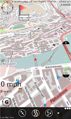
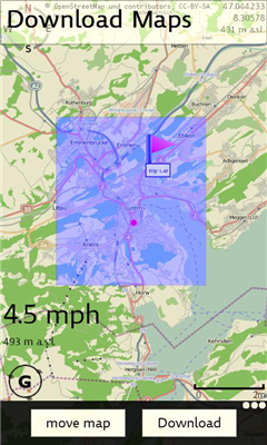
XMaps - With xMaps you have the possibility to use the worldwide map data from openstreetmaps.org on your phone. xMaps comes without any map data, you can download any maps in different zoom levels for free. You can zoom in / out and rotate and tilt the map.
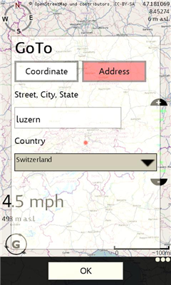
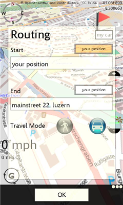
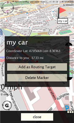
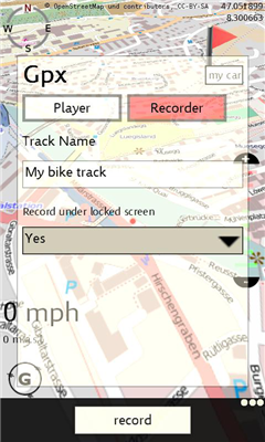
Use xMaps to search a point by coordinate or to plan a travel route by car or by foot. You have the possibility to add markers for your favorite places. With the GPX Recorder you can record a track and view it later on the GPX Viewer. xMaps is ideal for travelling, hiking or biking.
Like it? Share with your friends!
If you got an error while installing Themes, Software or Games, please, read FAQ.
Supported operating systems:
Windows 10 Mobile, Windows Phone 7, Windows Phone 8
Similar Software:
Bing This app helps to use the bing map with just a click
FidMe FidMe - Toutes vos cartes de fidélité réunies sur votre mobile !
FidMe, le portecarte mobile pour vos cartes de fidélité !
Innovante et simple à utiliser FidMe : enregistrez vos cartes de fidélité en quelques secondes
Tube Map Tube Map - Get round on the London tube like never before! Get LIVE train status updates on a map that you can scroll
Canada Topography Canada Topography - provides topographic information for the entire country of Canada. The maps provide details such as altitude, railways and numerous other layers. Using the GPS you can center on your current location and even zoom to specific areas of the country.
All maps are provided by Geocratis Canada (http://www.geogratis.gc.ca/geogratis/en/service/toporama
GeoBC Showcase GeoBC Showcase - This app takes advantage of geospatial layers provided by GeoBC. It will include Federal Electoral Districts and Local Health areas plus Primary Survey Parcels in British Columbia, Canada.
Select one of the layers from the list, then press a point on the map and hold to get information about that geographical point
Washington SR 520 Toll & Traffic Washington SR 520 Toll & Traffic - Electronic tolling on SR 520 will begin this spring. Be ready by checking how much it will cost you to cross SR 520. Application takes in account US Holidays and provides additional information, such as current crossing time for both directions, and traffic map of the bridges
Googlemaps Googlemaps - Enjoy Almost all features of Google Maps on your WindowsPhone7
Enjoy The Water-overlay mode, Physical mode, Hybrid mode, Satellite View, Street-View.
You can zoom in and zoom out without any Hindrance
MS Campus Maps MS Campus Maps - Need to quickly get to your next meeting? No matter if you are walking, driving, taking a shuttle, or trying to find a conference room inside a building, Microsoft Campus Maps is the solution.
Microsoft Campus Maps features:
* Walking directions to any building on the Redmond campus
WorldMaps Developed by Salman Shakeel
This application provides you total solution to navigation it is combinations of multiple maps at one place
Other Software by developer «itrona GmbH»:
XBalance XBalance ist eine Wasserwaage fur dein Telefon