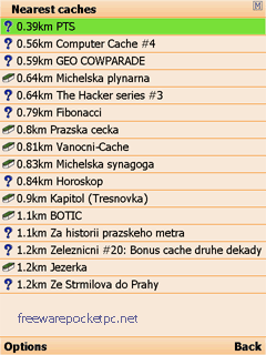
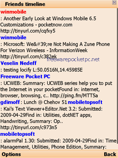
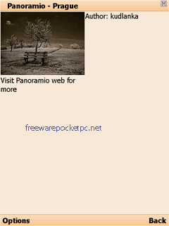
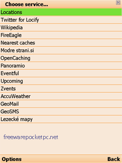
With Locify you can explore interesting places near you from Wikipedia, seek for geocaches, display map where you are (or you want to go), twitter your location, save interesting places from phone or web sync them and even navigate to them... and much more.
Locify is free application for common mobile phone. It can use phone's internal GPS or connected bluetooth GPS and is fairly usable even without any GPS device.
What's New in This Release:
· Map and navigation fix on certain phones
Like it? Share with your friends!
If you got an error while installing Themes, Software or Games, please, read FAQ.
Supported operating systems:
Java ME, Java Nokia 240x320, Java SE 240x320, Pocket PC 2002, RIM BlackBerry OS 1.0, RIM BlackBerry OS 2.0, RIM BlackBerry OS 3.x, RIM BlackBerry OS 4.0, RIM BlackBerry OS 4.1, RIM BlackBerry OS 4.2, RIM BlackBerry OS 4.3, RIM BlackBerry OS 4.5, RIM BlackBerry OS 4.6, RIM BlackBerry OS 4.7, RIM BlackBerry OS 5.0, RIM BlackBerry OS 6.0, Windows Mobile 2003, Windows Mobile 2003 Smartphone, Windows Mobile 5.0, Windows Mobile 5.0 Smartphone, Windows Mobile 6 Classic, Windows Mobile 6 Professional, Windows Mobile 6 Standard, Windows Mobile 6.1 Classic, Windows Mobile 6.1 Professional, Windows Mobile 6.1 Standard, Windows Mobile 6.5 Professional, Windows Mobile 6.5 Standard
Similar Software:
CityGoogler CityGoogler uses the GPS on your PocketPC to find the 50 closest local business from 2,238 type of Yellow Pages entry sorted via GPS distance and stores the results into files based on store type. Tap the button to start the GPS and when you get a lock tap on it to view the list of local businesses. The GPS maps and business search service is provided by Google
FON Access Points for Australia FON Access Points for Australia - FON offers you a new Points of Interest service (POIs). This allows you to download FONspots directly to your navigation device.
What does that mean? You can download a Points of Interest file directly to your navigation device
PictureGPSer PictureGPSer - PictureGPSer checks the camera storage folder for new pictures/videos and when detected places the current GPS tag at the end of the image/video. You can also view the images via a distance file viewer. You can also view and download a map of the pictures from Google.com.
This program requires that you have both the 'BeanDLL
FON Access Points for Turkey FON Access Points for Turkey - FON offers you a new Points of Interest service (POIs). This allows you to download FONspots directly to your navigation device.
What does that mean? You can download a Points of Interest file directly to your navigation device
StoreGPSed StoreGPSed - StoreGPSed allows you to make and edit text notes about stores based on your GPS. The program lists the stores via GPS distance from your current location. Tap on the store to view and edit the text notes for the store. You can also view and export a map of the stores on with the Google.com service.
This program requires that you have both the 'BeanDLL
BoatOdometers BoatOdometers - BoatOdometers uses the GPS on your PocketPC to measure your boat's speed and displays it in real time in Knots/hr, KM/hr and Miles/hr. The program also displays your latitude and longitude.
This program requires that you have both the 'BeanDLL.dll' file ** and ** the runtime files for Visual Basic on your PocketPC computer
GPSWM65Mapping GPSWM65Mapping - GPSWM65Mapping is a full featured map downloader that uses GPS. You can enter the lat/long coordinates or use your current GPS location to download a map. You can download in GIF, PNG or JPEG format. The app has several options to customize the map. The map service is provided by Google
GPSWM65Indicator GPSWM65Indicator uses GPS to find your current coordinates and displays your latitude/longitude on the upper right of your display
ExcelGPSer ExcelGPSer - ExcelGPSer allows you to make Pocket Excel files and attaches a GPS tag to the end of the file. You can also view the notes via GPS distance from your current GPS using "The Vincenty inverse formula for ellipsoids." (accuracy to within 0.5mm, or 0.000015")
This program requires that you have both the 'BeanDLL
amAze (Sony Ericsson) AmAze is a first of its kind free navigation and local search service. It is free to download and use and it contains wide coverage of maps including aerial photo in Europe, North America, Australia and parts of Asia and Africa
Other Software by developer «Locify»:
not found
Comments on Locify:
B SAMBASIVARAO:
kothagudem
Date: 8 Mar 11
If you noted an error or download link is broken, please, report it via this page or use comments.
Attention! Locify may be not compatible with your device Datalogic Mobile Elf QWERTY / Numeric


")