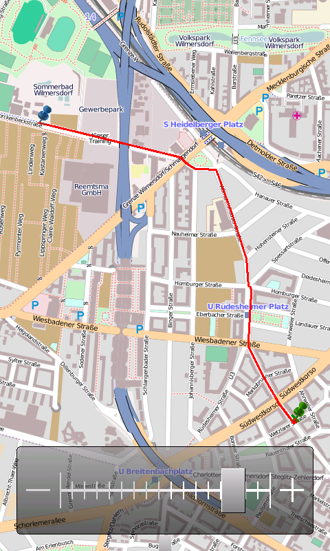
OpenMobileMaps - An application similar to Google Maps, but relying on OpenStreetMap
· showing map in fullscreen
· finger friendly user interface
· map tiles are automatically downloaded if internet connection is available
· map tiles are stored locally for offline use
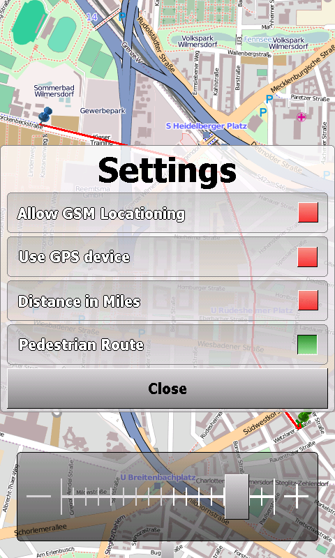
· GPS support and GSM triangulation
· show actual position on map
· follow-mode to automatically scroll the map
· search addresses
What's New in This Release:
· just a few bugfixes to prevent instabilities on certain phones
What's New in 1.4.3816.9028:
· WebServices updated to match the new OpenMobileMaps website.
Like it? Share with your friends!
If you got an error while installing Themes, Software or Games, please, read FAQ.
Supported operating systems:
Windows Mobile 5.0, Windows Mobile 6 Classic, Windows Mobile 6 Professional, Windows Mobile 6.1 Classic, Windows Mobile 6.1 Professional, Windows Mobile 6.5 Professional
Similar Software:
PoliceSyncer PoliceSyncer - PoliceSyncer can be used by a Police officer to create dated GPS POI based note/picture/video logs and also share information on a secure remote FTP server with other police officers. The program uses the GPS on the PocketPC to find the distance of each GPS POI point and you can view or download the map the points on Google.com map service
e-Mobile GPS Tracker e-Mobile GPS Tracker -
System Requirements
Internet enabled Windows mobile Pocket PC with GPS.
Requires WM5 and WM6 mobile devices
FON Access Points for Cape Verde FON Access Points for Cape Verde - FON offers you a new Points of Interest service (POIs). This allows you to download FONspots directly to your navigation device.
What does that mean? You can download a Points of Interest file directly to your navigation device
FON Access Points for Ecuador FON Access Points for Ecuador - FON offers you a new Points of Interest service (POIs). This allows you to download FONspots directly to your navigation device.
What does that mean? You can download a Points of Interest file directly to your navigation device
TwitterGPSer TwitterGPSer uses the GPS on your PocketPC to find your current latitude/longitude/speed and allows you to update Twitter.com. Tap the button to get the GPS lock and when the program gets the lock it will create a Tweet with a Google.com map link. This service is provided by Twitter
trackr! Use trackr! to let people know where you are and where you have been. All you need is the Internet, a GPS receiver and your mobile phone (or a mobile phone with an internal GPS receiver)
FON Access Points for Togo FON Access Points for Togo - FON offers you a new Points of Interest service (POIs). This allows you to download FONspots directly to your navigation device.
What does that mean? You can download a Points of Interest file directly to your navigation device
FON Access Points for China FON Access Points for China - FON offers you a new Points of Interest service (POIs). This allows you to download FONspots directly to your navigation device.
What does that mean? You can download a Points of Interest file directly to your navigation device
RulerZIPeds RulerZIPeds allows you to enter 2 American ZIP codes and converts the ZIP codes into GPS coordinates. The program then calculates the distance between the points. You can also download a Google.com map of the route. This service is provided by USZIP
Map Calibrator Map Calibrator - If you would like to calibrate maps on your desktop PC, use free Map Calibrator program. Map Calibrator is also useful to create map slices from a huge bitmap image file. You can convert GIF, BMP and PNG files into JPG file to use it in GPS Tuner as well
Other Software by developer «Cipher»:
not found
Comments on OpenMobileMaps:
vitor:
good
Date: 2 Mar 11
If you noted an error or download link is broken, please, report it via this page or use comments.
OpenMobileMaps is compatible with your device Datalogic Mobile Elf QWERTY / Numeric