OpenMobileMaps - An application similar to Google Maps, but relying on OpenStreetMap
· showing map in fullscreen
· finger friendly user interface
· map tiles are automatically downloaded if internet connection is available
· map tiles are stored locally for offline use
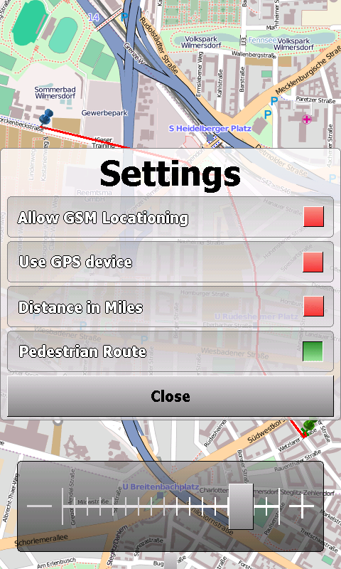
· GPS support and GSM triangulation
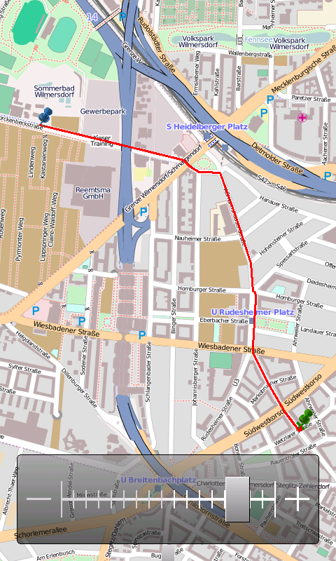
· show actual position on map
· follow-mode to automatically scroll the map
· search addresses
What's New in This Release:
· just a few bugfixes to prevent instabilities on certain phones
What's New in 1.4.3816.9028:
· WebServices updated to match the new OpenMobileMaps website.
Like it? Share with your friends!
If you got an error while installing Themes, Software or Games, please, read FAQ.
Supported operating systems:
Windows Mobile 5.0, Windows Mobile 6 Classic, Windows Mobile 6 Professional, Windows Mobile 6.1 Classic, Windows Mobile 6.1 Professional, Windows Mobile 6.5 Professional
Similar Software:
Satsports Log Satsports Log is your general sport app. Ideal for running, cycling, mountain biking, hiking and walking. It also has some fun visual features such as maps and graphs of your elevation, speed and pace. Real time Statistics: Satsports-log has all the stats you could wish
SirfGPSTweaker SirfGPSTweaker - application for displaying output from NMEA or SIRFBINARY based GPS device.
It has autodetection of data format (so it works both in NMEA or SIRF with on the fly detection). It can display statistics and data panel for cockpit use. Cockpit mode includes history graphs for speed and altitude
Wenak Wenak - Mobisoft Wenak lets you share your location with your friends, family members, co-workers and loved ones by making it easy to tell them where you are and see each other on the map. Wenak lets you share your location in the background, even when the app is closed
ppc FindMyCar ppc FindMyCar - Innovative software for Windows Mobile devices that uses the GPS signal to show signs that allow to reach a geographic location.
Suitable for various uses (eg. find car parked in a parking area or in an unknown city, finding a person (who has sent their coordinates) in a lovely beach, in a fair, in another boat, find an area of sea fishing, etc..)
locr GPS Photo v1.0 beta 3 locr GPS Photo-more and more mobile phone users are discovering geotagging, the latest hot trend. Using the new locr GPS Photo software for Windows Mobile, geotags are added to users’ photos, which can then be uploaded in a flash via GPRS, UMTS or W-LAN to www.locr.com
PocketGIS PocketGIS is a powerful mobile Geographical Information System (GIS) for field data capture which can display and edit map geometry and attributes. PocketGIS brings real GIS functionality to highly portable handheld devices which are lightweight, convenient and have a long battery life
FON Access Points for Australia FON Access Points for Australia - FON offers you a new Points of Interest service (POIs). This allows you to download FONspots directly to your navigation device.
What does that mean? You can download a Points of Interest file directly to your navigation device
Mobile Speedometer Mobile Speedometer - This application is part of the author's "30 Days of .NET" initiative to develop 30 mobile applications in 30 days. The source code of the application is included in order to help programmers new to Windows Mobile development write applications in .NET
TravelEncyclopediaer TravelEncyclopediaer uses the GPS on your PocketPC to find your current latitude/ longitude/ speed/ altitude and looks up the Wikipedia.org GPS listings and displays them. Tap the button to start the GPS and when you get the lock tap the button again to view the Wikipedia.org listings for the area. This service is provided by Geonames
Other Software by developer «Cipher»:
not found
Comments on OpenMobileMaps:
vitor:
good
Date: 2 Mar 11
If you noted an error or download link is broken, please, report it via this page or use comments.
OpenMobileMaps is compatible with your device Dopod CHT 9000 (HTC Hermes 200)

")