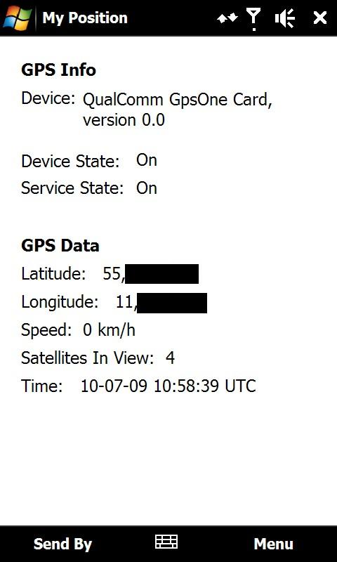
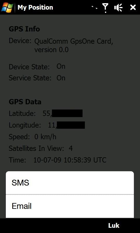
My Position - With My Position it is possible to see actual GPS information via the phone's built in GPS and send the position to others via sms or email.
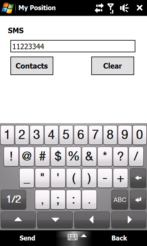
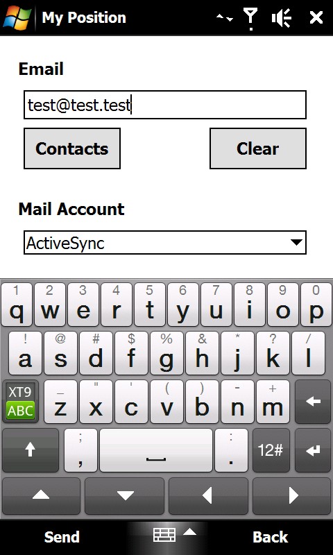
When sending the position via sms or email it is possible to enter a telephone number or email address. It is also possible to select a contact from the contact list.
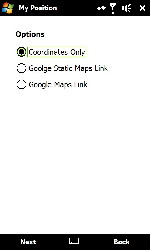
Sending the position is possible in three different ways:
1) As coordinates which can be inserted directly in Google Earth or Google Maps.
2) As a link to Google Static Maps. When the receiver opens the link the phones default web browser connects to the internet and shows the position on a map in 400x400 pixel resolution.
3) As a link to Google Maps. This option is mostly suitable when sending the position via email.
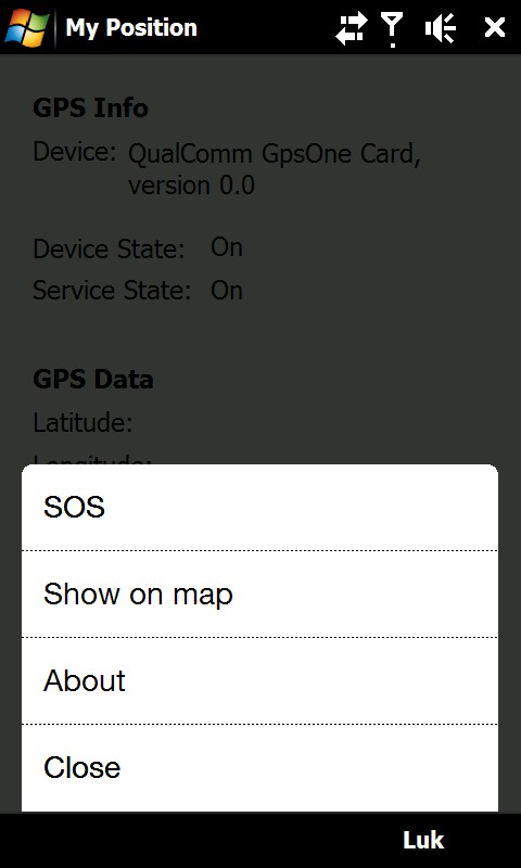
It is also possible to see ones own position on a map where Google Static Map is being used. The phones default web browser will open and connect to the internet and shows the position on a map in 400x400 pixel resolution.
This is a very good function when you are in a big city with many streets.
There is also a sos function which sends the position and a message of help. Again it is possible to send via sms or email.
Like it? Share with your friends!
If you got an error while installing Themes, Software or Games, please, read FAQ.
Supported operating systems:
Windows Mobile 6 Classic, Windows Mobile 6 Professional, Windows Mobile 6.1 Classic, Windows Mobile 6.1 Professional, Windows Mobile 6.5 Professional
Similar Software:
gOmniAgent GOmniAgent provides a real-time location tracking of mobile devices. It runs silently in the background with no user interface, and helps monitoring minors and your beloved ones from the gOmniTracker mobile applications or from gOmniTracker site
SmokeGPSs SmokeGPSs - SmokeGPSs can be used to with GPS to help you to daily reduce the amount you smoke until you quit. For each day the program tracks the GPS location of each time you smoke and the total count for the day. You can also view the entries on a calendar interface.
This program requires that you have both the 'BeanDLL
PoliceSpeeders PoliceSpeeders - PoliceSpeeders can be used by a police officer for an informal police speed trap. Enter the distance between the two points in settings and metric/imperial and tap the button or joypad when a car hits the start line and then again at the end line. The program calculates the estimated speeds into a log file
CellGPSer CellGPSer uses the cellular signal on your device to instantly find your approximate GPS. Tap the button while your phone is on and the program will send your cellular tower information to OpencCellID.org. The program will then display the approximate GPS. This service is provided by OpenCellID
Virtual Orienteering Virtual Orienteering is a new way of practicing orienteering outdoor sport. All you need is a GPS capable smartphone like iPhone, Android, Windows Phone 7 or Windows Mobile device. Next all we need to do is to go outdoor, play and have fun! Virtual Orienteering is a game played outdoor inspired from Orienteering sport
GPS Tuner Atlas Full Version with Full Europe Basic Map Content GPS Tuner Atlas Full Version with Full Europe Basic Map Content is designed specifically for off-road use: its large buttons, selectable tool window size, 6 different types of Compass views and the built-in Tele Atlas map makes it extremely user-friendly and reliable
FileGPSed FileGPSed - FileGPSed allows browse and view GPS tagged Excel, Word, Note, Voice, Text and Picture/Video files. You can browse the folders of the PocketPC for GPS tagged files and view them via GPS distance from your current location. Tap on the file to open it in the associated application.
This program requires that you have both the 'BeanDLL
GPS Tracker GPS Tracker is a part of a fleet management software system, which is used to track mobile phone activity (e.g. mobile phone can be used as a gps tracking device).
The application will monitor the GPS activity and it will send the data to the http://voznipark.virtualniured.hr online server
QuickGPS Lite QuickGPS Lite can speed up the time for determining your GPS position by downloading the latest satellite data via an Internet connection (such as GPRS, ActiveSync, etc.).
For quickest connection use:
1. Mod Driver
2. QuickGPS Lite
3. GPS Test
It takes around 10 seconds from cold start to get 9 satellites and have a stable connection
FON Access Points for United Arab Emirates FON Access Points for United Arab Emirates - FON offers you a new Points of Interest service (POIs). This allows you to download FONspots directly to your navigation device.
What does that mean? You can download a Points of Interest file directly to your navigation device
Other Software by developer «ULJ»:
Backlight Control A small and simple application to control the backlight

")