Android Locationis your free, location-aware, mobile social network.
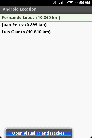
Meet real world friends. Reveal your location, befriend, and chat with people around you.
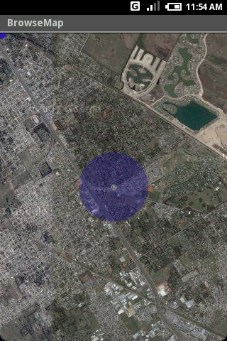
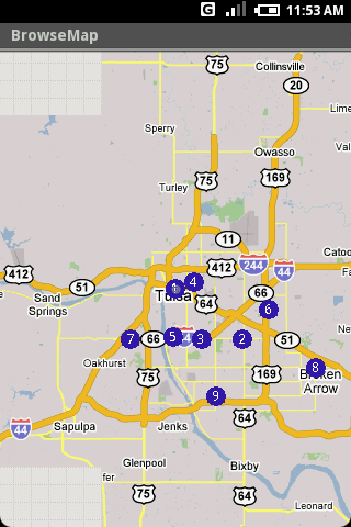
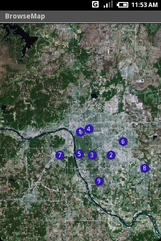
Using location-based technologies, Android Location lets you see where your friends are and what they are up to, in real time. Meet people around you. Discover who visits your favorite places. Join the community in real time.
· Know where you are without having a GPS
· Connect with friends and get alerted where they are nearby
· Explore places and events recommended by friends
· Recommend new places
· Search for stuff to buy in nearby stores
· It runs on any Cell Phone Provider
· It is FREE
Like it? Share with your friends!
Supported operating systems:
Google Android 1.0, Google Android 1.5, Google Android 1.6, Google Android 10.x, Google Android 2.0, Google Android 2.1, Google Android 2.2, Google Android 2.3, Google Android 3.0, Google Android 3.1, Google Android 3.2, Google Android 4.0, Google Android 4.1, Google Android 4.2, Google Android 4.3, Google Android 4.4, Google Android 5.x, Google Android 6.x, Google Android 7.x, Google Android 8.x, Google Android 9.x
Similar Software:
CopsAlarm No more tickets Show where the hiding police are on Google Map As well as speed cam,red light locations Lite shows police,red lights only
Google (Android) Download the official Google app to your phone, and get easy access to Search, Maps, Mail, and more. Never say "I don't know" again
JTrip JTrip - Create your own trip in Thailand. JTrip recommends attractions and directions that you need. Let's get to know Thailand together.
· select places.
· select hotel.
· show map location.
· route path form src to dest.
· taxi, time remaining.
· suggest bus number
amAze (Sony Ericsson) AmAze is a first of its kind free navigation and local search service. It is free to download and use and it contains wide coverage of maps including aerial photo in Europe, North America, Australia and parts of Asia and Africa
Osm2GpsMid GpsMid is a free, fully offline, vector based map application for your mobile phone. It displays your current position on a zoomable map and can be used to search for and navigate to roads or points of interest of your liking. As all data is stored in a compact binary format on your mobile phone you will incur no charges for extra data downloads
InstaMapper (Android) InstaMapper is a free service that allows you to track a person or vehicle online in real time using a GPS-enabled mobile phone.
To use InstaMapper, you create a free account. Registration takes only a minute or two. All it is asked for is a username, password, and a valid email address.
Next, you install a small application on your GPS-enabled phone
Big Planet TW Solution to Offline Google Maps on Android Phones
Gowalla Gowalla is the easiest way to share places you go with friends. Download the app to discover eateries, coffeehouses, hotspots, hangouts, shops, landmarks, parks, museums and more. Share your experiences through Gowalla with friends on Facebook and Twitter, then stamp your passport to earn rewards at the places you visit
Locus - addon Contacts Locus - addon Contacts - This is simple addon for Locus mapping application (version 0.9.17 and higher).
Allow to search contact location by address in Locus and add result into points, path or wherever is location needed.
This addon do not have any screen or widget
Map Explorer Map Explorer is a prototype that tries to improve map browsing experience. It is basically Google maps with an overlay that shows POIs even if they are beyond the display. Use the preferences to test different visualizations
Other Software by developer «HS Group»:
not found
Comments on Android Location:
jhackdhanieligama:
Good
Date: 3 Nov 21
If you noted an error or download link is broken, please, report it via this page or use comments.
Android Location is compatible with your device FirstOne GW10


")

")

")

_13333small.png "Gowalla")

