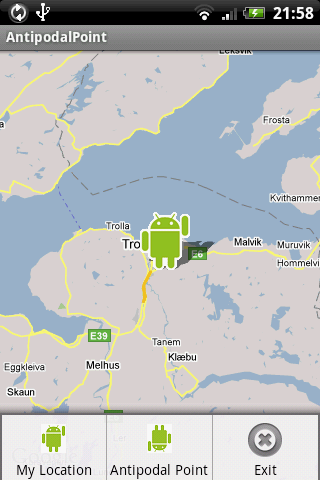
AntipodalPoint retrieves you position from the network provider or GPS and calculates and shows you antipodal point - the place exact opposite of you on Earth.
AntipodalPoint Pro enables you to browse the entire world and find antipodal points.
Like it? Share with your friends!
Supported operating systems:
Google Android 1.0, Google Android 1.5, Google Android 1.6, Google Android 10.x, Google Android 2.0, Google Android 2.1, Google Android 2.2, Google Android 2.3, Google Android 3.0, Google Android 3.1, Google Android 3.2, Google Android 4.0, Google Android 4.1, Google Android 4.2, Google Android 4.3, Google Android 4.4, Google Android 5.x, Google Android 6.x, Google Android 7.x, Google Android 8.x, Google Android 9.x
Similar Software:
Find my location Find my location - Sparar din plats och ger dig möjlighet att även få vägbeskrivning till den platsen.
Du kan även skicka din Position via sms i appen..
Open GPS Tracker Open Source recording, storing and accessing of your routes: Open GPS TrackerAn application that can track your travels of your Android by storing your GPS locations. Draws the route real-time on either Google or OSM maps
GPS Info for Android GPS Info for Android is an easy to use and functional GPS application for beginners and advanced users. All needed GPS data is bundled in one screen with perfectly designed layout, with usability in mind
My Family Geofence 1. With My Family Geofence, you can create a specific "safe zone" or "unauthorized zone" on a map and get an E-mail Alert if the phone leaves the area.
2. Receive an instant alert in case of breach of specific zone
GoPenS GoPenS is an OpenSource GPS application for Android phones, based on OpenStreetMap (OSM). OpenStreetMap is a collaborative map of the world. Therefore, one of the main functions of the application is to be able to record a trace and send it as a GPX to the OSM servers, and so edit the OSM Map
GPS Map Camera use GoogleMap GPS Map Camera use GoogleMap - The main feature of the 'GPS Map Camera':
When you take a piture with GPS enabled, it will paste the google map, address and weather to picture. (GPS latitue/longitude also include in the information)
Please enable your network and GPS function before using this application
GpsTicker Gpsticker is a program for outdoor orientation and navigation with GPS, it is best for hiking and biking. Maps are downloaded automatically from OpenStreetMaps, provided the Phone has an active internet connection
Locate My Team Locate My Team - Why do you need Locate My Team application?
1. Locate My Team tracks, monitors and manages an individual or group of people for operational and safety security reasons.
How to start?
1. Install the application on your Android phone.
2. Create your account by providing your email id, phone number of the device, name, country and submit it.
3
Automatic Location Track Track friends or gadgets everywhere to anticipate the alertness and spy on the nearest person
Geopaparazzi Geopaparazzi is a tool developed to do fast qualitative technical and scientific surveys. Its strength is its direct connection to the BeeGIS GIS, that can be used to further process the collected data.
Even if the main aim is in the field of surveying, it contains tools that can be of great use also to tourists that want to keep a geo-diary
Other Software by developer «Eirik Fauske»:
not found
Comments on AntipodalPoint:
Comments not found
If you noted an error or download link is broken, please, report it via this page or use comments.
AntipodalPoint is compatible with your device GiONEE CTRL V6L Dual SIM TD-LTE