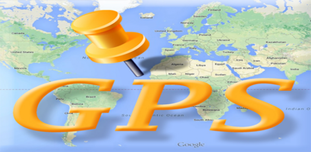
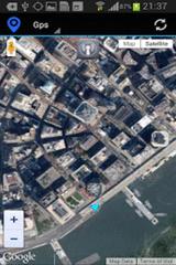
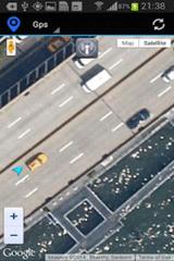
Gps Maps - Gps with Google Map, live current position. Very simple to use. It is the most easy way to know your exactly coordinates. Only 1.2 KB
Like it? Share with your friends!
Supported operating systems:
Google Android 10.x, Google Android 2.3, Google Android 3.0, Google Android 3.1, Google Android 3.2, Google Android 4.0, Google Android 4.1, Google Android 4.2, Google Android 4.3, Google Android 4.4, Google Android 5.x, Google Android 6.x, Google Android 7.x, Google Android 8.x, Google Android 9.x
Similar Software:
Open GPS Tracker Open Source recording, storing and accessing of your routes: Open GPS TrackerAn application that can track your travels of your Android by storing your GPS locations. Draws the route real-time on either Google or OSM maps
CompassNavi Compass / Navigation Activity, mainly for OpenGPX, but can be used from any application
TomTom Brazil for Android TomTom Brazil for Android - TomTom Brazil is a turn-by-turn GPS navigator for Android devices. The app includes accurate offline maps, so you can find your way anywhere, even without an internet connection
GPS Tracker GPS Tracker is used to monitor activity of android GPS device and send data to the server
My GPS Coordinates and Location My GPS Coordinates and Location - A simple application with crude, but adequate, support for 40 languages. Allows you to share your position via email, text message, twitter, etc, and displays your current GPS location in both decimal format and in sexagesimal (degrees minutes seconds) format. Internet access is not required to send your location with a text message
AlpineQuest Lite AlpineQuest Lite - AlpineQuest turns your Android device into an off-road GPS using offline topo maps. It is a complete solution for all outdoor activities and sports, including hiking, running, trailing, hunting, sailing, geocaching and much more
GPS Tracker GPS tracker for Android supporting KML export (Google Earth) and raw format export as txt data
Mapacha Mapacha - What you can do with Mapacha? You can localize your friends and family in a map. See where they are if your are meet with them and know how much they last for arrive. If you are worried about your sons or couple and see / track where they are. Also you can localize people from your country if you are abroad. What about privacy? Use it as you want
AugSatNav Walk AugSatNav is an augmented reality navigation system which overlays walking directions upon a live video feed of the path or road ahead.
With AugSatNav there is no need to follow instructions or interpret maps - you can simply find your way by walking along the route highlighted by a bright white line
Other Software by developer «Kayipkayik@gmail.com»:
not found
Comments on Gps Maps:
Comments not found
If you noted an error or download link is broken, please, report it via this page or use comments.
Gps Maps is compatible with your device Google Android 3.2