Categories: Business & Profession, Travel & Navigation
Upload date: 3 Nov 11
Developer: Code Sector
License: Freeware
Downloads: 2894 File Size: 2551 Kb
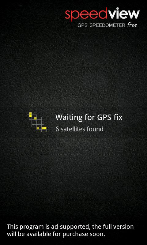
SpeedView - An advanced speedometer application that offers lots of useful features.
SpeedView uses the phone's built-in GPS system to show your current, maximum and average speed, as well as direction, total distance and time traveled. Suitable for running, car driving, biking or hiking.
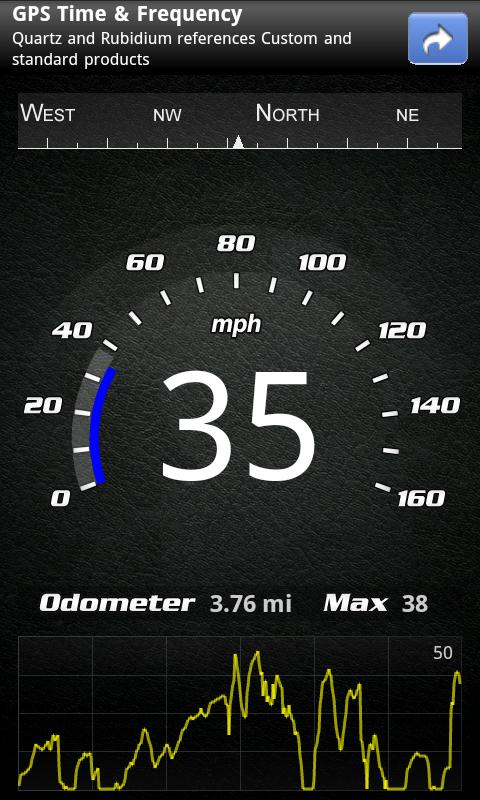
* High accuracy
GPS-based speedometer that is more accurate than the one in your car.
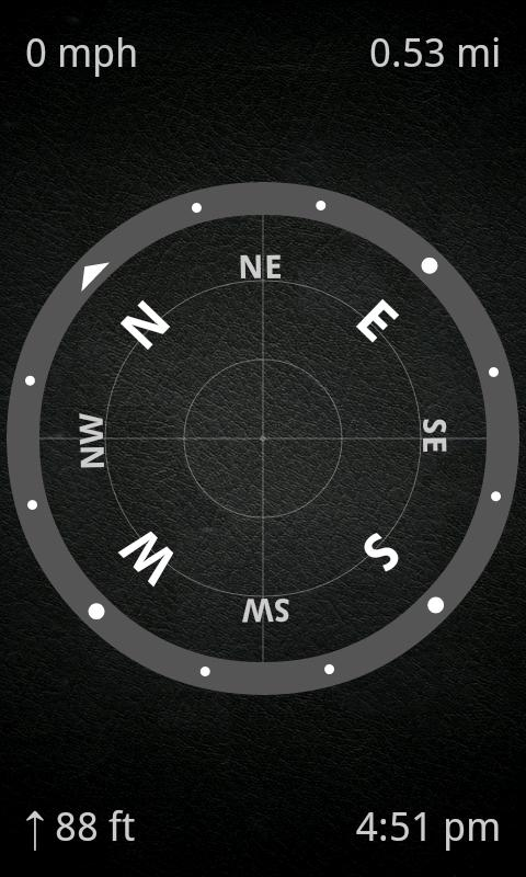
* Linear compass
Shows your direction of travel. Compass mode is also available.
* HUD mode
Mirrors the numbers so you can place the phone under your car's windshield and see the speed reflected on it in the dark.
* Speed graph
Displays a graph chart covering the last several minutes.
* Speed warning
You can set speed limits for three different types of roads, so when you go over a visual alert or sound will notify you.
* Display units
Supports units such as miles, kilometers and nautical miles.
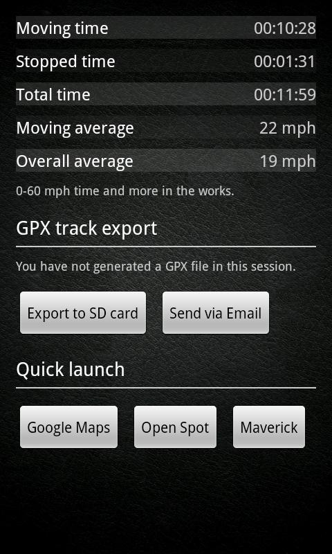
* GPX track export
Enables you to save your current track to SD card or email it to someone. GPX format is supported by many applications.
* Background mode
You can minimize the program and keep it running in background. It will work as usual and even notify you when you exceed the speed limit!
Please note that the accuracy depends on your GPS reception quality. If you have any questions or comments, feel free to post them on our blog.
NOTE: Contains ads. A paid version is also available.
Like it? Share with your friends!
Supported operating systems:
Google Android 1.0, Google Android 1.5, Google Android 1.6, Google Android 10.x, Google Android 2.0, Google Android 2.1, Google Android 2.2, Google Android 2.3, Google Android 3.0, Google Android 3.1, Google Android 3.2, Google Android 4.0, Google Android 4.1, Google Android 4.2, Google Android 4.3, Google Android 4.4, Google Android 5.x, Google Android 6.x, Google Android 7.x, Google Android 8.x, Google Android 9.x
Similar Software:
Compass Pro Navigator Compass Pro Navigator - This compass is a tool to search bearings(azimuth) using the built-in magnetic sensors. It has 4 significant features. 1. Although you may turn the phone into portrait or landscape mode, the heading is fixed. 2. The Camera's view is used for reality. 3. Metal Detector is included to verify the magnetic sensor. 4. GPS is supported
GPS Map Search Compass & Track An app for all the purpose so what you're waiting for....!!! Yes.... creatiosoft proudly introduced an awesome GPS Toolbox where you can do anything whatever you desired. Lets track all the locations of yourself via GPS where you are expedition
Smart Measure - rangefinder You can measure the distance and height of an object. Smart Measure Lite is the part 2. of Smart Tools series. (distance, height) This range-finder measures the Distance and the Height of an object by trigonometry
My Sensors Ad For those Android smart-phones that have various sensors built-in, this app attempt to access and retrieve values for display. Three common sensors are shown. Light, Temperature, 3-axis Magnetic field
Super Compass Free Super Compass Free - Super Compass Free is a basic compass application that shows you which direction your phone is pointed. You can use Compass in all outdoor activities as you can think about - walking, sailing, hiking, climbing, camping, flying, reading a map and so much more
Smart Compass 360 Smart Compass 360 - Smart Compass 360 is a basic compass application that shows you which direction your phone is pointed. You can use Compass in all outdoor activities as you can think about - walking, sailing, hiking, climbing, camping, flying, reading a map and so much more. Smart Compass 360 is a traveler's best friends
Point Lite Point Lite Want to know where you are relative to specific places important to you? Or where to go?Point shows it to you in one glance!Add your own points of interest. Mark your current spot before taking a stroll to easily find your way back.Or ask Point to give you a sign when you are near an important spot
Marine Compass Marine Compass - A simple marine compass: move your Android phone in all positions, and the compass will always stay parallel to the floor! Just for fun!
Note: Accuracy depends on the hardware, not on the software. This software only displays sensors values
GeoLog GeoLog saves the sensors data (gps, accelerometer, magnetometer data, etc.) of your device to a log file and calculates the coverage of the site. The coverage is a ratio of the track covering area to the area of the site (expressed in percents)
Other Software by developer «Code Sector»:
Maverick Off-road GPS navigator with offline maps support, compass and track recording. Use offline maps and GPS even without an internet connection. This app is great for hiking, boating, geocaching and other outdoor activities
SpeedView: GPS Speedometer SpeedView: GPS Speedometer - An advanced speedometer application that offers lots of useful features.
SpeedView uses the phone's built-in GPS system to show your current, maximum and average speed, as well as direction, total distance and time traveled. Suitable for running, car driving, biking or hiking