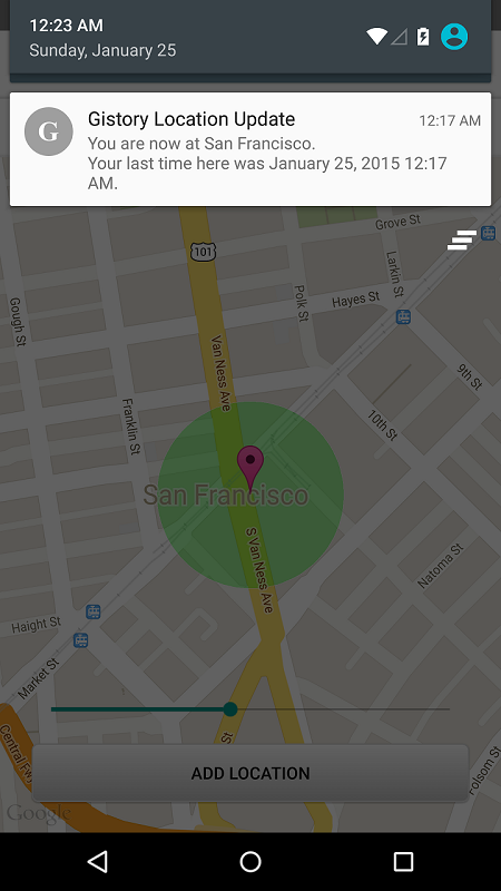
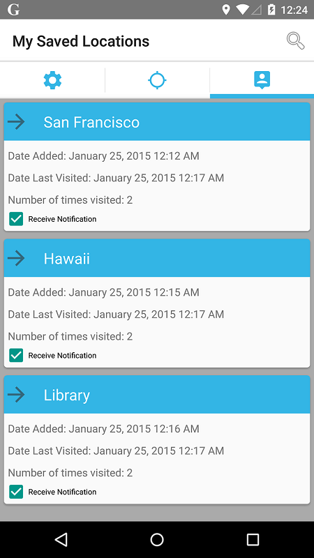
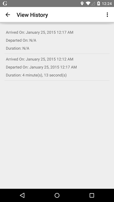
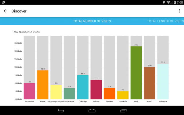
Gistory Analytics - Gistory is a powerful app that allows you to record the places you have been. In addition, you can also use the built-in analytics tool to allow you to discover how often and where you spend your time the most. Just save your current location in the app, and Gistory will take care of the rest. The next time you come back to this place, Gistory will let you know when the last time you were here and how long you stayed. In addition, Gistory will also allow you to take pictures and tag it to the place so you can remember exactly where you took them. Gistory can help answer questions like… - When was the last time I went to Hawaii? - How long do I spend at the gym every week? - Where was this picture taken? - Did I spend more time at work or at home last month? - How often did I go shopping two months ago?
Like it? Share with your friends!
Supported operating systems:
Google Android 10.x, Google Android 3.0, Google Android 3.1, Google Android 3.2, Google Android 4.0, Google Android 4.1, Google Android 4.2, Google Android 4.3, Google Android 4.4, Google Android 5.x, Google Android 6.x, Google Android 7.x, Google Android 8.x, Google Android 9.x
Similar Software:
Route Monitor Route Monitor - This application helps you to find the driving route between any start and end location which would have been set by you. It is very simple to use. Just search/select your source / destination location and press the submit button! The route between those two locations will be shown on the map. You can view the route in text format too
GPS Essentials Turn your phone into a fully-featured GPS receiver!
amAze (LG) AmAze is a first of its kind free navigation and local search service. It is free to download and use and it contains wide coverage of maps including aerial photo in Europe, North America, Australia and parts of Asia and Africa
runtastic GPS Coach Your personal GPS sports assistant for running, cycling, walking, hiking, ... runtastic GPS is your personal running and fitness application for all outdoor (running, nordic walking, hiking, skating,..) and indoor sports (treadmill, cardio, yoga, bodybuilding)
Android Photo GeoTag Android Photo GeoTag - Take pictures with your mobile phone and incorporate the data of the geographical location. The application allows you to include in the photographs, data from the GPS receiver, along with a brief note. If you know the coordinates, not having the GPS receiver, you can also handwrite geographic data
Family finder from Life360 Family finder from Life360 - Family finder from Life360 - this is a very useful and interesting for the whole family. If you often leave somewhere all the staff, this program is a must, especially in an unfamiliar area. On the screen of your Android device will be a real map, which will be marked by all the participants of your trip
Redpin The aim of the Redpin project is to create an open source system that allows indoor positioning up to room-level description using mobile phones
MySpeed MySpeed will record your speed and location to a log file and show it on a map.
It can use a database of speed camera locations to alert you when you're near a speed camera.
There is no speed camera database included. You'll need to download the data from a site such as scdb.info, flitspaal.nl, pocketgpsworld.com, maparadar.com, etc
AugSatNav Walk AugSatNav is an augmented reality navigation system which overlays walking directions upon a live video feed of the path or road ahead.
With AugSatNav there is no need to follow instructions or interpret maps - you can simply find your way by walking along the route highlighted by a bright white line
Geocast A location and multimedia enabled file sharing application
Comments on Gistory Analytics:
Comments not found
If you noted an error or download link is broken, please, report it via this page or use comments.
Gistory Analytics is compatible with your device Google Android 4.0


")


