Outdoor Share for Android - The Outdoor Navigation software is your best friend through your adventures in the wild.
Go into the outdoors with confidence and enjoy your activities without worrying about the tools to help you navigate. Your Outdoor Navigation app is made by the people who have been developing this software since 2003 across multiple platforms. Be sure that you will stay ahead of the rest with continuous updates and relevant tools.
It is an excellent tool for biking, jogging, skiing, hiking, geocaching, boating, flying and many other sporting activities.
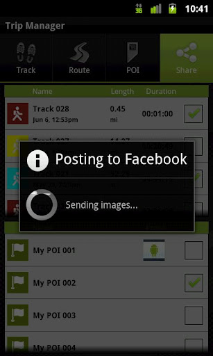
Your Outdoor Share will give you the ability to take those valuable tracks and POIs that you have created with your Outdoor Navigation base application and share them with your Facebook pals by uploading them to your Facebook account.
· Allows to share tracks and POIs with Facebook (besides the sharing via mail that is available also in the base version)
Installation instructions:
Outdoor Share is an add-on for the free Outdoor Navigation application. You need to have your Outdoor Navigation installed to be able to use Outdoor Share.
Download and install Outdoor Share on your Android device. Start the Outdoor Share plugin to complete the license checking: when activation will be completed then the icon will be removed (you need to restart your device to hide the icon) and the plugin will be used inside Outdoor Navigation application.
What's New in This Release:
· Bug fixing
Like it? Share with your friends!
Supported operating systems:
Google Android 10.x, Google Android 2.1, Google Android 2.2, Google Android 2.3, Google Android 3.0, Google Android 3.1, Google Android 3.2, Google Android 4.0, Google Android 4.1, Google Android 4.2, Google Android 4.3, Google Android 4.4, Google Android 5.x, Google Android 6.x, Google Android 7.x, Google Android 8.x, Google Android 9.x
Similar Software:
NAVIGON MobileNavigator NAVIGON MobileNavigator - Turn your Android phone into a mobile navigation device with lots of useful functions that will delight you! The pocket navigation device will show you the right way with functions such as Reality View Pro and Lane Assistant Pro
GPS Map Camera use GoogleMap GPS Map Camera use GoogleMap - The main feature of the 'GPS Map Camera':
When you take a piture with GPS enabled, it will paste the google map, address and weather to picture. (GPS latitue/longitude also include in the information)
Please enable your network and GPS function before using this application
Turbo GPS 2 (Android) Turbo GPS 2 (Android) - The known all-in-one GPS for Android devices, now in version 2
Track Location Track Location is an Android app which uses GPS or your network to display your location anywhere in the world. You can see the latitude and longitude of your current position and save the coordinates
uWho Find Me uWho Find Me will send a text message with your current location to help people find you.Simply have your friend or family member send you a text with your uWho Find Me Access code as the body of the text and your current location will be sent back.
Notes:
Application runs on phone boot up
YGPS Satellites YGPS Satellites - YGPS Satellites is a small mobile application that allows you to easily assess the quality of your GPS signal. The utility displays the location of all the GPS satellites and shows the signal strength for every one of them.
Using the app is pretty straightforward
Navigation gestures Navigation gestures - is an application which will add navigation gestures to any Android device. With this program you will get more useful space of screen. Moreover, with the help of this utility you can set gesture functions and change appearance
OpenGPSTracker OpenGPSTracker adds the capability to store and review where you and your Android device have been. Basically you press record at the start of your trip and your phone stores the route you take. This route is drawn real-time on the Maps functionality of Android or in the background with an idle device. The route is stored on your phone for review and further use
GPS Status GPS Status is an application which displays the information received from the phone's GPS receiver. In addition to the basic location information it can extract and display the state and location of each visible GPS satellite which is displayed on a simple sky view. The outer circle represents the horizon while the center corresponds to the zenith right above your head
wheredroid wheredroid is a simple application to display your coordinates from the GPS receiver: latitude, longitude, heading, speed, number of satellites used and (it's its peculiarity) altitude and accuracy. It is quite usable as an altimeter and a compass.
What's New in This Release:
· fixes a bug inverting East with West on some displays
What's New in 1.4
Other Software by developer «GPS Tuner»:
GPS Tuner Essentials Full Version with Nordic Countries Basic Map Content GPS Tuner Essentials Full Version with Nordic Countries Basic Map Content is designed specifically for off-road use: its large buttons, selectable tool window size, multiple Compass views and the built-in Tele Atlas map makes it extremely user-friendly and reliable
Outdoor Navigation Pro for Android Outdoor Navigation Pro for Android - The Outdoor Navigation software is your best friend through your adventures in the wild.
Go into the outdoors with confidence and enjoy your activities without worrying about the tools to help you navigate. Your Outdoor Navigation app is made by the people who have been developing this software since 2003 across multiple platforms
GPS Tuner Essentials Full Version with Brazil Basic Map Content GPS Tuner Essentials Full Version with Brazil Basic Map Content is designed specifically for off-road use: its large buttons, selectable tool window size, multiple Compass views and the built-in Tele Atlas map makes it extremely user-friendly and reliable
GPS Tuner Essentials Full Version with Central Europe Basic Map Content GPS Tuner Essentials Full Version with Central Europe Basic Map Content is designed specifically for off-road use: its large buttons, selectable tool window size, multiple Compass views and the built-in Tele Atlas map makes it extremely user-friendly and reliable
GPS Tuner Essentials Full Version with France, Monaco, Belgium, Switzerland Basic Map Content GPS Tuner Essentials Full Version with France, Monaco, Belgium, Switzerland Basic Map Content is designed specifically for off-road use: its large buttons, selectable tool window size, multiple Compass views and the built-in Tele Atlas map makes it extremely user-friendly and reliable
GPS Tuner Essentials Full Version with Canada Basic Map Content GPS Tuner Essentials Full Version with Canada Basic Map Content is designed specifically for off-road use: its large buttons, selectable tool window size, multiple Compass views and the built-in Tele Atlas map makes it extremely user-friendly and reliable
GPS Tuner Essentials Full Version with United States Basic Map Content GPS Tuner Essentials Full Version with United States Basic Map Content is designed specifically for off-road use: its large buttons, selectable tool window size, multiple Compass views and the built-in Tele Atlas map makes it extremely user-friendly and reliable
GPS Tuner Essentials GPS Tuner Essentials is designed specifically for off-road use: its large buttons, selectable tool window size, multiple Compass views make it extremely user-friendly and reliable
Outdoor Speedometer for Android Outdoor Speedometer for Android - The Outdoor Navigation software is your best friend through your adventures in the wild.
Go into the outdoors with confidence and enjoy your activities without worrying about the tools to help you navigate. Your Outdoor Navigation app is made by the people who have been developing this software since 2003 across multiple platforms
GPS Tuner Atlas Full Version with Full Europe Basic Map Content GPS Tuner Atlas Full Version with Full Europe Basic Map Content is designed specifically for off-road use: its large buttons, selectable tool window size, 6 different types of Compass views and the built-in Tele Atlas map makes it extremely user-friendly and reliable


")


