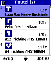
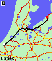
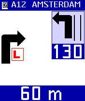
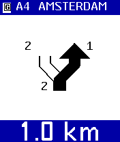
With Nav4All you can navigate worldwide on your own mobile phone.
You will never lose your way again and you will always know where you and your friends are located.
You get access to over 1 billion addresses on MyWorld, including Yellow Pages, phonebooks, etc.
While you're on the road you can easily save an interesting location by pressing one button. Or you can take a picture which will be instantly visible on a map on the Myworld website. Your pictures are visible to you or also to your friends, that's up to you.
Like it? Share with your friends!
Supported operating systems:
Google Android 1.0, Google Android 1.5, Google Android 1.6, Google Android 10.x, Google Android 2.0, Google Android 2.1, Google Android 2.2, Google Android 2.3, Google Android 3.0, Google Android 3.1, Google Android 3.2, Google Android 4.0, Google Android 4.1, Google Android 4.2, Google Android 4.3, Google Android 4.4, Google Android 5.x, Google Android 6.x, Google Android 7.x, Google Android 8.x, Google Android 9.x
Similar Software:
FastToolBar FastToolBar - It is simple and easy controller:
-Sound control
-WiFi control
-Bluetooth control
-GPS control
One click and you can turn on/off this functions.
Simple and very convenient widget will not take you on the phone a lot of memory
TomTom Europe for Android TomTom Europe for Android - TomTom Europe is a turn-by-turn GPS navigator for Android devices. The app includes accurate offline maps, so you can find your way anywhere, even without an internet connection
Current Location Finder Current Location Finder - Current Location finder which can be used to locate your location with the aid of a live satellite map you can dynamically (real time) determine ... Use the live satellite maps
GPS Odometer GPS Odometer - A simple and easy to use odometer. There is no maze of menus and no mysterious settings. GPS Odometer only does one thing, and does it well: measure distance traveled.
Note: Intended to measure relatively short distances, the application does not run in the background
jFireEagle (Android) JFireEagle is an Android application that connects to Yahoo Fire Eagle
Android Photo GeoTag Android Photo GeoTag - Take pictures with your mobile phone and incorporate the data of the geographical location. The application allows you to include in the photographs, data from the GPS receiver, along with a brief note. If you know the coordinates, not having the GPS receiver, you can also handwrite geographic data
TomTom Poland for Android TomTom Poland for Android - TomTom Poland is a turn-by-turn GPS navigator for Android devices. The app includes accurate offline maps, so you can find your way anywhere, even without an internet connection
GPS status & toolbox GPS status & toolbox - is a very useful program for working with GPS. This utility is aimed at viewing GPS condition and settings. It can display all data of a sensor and GPS: positions and satellite signal power, accuracy, speed, acceleration, height, step and even battery status
Boundary Reminder Boundary Reminder - This application is a reminder tool which works with your location. A boundary is registered in drawing a circle on the map, you get a notification when you pass over the boundary.(The application works in background as Service.) Your location data is NOT send to a server
Other Software by developer «Nav4All»:
Nav4All (BlackBerry) Nav4All (BlackBerry) - With Nav4All you can navigate worldwide on your own mobile phone.
You will never lose your way again and you will always know where you and your friends are located.
You get access to over 1 billion addresses on MyWorld, including Yellow Pages, phonebooks, etc
Nav4All (Java) Nav4All (Java) - With Nav4All you can navigate worldwide on your own mobile phone.
You will never lose your way again and you will always know where you and your friends are located.
You get access to over 1 billion addresses on myworld, including Yellow Pages, phonebooks, etc

")
")


")


")
")