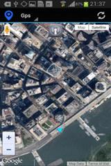
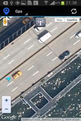
Gps Maps - Gps with Google Map, live current position. Very simple to use. It is the most easy way to know your exactly coordinates. Only 1.2 KB
Like it? Share with your friends!
Supported operating systems:
Google Android 10.x, Google Android 2.3, Google Android 3.0, Google Android 3.1, Google Android 3.2, Google Android 4.0, Google Android 4.1, Google Android 4.2, Google Android 4.3, Google Android 4.4, Google Android 5.x, Google Android 6.x, Google Android 7.x, Google Android 8.x, Google Android 9.x
Similar Software:
OSMTracker for Android OSMTracker stands for OpenStreetMap Tracker. It allows you to track your journey and mark significant way points. Way points can be marked with a tag using a button, with a quick voice record, a text note or by taking a picture. The various button pages and layouts can be customized to suit your OpenStreetMap activities
Chennai Everything Chennai Everything - STEPS: 1.Open app 2.Choose Category( ATM , Shopping mall, Cafe , Restaurant Etc, ) 3.choose the place, get details and reviews of the places Features : 1. every places 2. all detail about the place 2. google map support 3. Directions 4. Reviews of the place 5
iTrack iTrack is an application for tracking your friend's location in real time. You and your friend must both install this application. Click menu to show current online users; Click your friend and make a request. Your friend will be notified and respond to your request. The map will be updated in real time if your friend allows tracking
My Fleet Geofence My Fleet Geofence - Why do you need My Fleet Geofence application?
1. With My Fleet Geofence, you can create a specific "safe zone" or "unauthorized zone" on a map and get an E-mail Alert if the phone leaves the area.
2. Receive an instant alert in case of breach of specific zone.
How to start?
1. Install the application on your Android phone.
2
Location Tracker Why do you need Location Tracker application? 1. Track, monitor and manage an individual or group of people for operational and safety security reasons. 2. Send an instant alert in emergency situation by pressing the Panic button
CompassNavi Compass / Navigation Activity, mainly for OpenGPX, but can be used from any application
NAVIGON Australia for Android NAVIGON Australia for Android - NAVIGON turns your mobile device into a fully featured GPS navigation system. The software provides advanced functionality for both drivers and pedestrians, including 2D and 3D maps, route planner, speed assistant, voice directions, local search, and more
Outdoor Share for Android Outdoor Share for Android - The Outdoor Navigation software is your best friend through your adventures in the wild.
Go into the outdoors with confidence and enjoy your activities without worrying about the tools to help you navigate. Your Outdoor Navigation app is made by the people who have been developing this software since 2003 across multiple platforms
GeoPix GeoPix - Headed to work or class? Want your school's mascot or company logo to show up as your wallpaper, "abracadabra" style, just as you arrive? Simply choose an image from Myxer’s massive catalog of wallpapers, or grab one from your phone, set the address- and watch it "auto-magically" appear as you reach your destination
Other Software by developer «Kayipkayik@gmail.com»:
not found
Comments on Gps Maps:
Comments not found
If you noted an error or download link is broken, please, report it via this page or use comments.
Gps Maps is compatible with your device Google Android 8.x