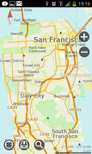
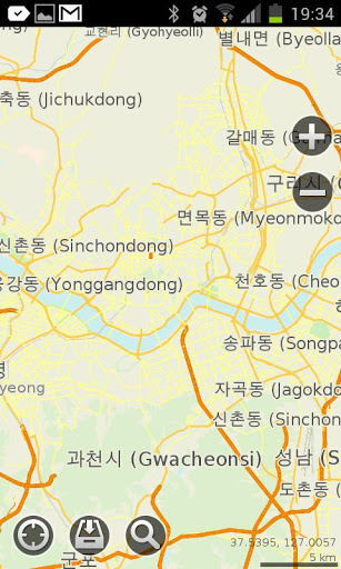
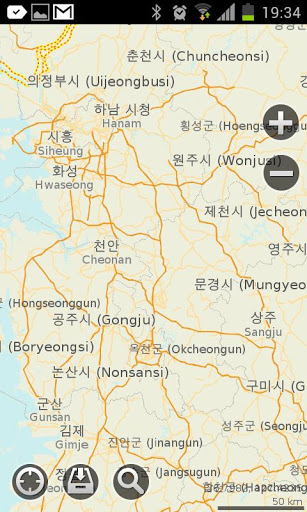
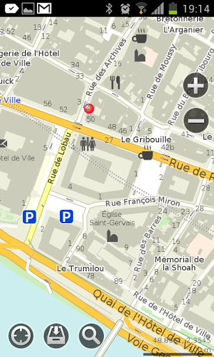
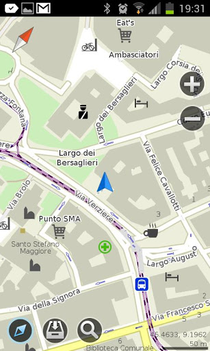
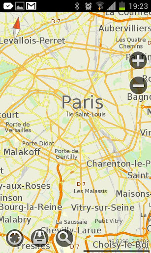
MapsWithMe Pro for Android - MapsWithMe allows you to access maps of all the countries in the world while on the go. The maps are based on OpenStreetMap data and work completely offline, without requiring an internet connection.
With MapsWithMe installed on your iOS device, you can find out your current location using GPS, search for points of interest, bookmark favorite spots, and more. MapsWithMe Pro for Android features:
· All countries, all cities covered
· High level of detail
· Offline search, auto-suggestion feature
· Thousands of POI
· Bookmarks
· GPS positioning and compass
· Map rotation and auto-follow mode
· Vector maps
· Innovative map data compression method
· English, Russian, Spanish, German, Czech, Dutch, Japanese, Korean supported
What's New in This Release:
· Fixed bug on Samsung Galaxy S4 GT-I9500
What's New in 2.5.0:
· Paths/lines/tracks import from KML. Finally you can display and use the lines from other apps in MapsWithMe. Import KML file to MapsWithMe and view the projected route on the map. Further improvements are coming soon.
· Map data updated
· Bug fixes
What's New in 2.4.6:
· Map updates notification. You do not need to check whether new map details are available or not any more. Now the app informs you which maps need to be updated
· Travel guides availability notification. To help you make your travel more enjoyable, we provide reliable country information. Once you've downloaded the map, free travel guide GuideWithMe app can be offered for your destination
· Android 4.3 support
· Map data updated
· Bug fixes
What's New in 2.4.4:
· New option is available: get and copy precise coordinates of any point on the map. Coordinates info is displayed on the POI information screen
· Fresh OpenStreetMap data
· Bug fixes
What's New in 2.3.5:
· We made maps faster!
· Added Poland and Ukraine translations: the option of searching by keywords in native language is enabled for you.
· Optimized for new devices' screens
· Changed UI color theme to white
· Fixed installation issue on some Android devices
What's New in 2.3.4:
· optimized the map brightness and contrast
· changed the map fonts
· fixed the bugs
What's New in 2.3.3:
· Meet a brand new feature - location sharing! It enables you to send a pin to any place on the map via e-mail or sms.
· Traditional Chinese, Korean, Japanese, Dutch, Ukrainian languages added
· API for external apps via geo url scheme added
· Map data updated
· Smoother map handling
What's New in 2.3.2:
· IMPORT/EXPORT OF BOOKMARKS. Share your favorite places with friends via email or add bookmarks from other maps to MapsWithMe. KML/KMZ files are supported.
· "My position" arrow problem fixed
· Map data updated
· Smoother map handling
What's New in 2.3.0:
· Bookmarks feature! Now you are able to mark and save your favorite locations, POI and destinations. The option of creating a group of bookmarks is added
· Improved search: more detailed categories; an option to choose the location where to search is available
· Compass and GPS issues fixed
· Map data updated
What's New in 2.2.1:
· There are lots of improvements and bug fixes in the new version.
Like it? Share with your friends!
Supported operating systems:
Google Android 10.x, Google Android 2.1, Google Android 2.2, Google Android 2.3, Google Android 3.0, Google Android 3.1, Google Android 3.2, Google Android 4.0, Google Android 4.1, Google Android 4.2, Google Android 4.3, Google Android 4.4, Google Android 5.x, Google Android 6.x, Google Android 7.x, Google Android 8.x, Google Android 9.x
Similar Software:
World Map 2011 FREE World Map 2011 FREE - World Map
*** NEW RELEASE ***
View a large quick reference World Map on your Android today!
Contains Up-To-Date World Maps!
Did you know?
-------------
South Sudan became the world's 195th country following separation from Sudan on 9 July 2011
Features
---------
- Political World Map
- No internet connection is required
InstaMapper (Android) InstaMapper is a free service that allows you to track a person or vehicle online in real time using a GPS-enabled mobile phone.
To use InstaMapper, you create a free account. Registration takes only a minute or two. All it is asked for is a username, password, and a valid email address.
Next, you install a small application on your GPS-enabled phone
OSMTracker for Android OSMTracker stands for OpenStreetMap Tracker. It allows you to track your journey and mark significant way points. Way points can be marked with a tag using a button, with a quick voice record, a text note or by taking a picture. The various button pages and layouts can be customized to suit your OpenStreetMap activities
Vespucci OpenStreetMap Editor Vespucci is the first editor for OpenStreetMap on Android. You can download the map data for a specific area and edit the map. After editing, you can send it directly to the OSM Server.
What's New in This Release:
New features:
· OpenStreetBugs support(disabled by default)
· layers incl
ViewRanger GPS ViewRanger is a unique mapping, navigation, tracking, and information tool for mobile phones that provides fully featured outdoor gps and trail navigation through a natural and intuitive display. ViewRanger transforms a Nokia or other Symbian S60 smartphone into a fully featured trail navigation system
Locus - addon AR This is BETA version of simple addon for Locus mapping application (version 1.1.0 and higher). Allow to show actual POI's visible on map, in Augmented reality view. In Locus Free, usage is limited to 1 minute. This addon do not have any screen or widget
Walk And Run Keeper Walk And Run Keeper - Lets you measure how far you ran/walked, track your walking distance, speed, time, and calories burned and store a record of your daily workouts to stay fit.
This is the best way to maintain walking schedules. Use this app and measure your walking route and calculate your burned calories per session
Trapster Trapster- Your mobile phone alerts you as you approach police speed traps, red light and speed cameras, via spoken warnings in fun voices! Join world''s largest driver''s social network, 5 million users and growing! Drivers helping drivers! New for 1.6
Map Locate Ad This app is not created to replace Google Maps or other feature rich mapping apps. What this app does is to serve a simple need for certain group of users. Use case is you own jpg,png image files of tradeshow,house,store,apartment,garden etc floorplan and you want to draw pins on different location
Map Explorer Map Explorer is a prototype that tries to improve map browsing experience. It is basically Google maps with an overlay that shows POIs even if they are beyond the display. Use the preferences to test different visualizations
Other Software by developer «MapsWithMe»:
MapsWithMe Lite for iPhone/iPad MapsWithMe Lite for iPhone/iPad - MapsWithMe allows you to access maps of all the countries in the world while on the go. The maps are based on OpenStreetMap data and work completely offline, without requiring an internet connection
MAPS.ME for Android MAPS.ME for Android - MapsWithMe allows you to access maps of all the countries in the world while on the go. The maps are based on OpenStreetMap data and work completely offline, without requiring an internet connection
MAPS.ME for iPhone/iPad 3. MAPS.ME for iPhone/iPad 3. - MapsWithMe allows you to access maps of all the countries in the world while on the go. The maps are based on OpenStreetMap data and work completely offline, without requiring an internet connection
MAPS.ME Lite for iPhone/iPad 3. MAPS.ME Lite for iPhone/iPad 3. - MapsWithMe allows you to access maps of all the countries in the world while on the go. The maps are based on OpenStreetMap data and work completely offline, without requiring an internet connection
MapsWithMe Pro for iPhone/iPad MapsWithMe Pro for iPhone/iPad - MapsWithMe allows you to access maps of all the countries in the world while on the go. The maps are based on OpenStreetMap data and work completely offline, without requiring an internet connection


")


_13470small.png "Trapster")


