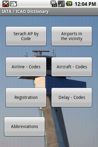
IATA / ICAO Dictionary -This application is an offline database for IATA / ICAO airport, airline, aircraft, delay codes and aircraft registration codes.
The airport database provides:
- Name
- Elevation
- Latitude and Longitude coordinates,
- timezone,
- runway and communication information (not every airport)
- Metar / TAF reports (not every airport)
- google map (not every airport)
- sunrise / set calculation
- find other airport in the vicinity of the selected airport or from your present position (GPS required)
- calculate the distance to the selected airport (GPS required)
The airline database provides:
- Name
- Country
- Callsign
- picture of the airline with airliners.net
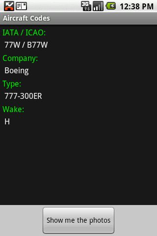
The aircraft database provides:
- Company
- Type
- wake category
- picture of the aircraft with airliners.net
Other functions are:
AC registrations; selection by
- country - registration
- registration - country
Delay codes
general aviation abbreviations
Like it? Share with your friends!
Supported operating systems:
Google Android 1.5, Google Android 1.6, Google Android 10.x, Google Android 2.0, Google Android 2.1, Google Android 2.2, Google Android 2.3, Google Android 3.0, Google Android 3.1, Google Android 3.2, Google Android 4.0, Google Android 4.1, Google Android 4.2, Google Android 4.3, Google Android 4.4, Google Android 5.x, Google Android 6.x, Google Android 7.x, Google Android 8.x, Google Android 9.x
Similar Software:
TrafficDroyd TrafficDroyd - real-time traffic information for the countries of Germany, Netherlands and Belgium.
Display traffic messages both in compact and full view:
· road name (e.g. "A8")
· road segment (e.g
indian rail train PNR and hotels indian rail train PNR and hotels - Official ixigo indian rail app recommended by Google CEO, Sundar Pichai
Citybike Stationen Wien Zeigt eine Liste der Wiener Citybike Stationen nach der Entfernung vom aktuellen Standort geordnet an. Fur jede Station ist die Anzahl der freien Rader, die Anzahl der freien Boxen, sowie der Standort ersichtlich. Bitte Hinweise unter Menu / About beachten (Beta Version)!
Bookatable (Android) Bookatable for Android is a free and easy way for you to find and book 1000's of restaurants in the UK, Europe and USA
TripIt: Travel organizer TripIt - is an application for planning all your trips in one place. This utility can create a master-route for each of your trips. With the help of this application you can get access to your plans any time and any place. Moreover, the program is synchronized with a calendar so as you don't forget about other events happening on the dates of your trips
Orari GTT - Turin Transport Orari GTT - Turin Transport - OrariGTT provides the passage time of public transportation in real-timein the city of Turin and in his belt, including the Metro. Thanks to OrariGTT you can: * Look for a bus or a subway GTT station to get the passage time of the means of transport. * View all the stops of GTT network on the map. * Display the paths of all the GTT lines
İller Arası Mesafe Ölçer Uygulamamız sayesinde iller arası mesafeleri, il merkezinden ilçeler arası uzaklıkları, yolculuğunuzun ne kadar süreceğini öğrenebilir, karayollarıyla ilgili bütün kuruluşların telefon numaralarına tek tuşla ulaşabilirsiniz
KAYAK Lite KAYAK Lite Flight, Hotel, Car Search plus Flight Tracker. FREE.
If you need quick access to KAYAK travel search functions, this is the app for you.
Flight Search - find the best flight options for your trip.
Hotel Search - get the hotel that is right for you: 5-star or budget, we'll find it
Los AngelBus Los AngelBus - This application shows locations and predicts bus times in Los Angeles using GPS info from the Los Angeles Metro.
What's New in This Release:
· GPS now turns on when you start the app to allow quicker location lookup times
Informasi Tol Indonesia Aplikasi informasi tol ini dapat memberikan informasi terkini jalan tol (Gambar CCTV), peta di ruas jalan tol, tarif jalan tol, kontak layanan lalulintas jalan tol, dan informasi fasilitas area peristirahatan di jalan tol
Other Software by developer «Steve Dexter»:
Aviation Weather with Decoder Aviation Weather with Decoder - An easy way to receive metar and TAF reports from NOAA
Snowtam Decoder Snowtam Decoder - You have a snowtam in the metar report, you want to decode. Snowtam Decoder does it for you.
· Decoding of a snowtam in metar format
· Explanation of the items (A ,B , C, ..
Guess the X Guess the X - With this game you can guess a flag, a capital, a land and boundaries.
There are four input methods available to enter the answer: an autocomplete editbox, via a listview, multiple choice and a tap mode.
There are also options to change the color, size and font


")


