Pocket PC Geocaching Tools - Many tools in one program to help you while you are geocaching.
What's included?
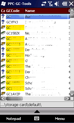
* Open GSAK databases directly
* HTML view
* Field Notes
* Hint decoder and decryption
* Several coordinate functions
* Solver
* Transformer (Text to Digits, etc.)
* Step counter
* Notepad
Like it? Share with your friends!
If you got an error while installing Themes, Software or Games, please, read FAQ.
Supported operating systems:
Windows Mobile 2003, Windows Mobile 5.0, Windows Mobile 6 Classic, Windows Mobile 6 Professional, Windows Mobile 6.1 Classic, Windows Mobile 6.1 Professional, Windows Mobile 6.5 Professional
Similar Software:
MapGoogler MapGoogler uses the GPS on your PocketPC to find your current latitude/longitude/speed and altitude and allows you to view your position on a map from the Google.com maps service. You can customize the maps zoom, and type via the 'Options' in the toolbar. The maps service is provided by Google
Satsports Log Satsports Log is your general sport app. Ideal for running, cycling, mountain biking, hiking and walking. It also has some fun visual features such as maps and graphs of your elevation, speed and pace. Real time Statistics: Satsports-log has all the stats you could wish
VoiceGPSes VoiceGPSes - VoiceGPSes allows you get your GPS and then create a voice recording and send it via email attachment with your current GPS and Google.com map link. Tap 'Start GPS' to get your current GPS and tap the button to start/stop the recording and send it via email.
This program requires that you have both the 'BeanDLL
AccountingGPS AccountingGPS - Each sheet has the GPS home setting and you can use the GPS on your PocketPC to view the distance of every sheet. Select the sheet to view/edit the entry for it. You can also view a Google.com map of your current or the sheets GPS
FON Access Points for Spain FON Access Points for Spain - FON offers you a new Points of Interest service (POIs). This allows you to download FONspots directly to your navigation device.
What does that mean? You can download a Points of Interest file directly to your navigation device
bliinGPSXS bliinGPSXS is a free and easy software that sends your GPS-location to the bliin servers so you can be positioned Live! on the map in real-time. On bliin, users can locate and follow friends on a map in real-time, upload media: "Shares" - photos, videos, audio and text to Google Maps or other mapping services. Shares are geo-tagged to the location of capture
TwitterGPSings TwitterGPSings allows you to update and view Twitter contacts via GPS. You can use the GPS to find your current location and send a tweet and also track your friends via Twitter. The map service is provided by Google.com. The tweet service is provided by Twitter
Sorry I'm Late Sorry I'm Late - People are always in a hurry to get somewhere. A common issue is to inform someone waiting for us that we are, let’s say, a bit late and maybe reassure him that we will be there in some time
TravelReaderer TravelReaderer - TravelReaderer uses the GPS on your PocketPC to find your current latitude/longitude and says the readings in a computer voice. You can also view and download a map of your current position from the Google.com map service. You can customize the maps via the options setting in the toolbar.
This program requires that you have both the 'BeanDLL
MapTexterer MapTexterer - MapTexterer allows you to create text based GPS maps. When you get a GPS lock then you can create a new map and enter text for the area. When you save the text the map is downloaded and the text and GPS is appended to the end of the map with current GPS.
This program requires that you have both the 'BeanDLL
Comments on Pocket PC Geocaching Tools:
Comments not found
If you noted an error or download link is broken, please, report it via this page or use comments.
Pocket PC Geocaching Tools is compatible with your device HTC HD2 Telstra (HTC Leo)

")