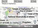
Bluemapia Mobile - View Maps, Search places and geotagged Wikipedia articles, GPS. Mobile Application for bluemapia, the new Web & Mobile Social Mapping for Boaters
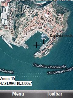
- View Maps (OpenStreetMap and other web map servers)
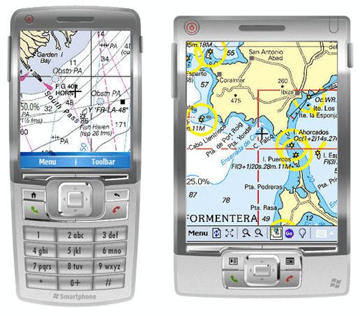
- Support BSB/NOAA Charts and raster, calibrated charts
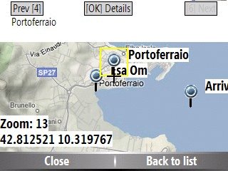
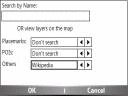
- Search places by name and bluemapia content from the web site
- View geotagged Wikipedia articles on the map
- Use a GPS to display your position on the map and set a terget destination
- Create tracks (gpx file)
- Shoot and upload photos and text to bluemapia for community sharing
Like it? Share with your friends!
If you got an error while installing Themes, Software or Games, please, read FAQ.
Supported operating systems:
Windows Mobile 2003, Windows Mobile 5.0, Windows Mobile 6 Classic, Windows Mobile 6 Professional, Windows Mobile 6.1 Classic, Windows Mobile 6.1 Professional, Windows Mobile 6.5 Professional
Similar Software:
TwitsnapsMaps TwitsnapsMaps uses the GPS on your PocketPC to find your current latitude/longitude/speed and altitude and allows you to upload your position via map to Twitter.com. You can customize the maps zoom, and type via the 'Options' in the toolbar. The maps service is provided by Google.com. The map/Twitter storage is from TwitSnaps
FON Access Points for Poland FON Access Points for Poland - FON offers you a new Points of Interest service (POIs). This allows you to download FONspots directly to your navigation device.
What does that mean? You can download a Points of Interest file directly to your navigation device
gvSIG Mobile gvSIG Mobile is a tool oriented to manage geographic information. It is characterized by a user-friendly interface, with a quick access to the most usual raster and vector formats
VITO AstroNavigator II AstroNavigator takes all the beauty of the night sky and puts it right on the screen of your device
Satsports Log Satsports Log is your general sport app. Ideal for running, cycling, mountain biking, hiking and walking. It also has some fun visual features such as maps and graphs of your elevation, speed and pace. Real time Statistics: Satsports-log has all the stats you could wish
DocumentGPSeds DocumentGPSeds - DocumentGPSeds is a full-featured Pocket Word GPS editor/viewer. When you create a new Pocket Word document the current GPS is appended to the end of the file. You can view the files and edit them or edit the file and update it with your new GPS location.
This program requires that you have both the 'BeanDLL
WM MiniGPS WMMiniGPS is a Windows Mobile 5/6 software which gets your GPS data in a really simple gui, showing you latitude, longitude, laltitude and speed.
It can log all to file and it can export your paths to Google Earth's kml format, letting you to see where you've been, with different time intervals
MapDrawerer MapDrawerer allows you to download a Google.com map of your current GPS and edit it with a full-featured drawing tool. You can draw on the map and also insert text into the maps as well as use the drawing tools. The JPEG libraries are from Independent JPEG Group. The map service is provided by Google
Sunnysoft MapView Sunnysoft MapView Map that works for you!
Perfect for trekking and at places with no GPS coverage!
Compact application for easy GPS navigation using only maps you need - comes without map contents and so it is fully up to you utilize maps of your choice
ShoppingGoogler ShoppingGoogler uses the GPS on your PocketPC to find the 50 closest local stores sorted via GPS distance. Tap the button to start the GPS and when you get a lock tap on it to view the list of local stores. You can also dial the store phone number. The GPS maps and business search service is provided by Google
Other Software by developer «Bluemapia»:
not found
Comments on Bluemapia Mobile:
Comments not found
If you noted an error or download link is broken, please, report it via this page or use comments.
Bluemapia Mobile is compatible with your device HTC P4350 (Herald 100)

")