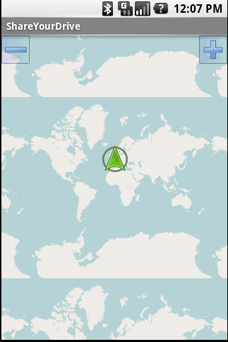
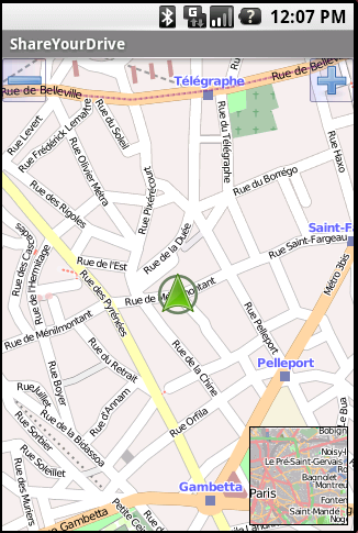
ShareYourDrive Transportation and cars especially are contaminating. Imagine with a few clicks, you can know who can give you a ride. The time real geolocalisation to save environment. Don't be afraid about security. Historic helps to know who was with you, when and where. Moreover you can give a rate to the persons you meet. This note is shown at the time you choose the person you want to ride with
Like it? Share with your friends!
Supported operating systems:
Google Android 1.0, Google Android 1.5, Google Android 1.6, Google Android 10.x, Google Android 2.0, Google Android 2.1, Google Android 2.2, Google Android 2.3, Google Android 3.0, Google Android 3.1, Google Android 3.2, Google Android 4.0, Google Android 4.1, Google Android 4.2, Google Android 4.3, Google Android 4.4, Google Android 5.x, Google Android 6.x, Google Android 7.x, Google Android 8.x, Google Android 9.x
Similar Software:
amAze (Sony Ericsson) AmAze is a first of its kind free navigation and local search service. It is free to download and use and it contains wide coverage of maps including aerial photo in Europe, North America, Australia and parts of Asia and Africa
Android FindMyCar Android FindMyCar - Innovative software for Android devices that uses the GPS signal to show signs that allow to reach a geographic location.
Suitable for various uses (eg. find car parked in a parking area or in an unknown city, finding a person (who has sent their coordinates) in a lovely beach, in a fair, in another boat, find an area of sea fishing, etc..)
amAze GPS light edition amAze GPS light edition provides access to worldwide street maps, full topographic map coverage of the USA and satellite imagery for 200 major cities around the world. It allows you to search in a worldwide rich POI database and you can upgrade to the full version that includes turn-by-turn voice guided navigation from within the application
OpenStreetMapViewer OpenStreetMapViewer provides Tools / Views to interact with OpenStreetMap-Data
CopsAlarm No more tickets Show where the hiding police are on Google Map As well as speed cam,red light locations Lite shows police,red lights only
Wi-Fi Map Maker - Free Wi-Fi Map Maker is application makes a map of Wi-Fi access points as you walk around.
· Maps out the actual coverage of each access point!
· Access point names are displayed on the map
· See street address and area of access points
· You can select the criteria for inclusion on your map
Map Explorer Map Explorer is a prototype that tries to improve map browsing experience. It is basically Google maps with an overlay that shows POIs even if they are beyond the display. Use the preferences to test different visualizations
zhiing zhiing connects people-to-people, people-to-places and people-to-services with dynamic maps and turn-by-turn driving directions. Forget about map printouts or scribbling down directions....use zhiing! Simply enter the mobile number you want to zhiing and hit send
MapMakr MapMakr If you’re an aid worker responding to a humanitarian crisis, up to date, accurate, and easy to read maps are vital. Knowing whether a bridge has collapsed, a road is passable and where you can land planes bringing in aid is really important
Other Software by developer «Fabien Carrion»:
not found
Comments on ShareYourDrive:
Comments not found
If you noted an error or download link is broken, please, report it via this page or use comments.
ShareYourDrive is compatible with your device HTC Explorer A310e (HTC Pico)

")


")


")
