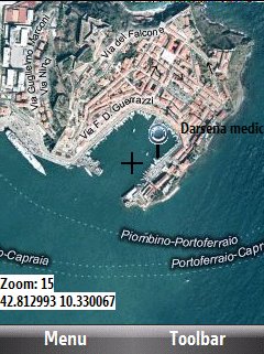
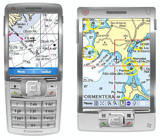
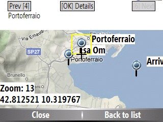
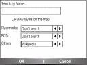
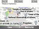
Bluemapia Mobile - View Maps, Search places and geotagged Wikipedia articles, GPS. Mobile Application for bluemapia, the new Web & Mobile Social Mapping for Boaters
- View Maps (OpenStreetMap and other web map servers)
- Support BSB/NOAA Charts and raster, calibrated charts
- Search places by name and bluemapia content from the web site
- View geotagged Wikipedia articles on the map
- Use a GPS to display your position on the map and set a terget destination
- Create tracks (gpx file)
- Shoot and upload photos and text to bluemapia for community sharing
Like it? Share with your friends!
If you got an error while installing Themes, Software or Games, please, read FAQ.
Supported operating systems:
Windows Mobile 2003, Windows Mobile 5.0, Windows Mobile 6 Classic, Windows Mobile 6 Professional, Windows Mobile 6.1 Classic, Windows Mobile 6.1 Professional, Windows Mobile 6.5 Professional
Similar Software:
Navigation BE-ON-ROAD Central Europe Q2/2011 Navigation BE-ON-ROAD Central Europe Q2/2011 - The new major version of be-on-road presents new features and is based on new platform which brings high level of reliability, portability and speed on almost any kind of device. The new be-on-road brings high value voice guided door-to-door navigation
FON Access Points for Monaco FON Access Points for Monaco - FON offers you a new Points of Interest service (POIs). This allows you to download FONspots directly to your navigation device.
What does that mean? You can download a Points of Interest file directly to your navigation device
CoffeeGoogler CoffeeGoogler uses the GPS on your PocketPC to find the 50 closest coffee shops sorted via GPS distance. Tap the button to start the GPS and when you get a lock tap on it to view the list of local coffee shops. You can also dial the store. The GPS maps and coffee search service is provided by Google
Leaf Locate Leaf Locate- Free location software for Windows Mobile
VoiceGPSes VoiceGPSes - VoiceGPSes allows you get your GPS and then create a voice recording and send it via email attachment with your current GPS and Google.com map link. Tap 'Start GPS' to get your current GPS and tap the button to start/stop the recording and send it via email.
This program requires that you have both the 'BeanDLL
TravelGPSeds TravelGPSeds - TravelGPSeds uses the GPS on your PocketPC to find your current latitude/longitude/speed and altitude and allows you to view your position on a map from the Google.com maps service. You can customize the maps zoom, and type via the 'Options' in the toolbar.
This program requires that you have both the 'BeanDLL
FON Access Points for Dominican Republic FON Access Points for Dominican Republic - FON offers you a new Points of Interest service (POIs). This allows you to download FONspots directly to your navigation device.
What does that mean? You can download a Points of Interest file directly to your navigation device
FON Access Points for Liechtenstein FON Access Points for Liechtenstein - FON offers you a new Points of Interest service (POIs). This allows you to download FONspots directly to your navigation device.
What does that mean? You can download a Points of Interest file directly to your navigation device
TerraTrack Recorder 7 Route guidance in 3D view, makes navigation processes very simple and intuitive
G-Watch G-Watch is a stop watch which supports GPS devices. It keeps track of your distance, speed and altitude. G-Watch is a tool which combines following features: stopwatch, countdown timer and geocaching
Other Software by developer «Bluemapia»:
not found
Comments on Bluemapia Mobile:
Comments not found
If you noted an error or download link is broken, please, report it via this page or use comments.
Bluemapia Mobile is compatible with your device HTC Touch Diamond2 T5353 (HTC Topaz 100)

")