GPSToday-GeoTerrestrial GPSToday now brings an unbeatable combination of location features to your mobile device.
Driving/Walking directions in many countries, with traffic-optimization option.
Log file plotting on map and animated "playback". Also, the geologger will now never clip corners, and will perfectly follow loopy highway ramps. You can now also upload your log-files to the desktop website.(full-featured log-editing on the desktop coming soon)
Location Tracking and sharing (GeoLocation). Track your location history online for your own private use, or share with friends/family. The power-saving ability of GPSToday means you can leave it on indefinitely without worrying about the battery.
Easily and privately (or publicly) share points-of-interest, pictures, messages with like-minded folks (GeoGroups). eg. Track or update swine-flu locations, right from your phone. The possibilities are endless.
'Slideshow' through all your address-book contacts on the map, or through driving directions, or local search results, or all friends' mobile locations
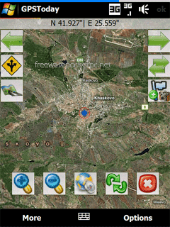
Satellite,Hybrid map views, and many more enhancements for ease of use.
Nearly worldwide support for many features that were previously US only.
Essentially the works, all in a still small package. More features are listed below the screenshots.
This software will not work on OS older than Windows Mobile 5.0 versions, or on any non-touchscreen smartphone. Data plan is recommended for online map features, but not necessary for offline features like geologging or geotagging. An Integrated GPS is advisable (but not mandatory) to fully enjoy the software.
Like it? Share with your friends!
If you got an error while installing Themes, Software or Games, please, read FAQ.
Supported operating systems:
Windows Mobile 5.0, Windows Mobile 6 Classic, Windows Mobile 6 Professional, Windows Mobile 6.1 Classic
Similar Software:
VirtualGPS Virtual GPS is a free, small utility, which fully emulates GPS module and returns your location (by using cellular towers).
Accuracy of coordinates is about 200m in urban area and up to 5km in countryside. Screenshots are explaining how to use VirtualGPS with navigation software (e.g. "Google Maps")
PictureGPS PictureGPS allows you to tag pictures from your PocketPC camera in real time with a GPS stamp and view the distance of each picture via your current GPS. You can use the ruler to view the distance of each picture and also view the GPS stats for each picture with a Google.com map. The map service is provided by Google
MyGPS_PDA MyGPS_PDA - MyGPS_PDA is a light MyGPS version for PocketPC systems. It reads the NMEA sentences coming from a GPS antenna connected to the PocketPC and shows your position on a MyGPS calibrated map. The program can also store on a file the track log together with specific waypoints created by the user
TasksGPSer TasksGPSer allows you to create date/time stamped tasks based on your current GPS. When you get a GPS lock then you can create a text task for the area. The program has a full featured file explorer that displays the tasks in order of distance from your current GPS. The map service is provided by Google
FON Access Points for Estonia FON Access Points for Estonia - FON offers you a new Points of Interest service (POIs). This allows you to download FONspots directly to your navigation device.
What does that mean? You can download a Points of Interest file directly to your navigation device
FamilyGPSs FamilyGPSs - FamilyGPSs can be used update your GPS location and track the GPS location of friends/family on your lists. You can view all family members on a map or view each person on a map. The map service is provided by Google.com
This program requires that you have both the 'BeanDLL.dll' file ** and ** the runtime files for Visual Basic on your PocketPC computer
TravelWiFier TravelWiFier - TravelWiFier can be used to log WiFi hotspots via GPS. Each time you find a hotspot you can create a new 'WiFi' file with the current GPS and login information. When you are traveling the program uses the GPS on your PocketPC to find the closest WiFi hotspot and displays the distance.
This program requires that you have both the 'BeanDLL
TravelReaderer TravelReaderer - TravelReaderer uses the GPS on your PocketPC to find your current latitude/longitude and says the readings in a computer voice. You can also view and download a map of your current position from the Google.com map service. You can customize the maps via the options setting in the toolbar.
This program requires that you have both the 'BeanDLL
GPSLocaterer GPSLocaterer uses the GPS on your PocketPC to find your current latitude/longitude/speed and altitude and allows you to view your position on a map from the Google.com maps service. You can customize the maps zoom, and type via the 'Options' in the toolbar
GPSEphemeris GPSEphemeris uses the GPS on your PocketPC to download the hourly Ephemeris file from the GPS network. You can use this before you start other GPS applications to get a quicker GPS lock. NOTE: The ephemeris file expires after about 1 hour
Comments on GPSToday:
Comments not found
If you noted an error or download link is broken, please, report it via this page or use comments.
GPSToday is compatible with your device HTC Touch Dual P5500 (Nike) NIKI100

.jpg "HTC Touch Dual P5500 (Nike) NIKI100")