OpenMobileMaps - An application similar to Google Maps, but relying on OpenStreetMap
· showing map in fullscreen
· finger friendly user interface
· map tiles are automatically downloaded if internet connection is available
· map tiles are stored locally for offline use
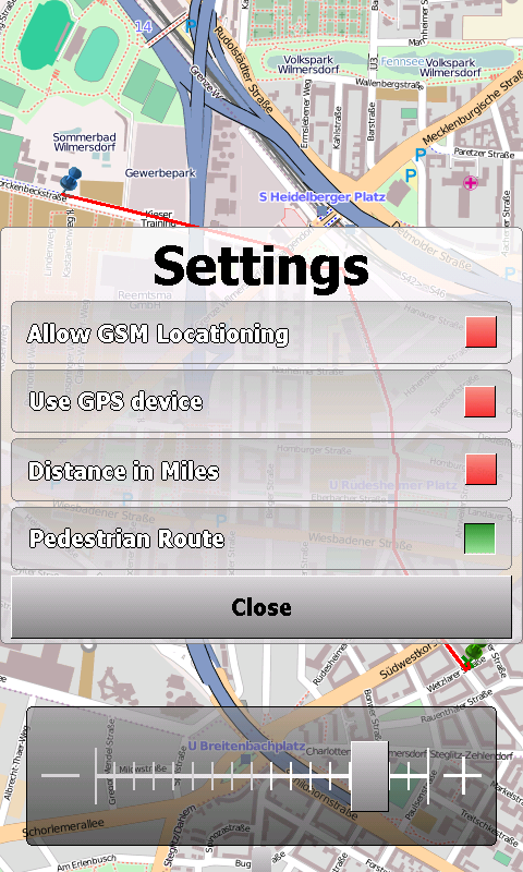
· GPS support and GSM triangulation
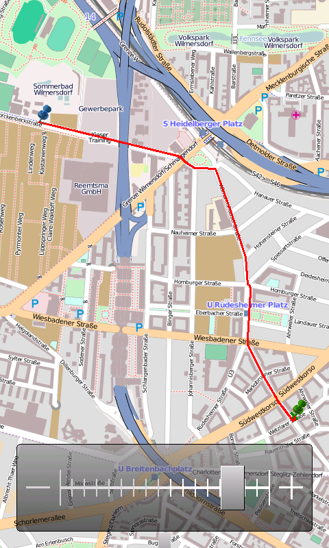
· show actual position on map
· follow-mode to automatically scroll the map
· search addresses
What's New in This Release:
· just a few bugfixes to prevent instabilities on certain phones
What's New in 1.4.3816.9028:
· WebServices updated to match the new OpenMobileMaps website.
Like it? Share with your friends!
If you got an error while installing Themes, Software or Games, please, read FAQ.
Supported operating systems:
Windows Mobile 5.0, Windows Mobile 6 Classic, Windows Mobile 6 Professional, Windows Mobile 6.1 Classic, Windows Mobile 6.1 Professional, Windows Mobile 6.5 Professional
Similar Software:
GPS Receiver Reset Utility GPS Receiver Reset Utility - Sometimes GPS receivers (at least my Hamlet HBTGPS20) stop working correctely (no or unstable fix). Hamlet advice is to reset it using a desktop Windows program that they provide. Unfortunately, this requires a BT enabled desktop or laptop PC. Very unpractical indeed!
This small utility can be used to reset GPS receivers
GPSTwitterer GPSTwitterer allows you to oAuth update and view Twitter contacts via GPS. You can use the GPS to find your current location and send a tweet and also track your friends via Twitter. The map service is provided by Google.com. The tweet service is provided by Twitter
RestaurantGoogler RestaurantGoogler uses the GPS on your PocketPC to find the top 50 closest local Restaurants sorted via GPS distance. Tap the button to start the GPS and when you get a lock tap on it to view the list of local Restaurants. You can also dial the Restaurant. The GPS maps and business search service is provided by Google
RulerGPS RulerGPS - This program allows you to calculate the distance in Miles, Feet, Inches, KM, Meters and CM based on two latitude and longitude points. This can be used as a ruler for construction etc. with GPS.
This program requires that you have both the 'BeanDLL.dll' file ** and ** the runtime files for Visual Basic on your PocketPC computer
SirfTech Pocket PC program for checking and setting practically all SiRF GPS settings and evaluating changes
PoliceGoogler PoliceGoogler uses the GPS on your PocketPC to find the 50 closest police services sorted via GPS distance. Tap the button to start the GPS and when you get a lock tap on it to view the list of local police services. You can also dial the numbers. The GPS maps and pig search service is provided by Google
FON Access Points for Colombia FON Access Points for Colombia - FON offers you a new Points of Interest service (POIs). This allows you to download FONspots directly to your navigation device.
What does that mean? You can download a Points of Interest file directly to your navigation device
gpsVP gpsVP works on virtually any Windows platform including mobile ones. It shows vector and raster maps, records and shows tracks, shows multiple navigation parameters, manages and shows waypoints. It aims to be as usable as possible.
What's New in This Release:
· Geoid correction matrix: Updated values Atlantic & east America's
Gpx2rt2 Set of programs to convert GPS-tracks of *.gpx, *.mps, *.plt or *.nmea format to route files *.rt2
Wenak Wenak - Mobisoft Wenak lets you share your location with your friends, family members, co-workers and loved ones by making it easy to tell them where you are and see each other on the map. Wenak lets you share your location in the background, even when the app is closed
Other Software by developer «Cipher»:
not found
Comments on OpenMobileMaps:
vitor:
good
Date: 2 Mar 11
If you noted an error or download link is broken, please, report it via this page or use comments.
OpenMobileMaps is compatible with your device i-teq X-Bond