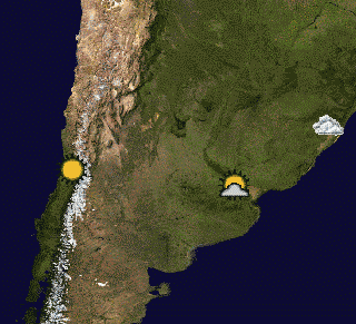
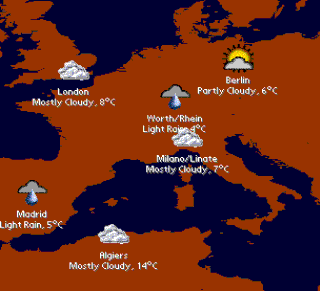
Current weather maps, reports and forecasts - This pack includes two weather maps containing 20 and 50 principal agglomerations of the world: Algiers, Ankara, Athens, Baghdad, Bangkok, Beijing, Berlin, Buenos Aires, Cairo, Caracas, Casablanca, Chennai (Madras), Chicago, Dallas-Fort Worth, Delhi, Dhaka, Guadalajara, Ho Chi Minh City, Hong Kong, Jakarta, Johannesburg, Karachi, Khartoum, Kinshasa, Lagos, Lima, London, Los Angeles, Madrid, Medellin, Metro Manila, Mexico City, Miami, Milan, Moscow, Mumbai (Bombay), Porto Alegre, Rhein-Ruhr North, Rio de Janeiro, Saint Petersburg, San Francisco-Oakland, Santiago (Chile), Seoul, Shanghai, Singapore, Sydney, Tehran, Tokyo, Toronto and Washington D.C.
These two maps require PrettyMap software installed and internet connection on your PDA.
Registered PrettyMap Full users can create weather maps with customized locations (e.g. cities of interest).
What's New in This Release:
· upgraded to conform with versions 4.x of PrettyMap
Like it? Share with your friends!
Supported operating systems:
Palm OS 3.x, Palm OS 4.x, Palm OS 5.x
Similar Software:
Weather Manager Weather Manager - With Weather Manager keep track of the current weather conditions and 5-day weather forecast for thousands of cities around the world with your Palm OS? device.
Weather Manager is a great travel companion. Check the weather on the road by using a Treo 600/650 or by connecting your Palm to a (wireless) modem or mobile phone
wthrcalc wthrcalc has four different weather related calculations.
Wind chill - relative humidity - F to C, C to F - and heat index.
The Wind chill has both the old formula (named aeronautical since it was told to me that it was more for wing icing and such on air planes so it is based on 9 meters up), and the new formula (named civil for feet planted on ground)
PalmaryClock Wireless (German) PalmaryClock Wireless (German) - PalmaryClock Wireless Edition is a powerful time management tool. All time handling functions are collected in one device! A nice clock with skins and backgrounds support also offers You unlimited quantity of independent alarms with MP3 support and an ability to start any program installed on your device
Weather Forecast Browser Weather Forecast Browser - Weather Forecast Browser (also known as WFBrowser) – is offline browser for weather forecast web sites. In current version all information gets from http://weather.yahoo.com. WFBrowser allows check forecast information in offline on closest 5 days
ThunderWonder! ThunderWonder! - calculates your distance from lightning. Tap the 'Flash' button when you see lightning then tap the 'Ka-Boom' button when you hear the thunder. ThunderWonder! uses NASA speed of sound calculations to estimate your distance in kilometers and miles. High Altitude checkbox compensates for thin air (where sound travels slower) when you're in the mountains
PalmaryClock Wireless PalmaryClock Wireless - PalmaryClock Wireless Edition s not just an improved clock, it is a technological breakthrough. Your Palm can now be not only a powerful organizer but a real-time assistant in your business! Nowadays it is very important to have the latest reliable information, and with the help of PalmaryClock Wireless Edition it is as easy as a pie
TealInfoDB: Air Toxics TealInfoDB: Air Toxics - toxic air pollution levels for over 1,800 compounds
TreoCiel (Palm OS) TreoCiel (Palm OS) - Get your local weather charts on your smartphone, so you can view a whole week in a snap and also get detailed hourly forecasts for the next days. Charts make it easy to show to friends and colleagues
WorldMate 2007 Professional Edition + Desktop Companion WorldMate 2007 Professional Edition + Desktop Companion - This package includes both WorldMate Professional Edition and WorldMate Desktop Companion, allowing you to plan your travel from the convenience of your office, and then have full itinerary details available to you while on the road in WorldMate Professional Edition
Other Software by developer «Maciej Komosinski»:
Top Sailor (iPhone/iPad) Top Sailor (iPhone/iPad) - Top Sailor is a highly realistic sailing and motorboat simulator. Take Top Sailor with you and learn basics of sailing! See how wind force affects the sail and test your skills against AI opponents in a yacht race. Learn how to trim the sails to make the most use of wind energy. Discover when there is a risk of capsizing
Little Sailor (iPhone/iPad) Little Sailor (iPhone/iPad) - Little Sailor is a highly realistic sailing and motorboat simulator. Take Little Sailor with you and learn basics of sailing! See how wind force affects the sail and test your skills against AI opponents in a yacht race. Learn how to trim the sails to make the most use of wind energy. Discover when there is a risk of capsizing
PrettyMap View maps of Earth and other planets with PrettyMap! See current day and night areas, learn geography with the quiz, enjoy 3D elevation relief, measure distances, edit locations!
Little Sailor: sailboat, surfing and motorboat simulator Little Sailor
Take Little Sailor with you and learn basics of sailing! See how wind force affects the sail and test your skills against AI opponents in a yacht race. Learn how to trim the sails to make the most use of wind energy
Free Earth Elevation Map for PrettyMap/PrettyEarth Earth Elevation Map for PrettyMap/PrettyEarth - This is a medium-resolution, free Earth elevation map for PrettyMap and PrettyEarth. It contains one elevation sample per 4 km, approximately.
Note: large file (16 MB download, 55 MB after installing).
Note for PrettyEarth users: this map will be installed to Program FilesPrettyMapmaps
PrettyEarth PrettyEarth
View maps of Earth with PrettyEarth! See current day and night regions, learn geography by taking the quiz, enjoy relief elevation surfaces and measure distances between locations
Vector Maps for PrettyMap Vector Maps for PrettyMap - This pack contains the most popular vector maps for PrettyMap
PrettyMap Basic View maps of Earth and other planets with PrettyMap! See day and night areas, learn geography, enjoy 3D elevation surfaces, measure distances and create your own maps with special places!
PrettyMap Full View maps of Earth and other planets with PrettyMap! See day and night areas, learn geography, enjoy 3D elevation surfaces, measure distances and create your own maps with special places!


")


")


")
")


